Barn Record Bristol
RETURN TO ‘FIND BARNS’
- Overview
-
Designations
n/a
Historic Significance
Architectural description:
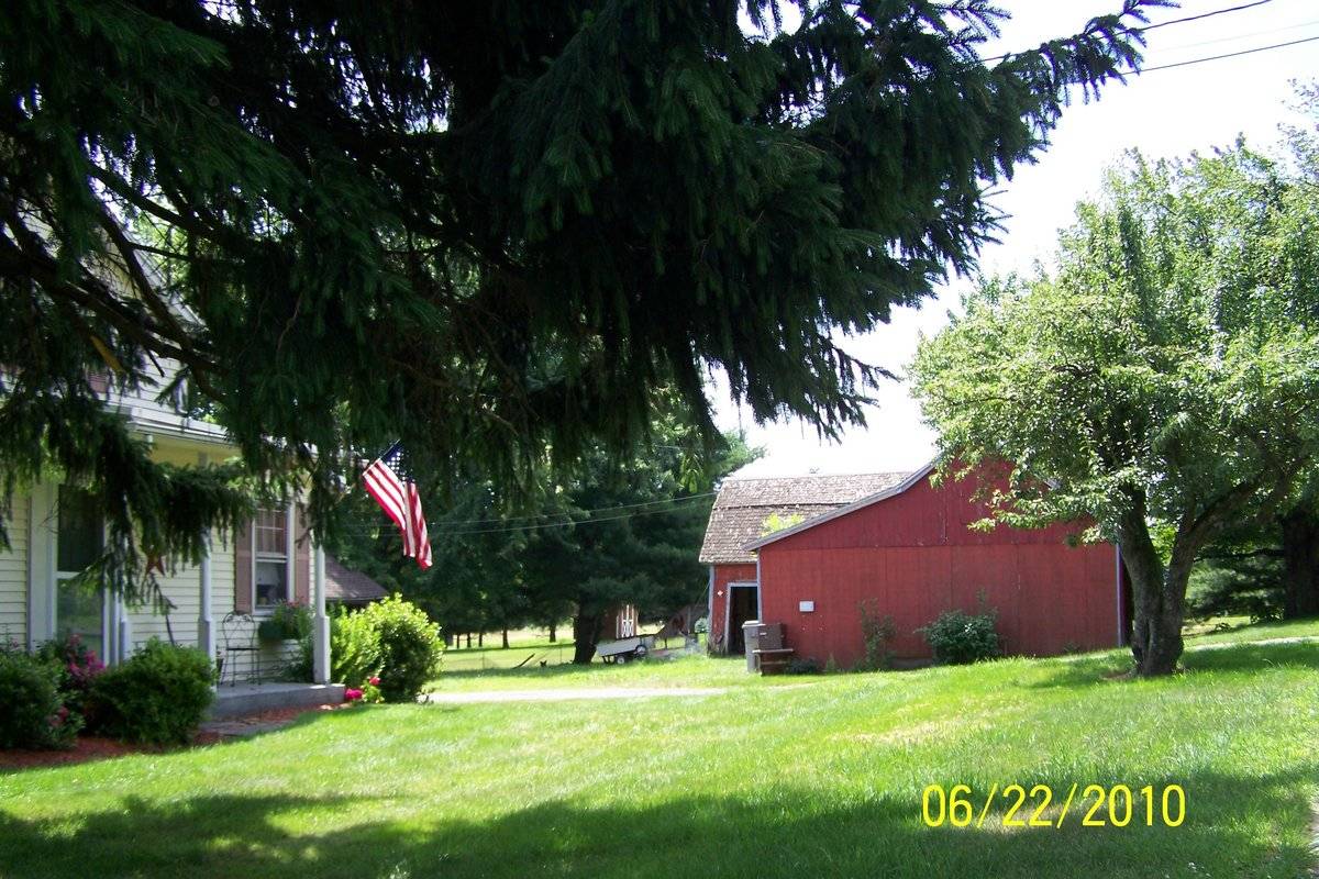
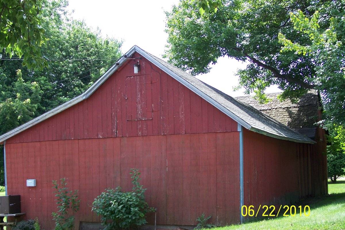
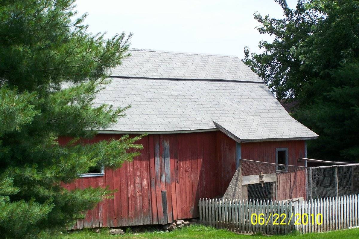
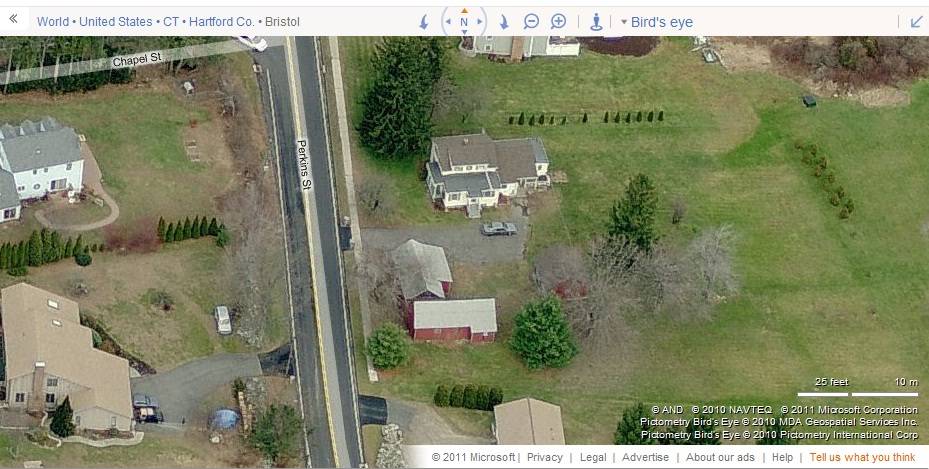
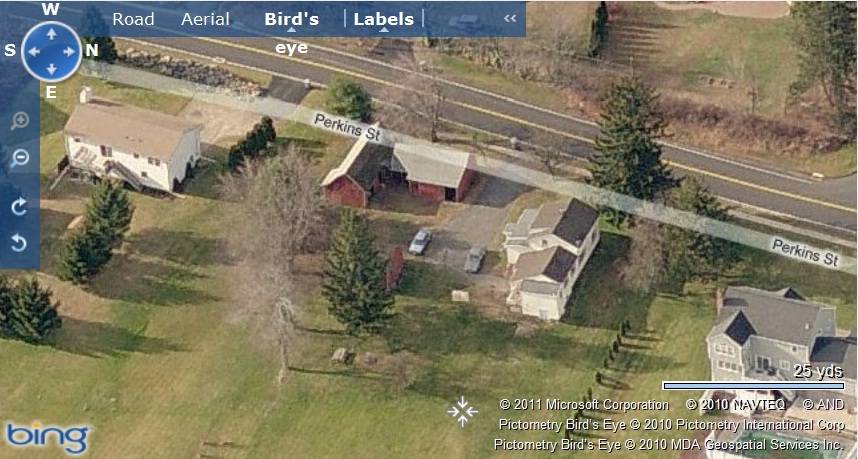
This is a L-shaped barn complex towards the east of Perkins Street comprising of two 1 1/2 – story gable-roof eave-entry barns. Barn-I is located towards the west with a shed-roof addition on its east eave-side towards the north and Barn-II attached to its south gable-end. The ridge line of Barn-I runs north-south parallel to the road while that of Barn-II runs east-west. The west eave-side of Barn-I facing the road appears to be the main façade with the main entrance off-centered towards the south through an exterior-hung double-height sliding wagon door. The north gable-end of Barn-I is flush with the north side-wall of the shed-roof addition on the west eave-side and has a distinct dropped girt siding divide line separating the gable attic. The gable attic is lined by cornice board with raking detail and has a hinged hay door just below the apex of the roof. The grade level along the north gable-end gradually declines towards the east revealing a portion of cement plastered masonry foundation of the barn. The west eave-side of Barn-I appears to have a wagon door entrance towards the south and the shed-roof addition covering almost two-thirds of the eave-side from the north. The west eave-side of the shed-roof addition appears to have two pass-through doors, one each towards each side. The north eave-side of Barn-II appears to have two wagon door entrances. The south eave-side of Barn-II has a small shed-roof addition towards the extreme east and a square window centered in the remaining portion. The south eave-side of the shed-roof addition has a half-height door towards the west opening into a fenced yard and a similar square window opening towards the west. The gable attic of the west gable-end of Barn-II is separated from the rest of the gable-end by a distinct dropped girt siding divide line and has a hinged hay door at the center.
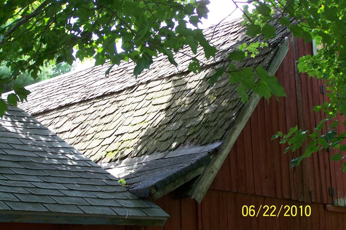
The wooden frame of Barn-I is supported on cement plastered masonry foundation and has asphalt shingle roofing while that of Barn-II is supported on field stone masonry foundation and has wood shingle roofing. Both the barns have red painted vertical siding walls.
Historical significance:
The oldest barns still found in the state are called the “English Barn,” “side-entry barn,” “eave entry,” or a 30 x 40. They are simple buildings with rectangular plan, pitched gable roof, and a door or doors located on one or both of the eave sides of the building based on the grain warehouses of the English colonists’ homeland. The name “30 by 40” originates from its size (in feet), which was large enough for 1 family and could service about 100 acres. The multi-purpose use of the English barn is reflected by the building’s construction in three distinct bays - one for each use. The middle bay was used for threshing, which is separating the seed from the stalk in wheat and oat by beating the stalks with a flail. The flanking bays would be for animals and hay storage.
Field Notes
The house was built in the 1880s and it's thought that the barn was built at around the same time. It was used as a dairy barn and still has wooden shingles on part of the roof. It was owned at one time by the Malsheske family and called East View Farm. The family later moved to another farm on Perkins street and that farm became East View Farm.
- Use & Accessibility
- Environment
Related features
Environment features
Relationship to surroundings
The .96 acres property, Account number – 0110019 and Map-Lot-unit number - 58/ / 61/ /, is located towards the east of Perkin Street. The property is situated in a predominantly residential area with individual plots separated by woodland and open land. Residential plots flank the plot towards the north, east, south and the west, across the street.
The L-shaped barn complex is located in the southwest corner of the property with Barn-I towards the west and Barn-II attached to its south gable-end. The ridge line of Barn-I runs north-south parallel to the road while that of Barn-II runs east-west. A 1 ½ - story two-bay eave-entry gable-roof shed can be seen towards the east of Barn-II with its ridge line running north-south. The circa 1880 main residence is located towards the northeast of the barn complex separated by a driveway. Few trees can be seen surrounding the barn complex while open land can be seen towards the east.
- Typology & Materials
-
Building Typology
Materials
Structural System
Roof materials
Roof type
Approximate Dimensions
Barn: 668 Sqft; Garage: 400 Sqft; Garage: 462 Sqft; Shed: 224 Sqft;
- Source
-
Date Compiled
04/28/2011
Compiled By
T. Levine and M. Patnaik, reviewed by CT Trust
Sources
Field notes and photographs provided by: Cherie Robinson, 03/05/2011.
Assessors’ records retrieved on April 28th, 2011 from website http://data.visionappraisal.com/BristolCT/DEFAULT.asp.
Photograph/Information retrieved on April 28th, 2011 from website http://www.google.com .Photograph/Information retrieved on April 28th, 2011 from website http://www.bing.com .
Photograph/Information retrieved on April 28th, 2011 from website http://www.zillow.com .
Sexton, James, PhD; Survey Narrative of the Connecticut Barn, Connecticut Trust for Historic Preservation, Hamden, CT, 2005, http://www.connecticutbarns.org/history .
Visser, Thomas D.,Field Guide to New England Barns and Farm Buildings, University Press of New England, 1997.
- PhotosClick on image to view full file
-