Barn Record Branford
RETURN TO ‘FIND BARNS’- Building Name (Common)
- John Rogers Barn
- Building Name (Historic)
- John Rogers Barn
- Address
- 690 Leetes Island Road (Rte 146), Branford
- Typology
- Overview
-
Designations
Historic Significance
Architectural description:
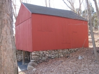
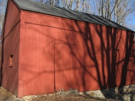
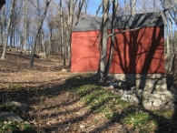
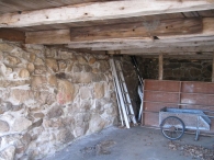
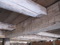
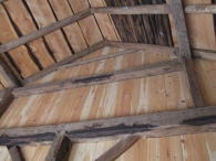
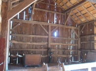
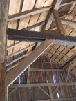
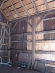
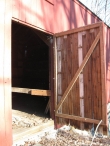
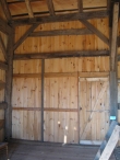
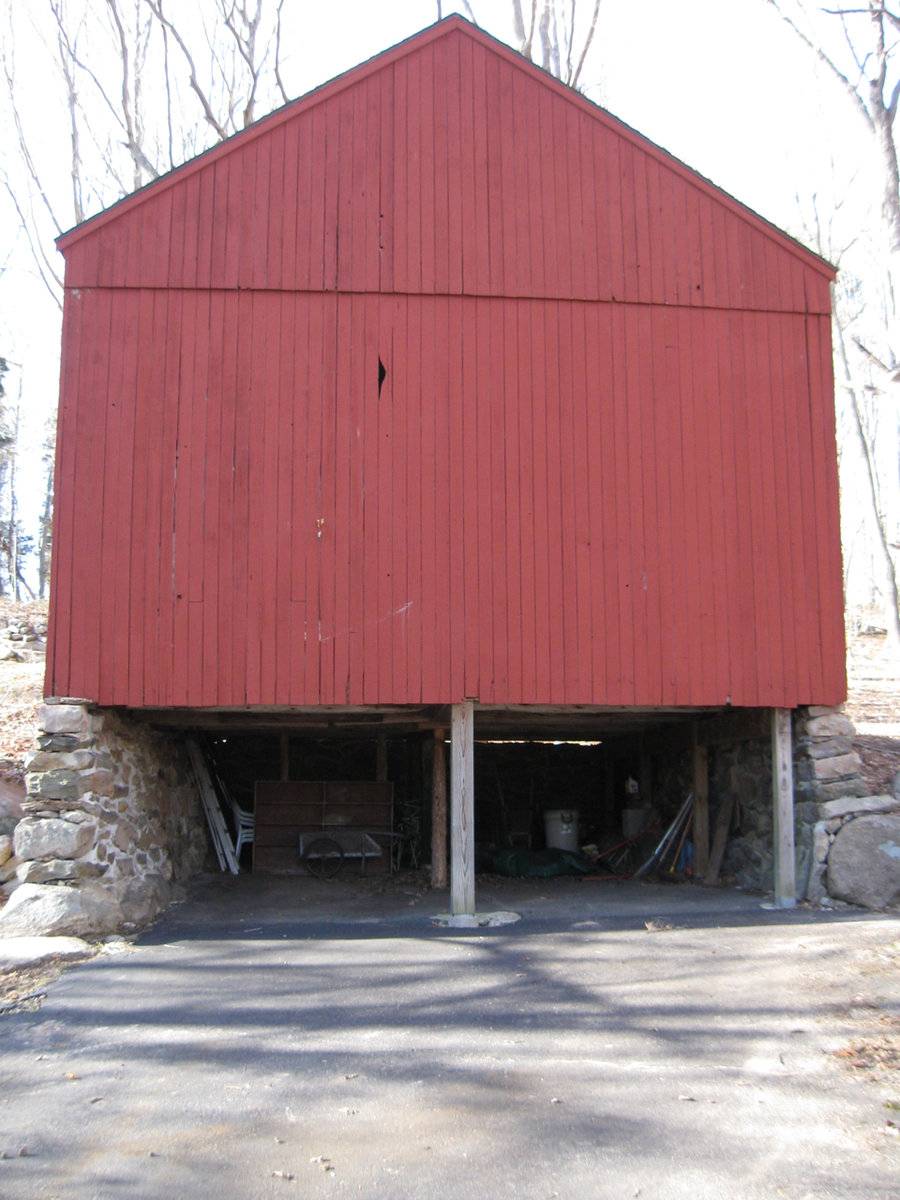
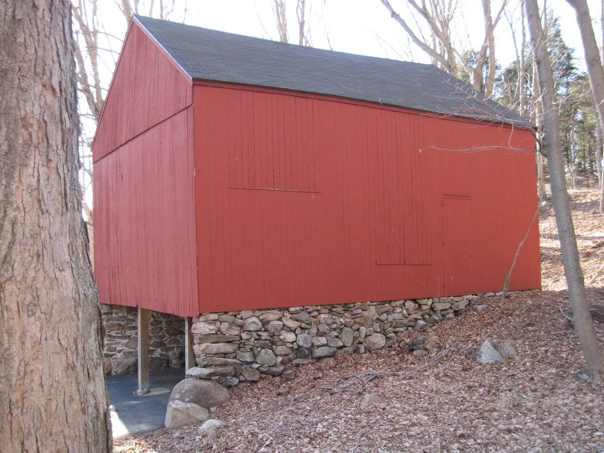
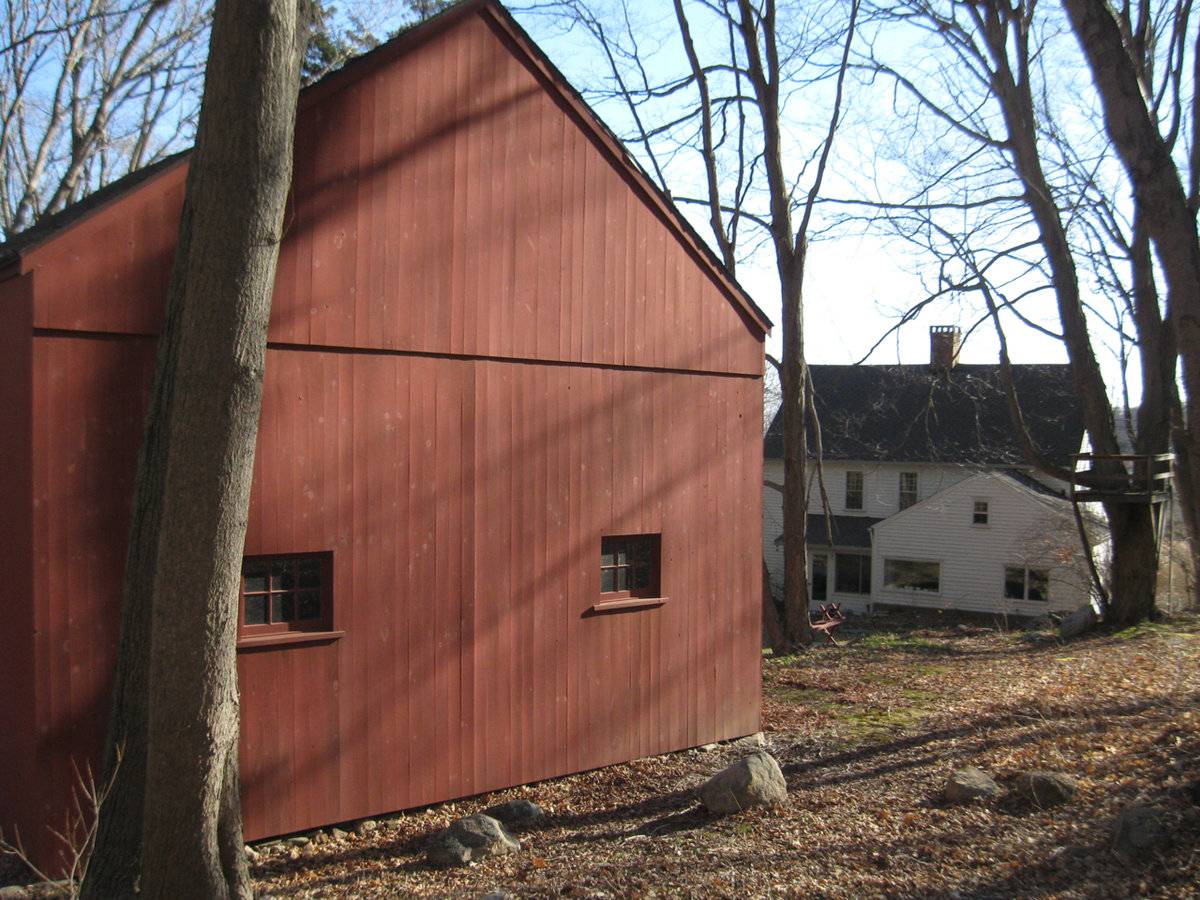
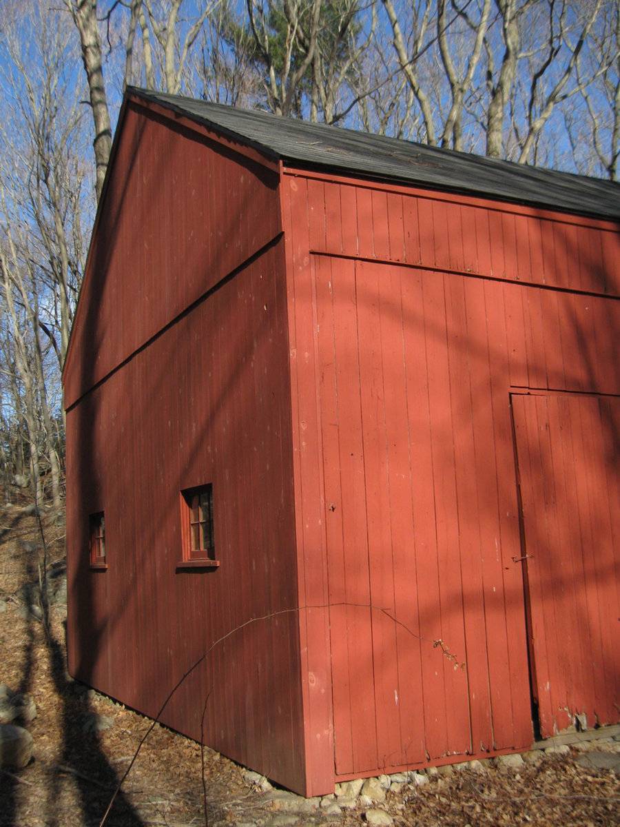
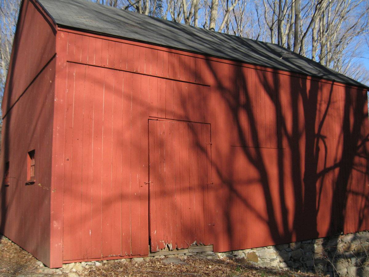
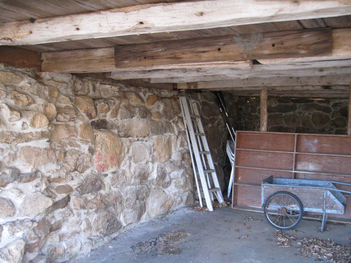
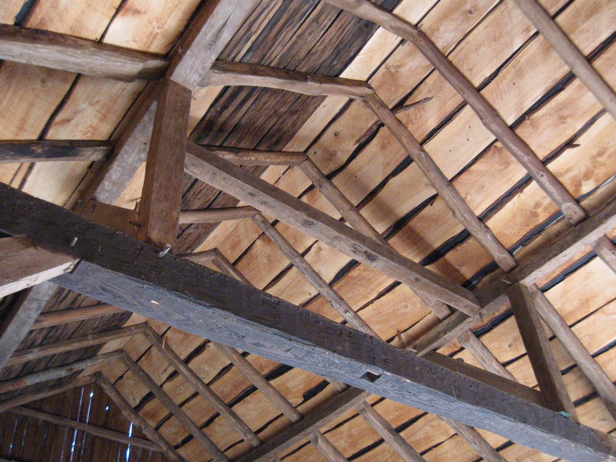
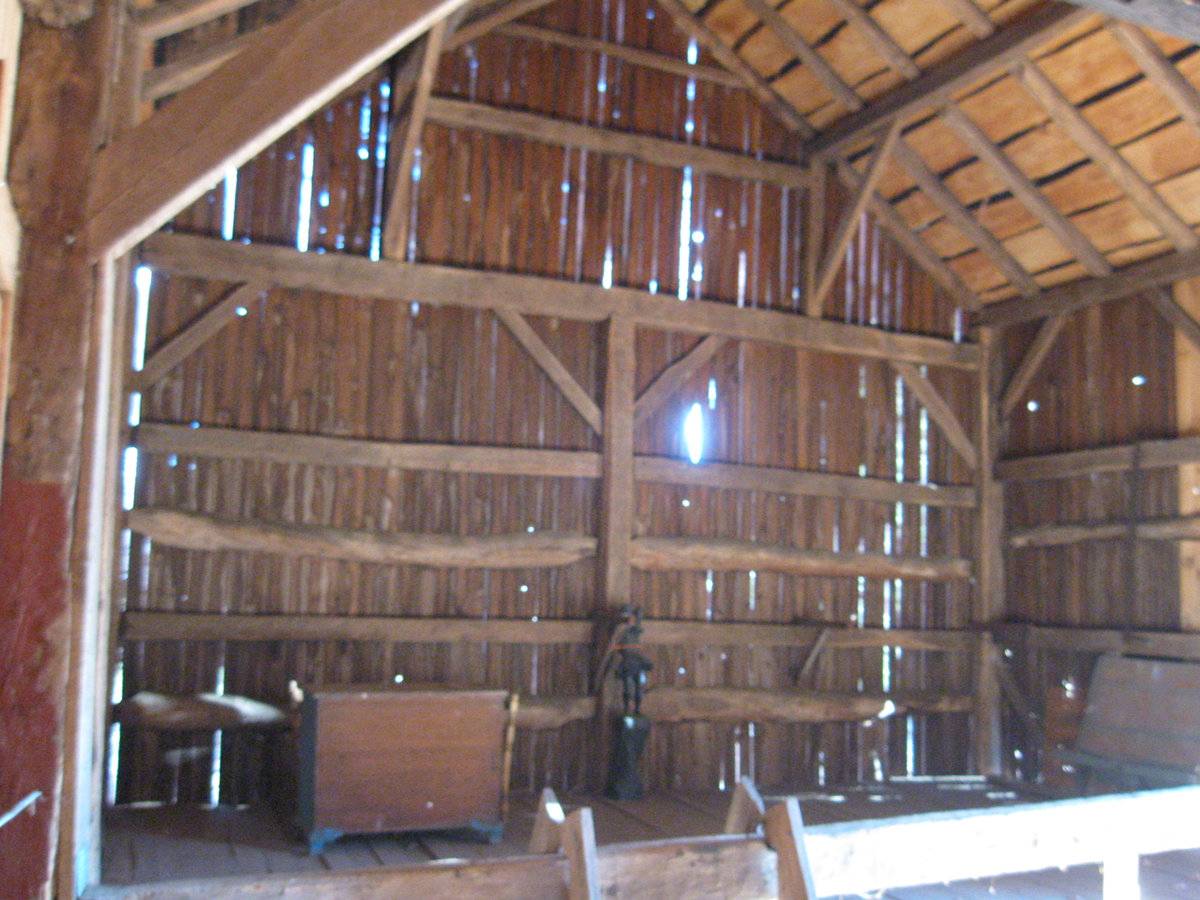
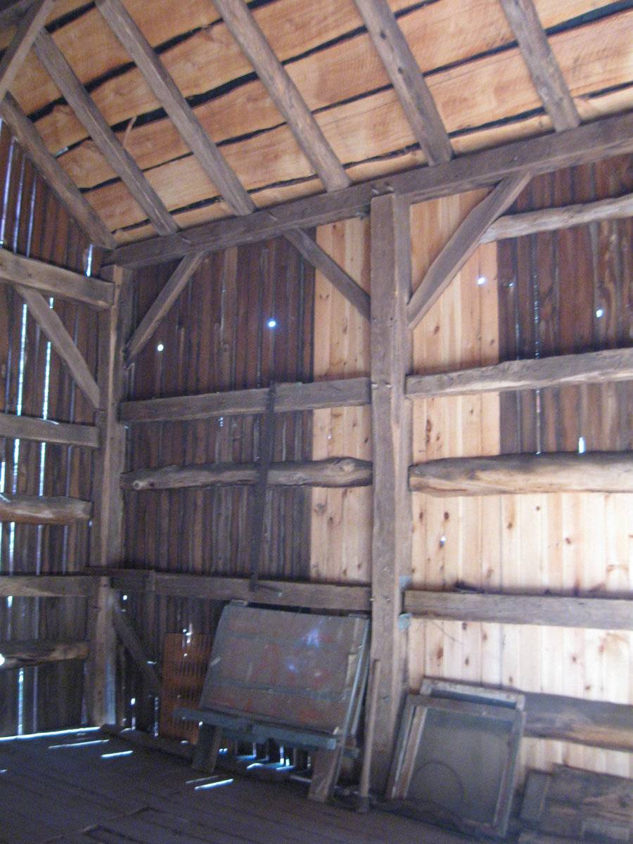
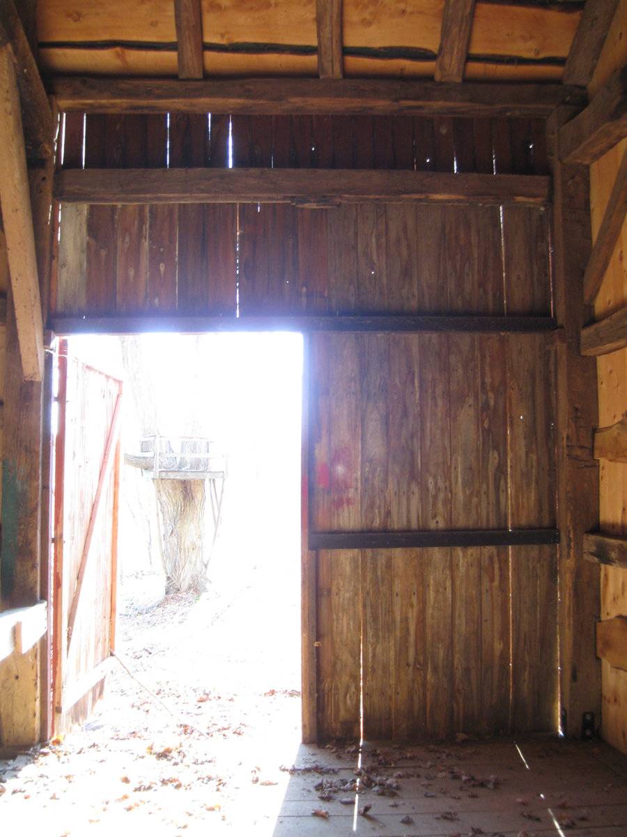
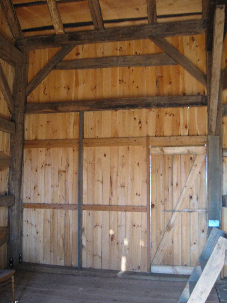
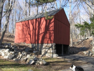
This is a 1 ½ - story three-bay eave-entry bank barn. The ridge line of the barn runs north-south while its south gable-end faces Leetes Island Road that runs at an angle from the southwest to the northeast. The three-bay west eave-side of the barn is the main façade with the main entrance in the first bay from the north through a hinged pass-through door. The original entrance to the barn appears to be through a double-height wagon door entrance spanning the entire length of the first bay from the north as evident from the markings on the siding. The grade level along the west eave-façade of the barn gradually declines towards the south revealing the un-coursed mortared field stone masonry of the bank level. The low grade level along the main façade wraps the barn around the south gable-end to form the bank level which has two open bays. The gable attic lined by fascia board is separated from the rest of the gable-end by a distinct dropped girt siding divide line. The grade level along the three-bay east eave-side of the barn gradually rises towards the north along the un-coursed un-mortared field stone masonry of the bank. The east eave-side of the barn has an entrance off-centered towards the north through a hinged pass-through door and appears to have originally at least two window openings towards the south as suggested by the markings on the siding. The north gable-end of the barn has two six-pane windows with trim at the first floor level. The gable attic lined by fascia board is separated from the rest of the gable-end by a distinct dropped girt siding divide line.
The wooden frame of the barn is supported on un-coursed field-stone masonry foundation. The barn has asphalt shingle roofing and red painted vertical siding walls.
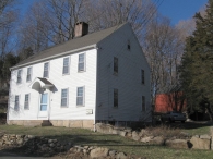
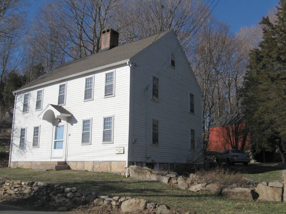
Historical significance:The barn is associated with the main residence of the property, John Rogers House, which is on the NR, 88002642 NRIS.
The oldest barns still found in the state are called the “English Barn,” “side-entry barn,” “eave entry,” or a 30 x 40. They are simple buildings with rectangular plan, pitched gable roof, and a door or doors located on one or both of the eave sides of the building based on the grain warehouses of the English colonists’ homeland. The name “30 by 40” originates from its size (in feet), which was large enough for 1 family and could service about 100 acres. The multi-purpose use of the English barn is reflected by the building’s construction in three distinct bays - one for each use. The middle bay was used for threshing, which is separating the seed from the stalk in wheat and oat by beating the stalks with a flail. The flanking bays would be for animals and hay storage.The 19th century saw the introduction of a basement under the barn to allow for the easy collection and storage of a winter’s worth of manure from the animals sheltered within the building. The bank barn is characterized by the location of its main floor above grade, either through building into a hillside or by raising the building on a foundation. This innovation, aided by the introduction of windows for light and ventilation, would eventually be joined by the introduction of space to shelter more animals under the main floor of the barn.
Field Notes
n/a
- Use & Accessibility
Use (Historic)
Use (Present)
Exterior Visible from Public Road?
Yes
Demolished
n/a
Location Integrity
Unknown
- Environment
Related features
Environment features
Relationship to surroundings
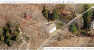
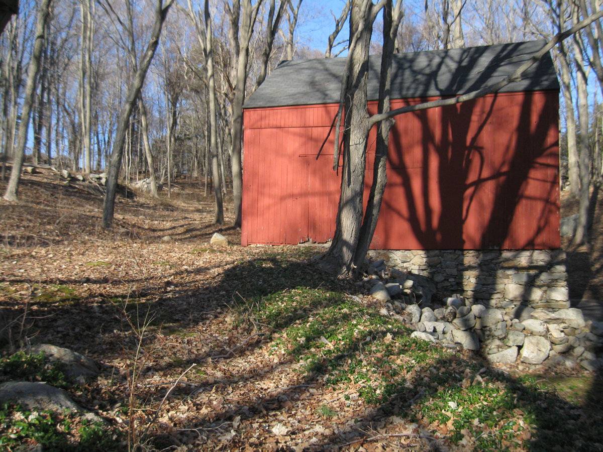
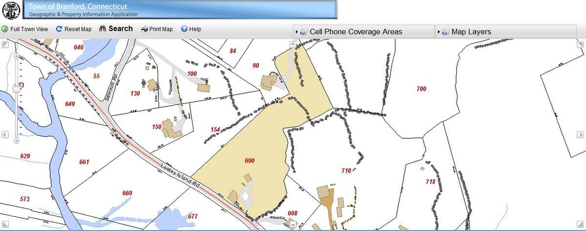
The 3.09 acres property, Account number – 006114 and Parcel number- K09/000/003/00004, is located towards the northeast of Leetes Island Road which runs at an angle from the southeast to the northwest. The property is located in a sparsely populated residential area of suburban character with individual plots separated by woodland and water bodies. The property has relatively narrow frontage to the road spreading out towards the east and the north. Residential plots flank the property towards the north and the south while farmland with barns can be seen towards further south. The area towards the west of the property across the road is covered by water steams and its flood plains.
The barn is located along the southern edge of the property with its ridge line running north-south, almost perpendicular to this portion of Leetes Island Road. The circa 1765 colonial main residence of the property is located towards its southwest abutting to the road. The property is accessed by a driveway towards the south of the main residence which continues north approaching the barn. Part of the west edge of the property along the road and the southern edge is demarcated by un-coursed un-mortared field stone masonry boundary wall. The area towards the east and the north is the property is covered by dense woodland.
- Typology & Materials
-
Building Typology
Materials
Structural System
Roof materials
Roof type
Approximate Dimensions
Barn: 696 SqFt;
- Source
-
Date Compiled
05/18/2011
Compiled By
T. Levine and M. Patnaik, reviewed by CT Trust
Sources
Field notes provided by: Charlotte Hitchcock, 03/20/2011.
Assessors’ information retrieved on May 18th, 2011 from website http://data.visionappraisal.com/BranfordCT/search.asp.
GIS Map retrieved on May 18th, 2011 from website http://www.branfordgis.com/AGS_MAP/default.htm
Architectural Preservation Trust of Branford, Inc., John Rogers House, National Register Nomination Number-88002642, National Park Service, 1988.
http://pdfhost.focus.nps.gov/docs/NRHP/Text/88002642.pdf
http://pdfhost.focus.nps.gov/docs/NRHP/Photos/88002642.pdfPhotograph/Information retrieved on May 18th, 2011 from website http://www.google.com
Photograph/Information retrieved on May 18th, 2011 from website http://www.bing.com.
Photograph/Information retrieved on May 18th, 2011 from website http://www.zillow.com.
Sexton, James, PhD; Survey Narrative of the Connecticut Barn, Connecticut Trust for Historic Preservation, Hamden, CT, 2005, http://www.connecticutbarns.org/history.
Visser, Thomas D.,Field Guide to New England Barns and Farm Buildings, University Press of New England, 1997.
- PhotosClick on image to view full file
-