Barn Record Burlington
RETURN TO ‘FIND BARNS’- Building Name (Common)
- n/a
- Building Name (Historic)
- Hinman / Pine Hill Farm, formerly part of
- Address
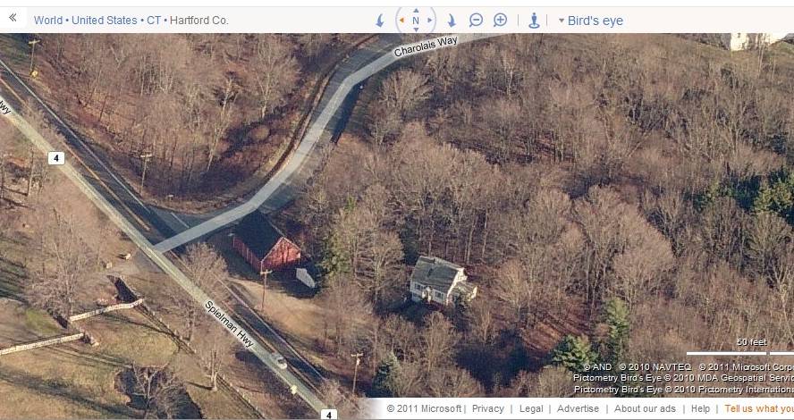
- 0 Spielman Highway (Rte 4), Burlington
- Typology

- Overview
-
Designations
n/a
Historic Significance
Architectural description:
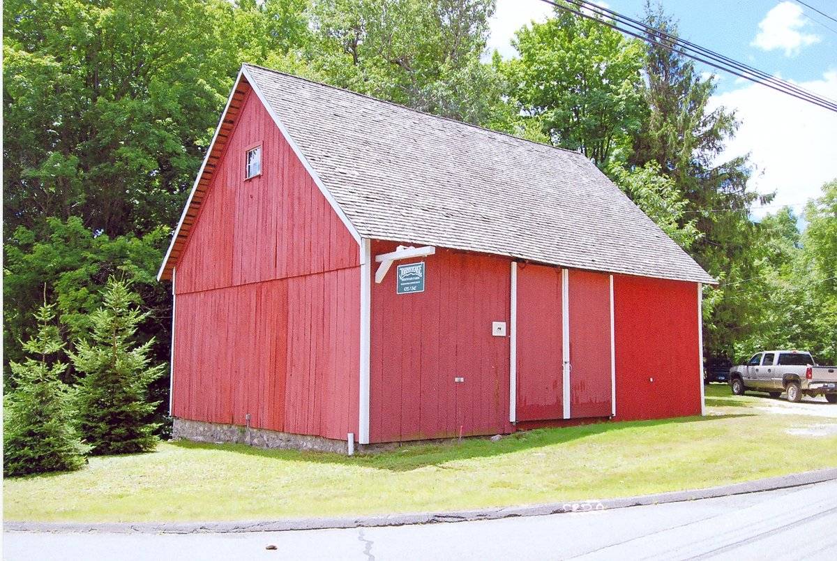
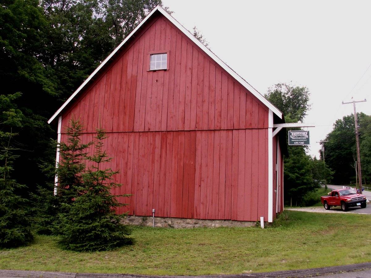
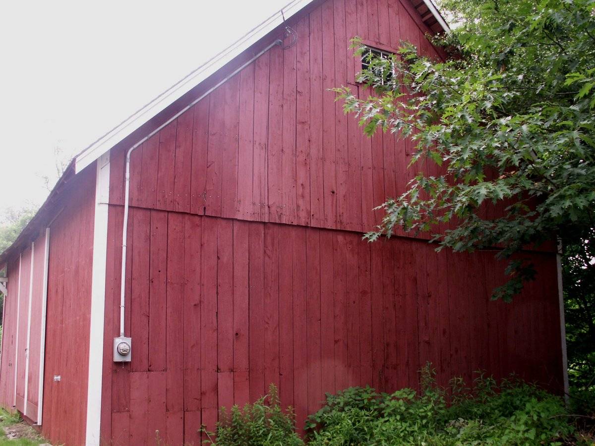
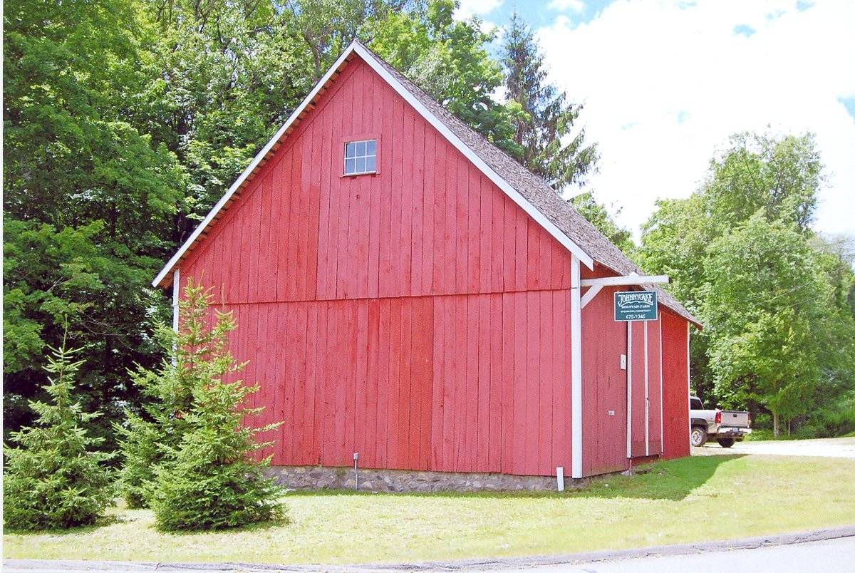
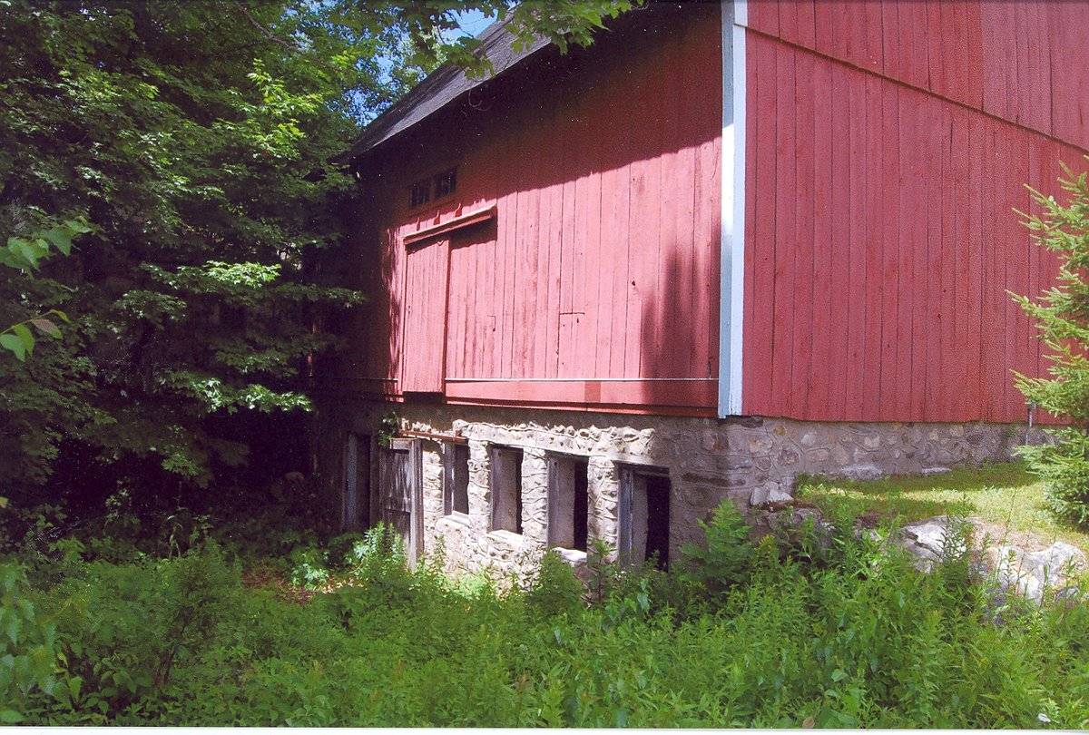
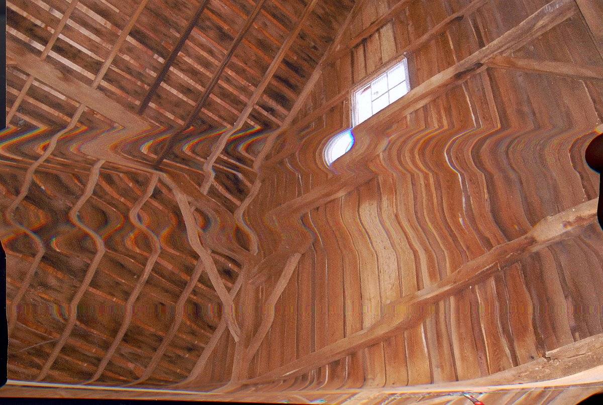
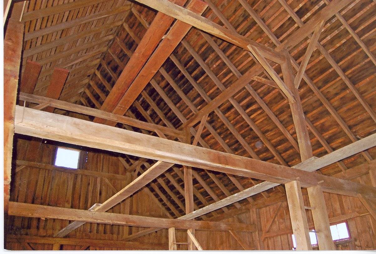
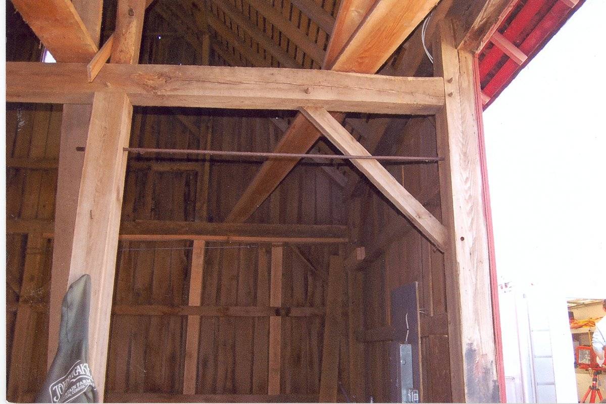
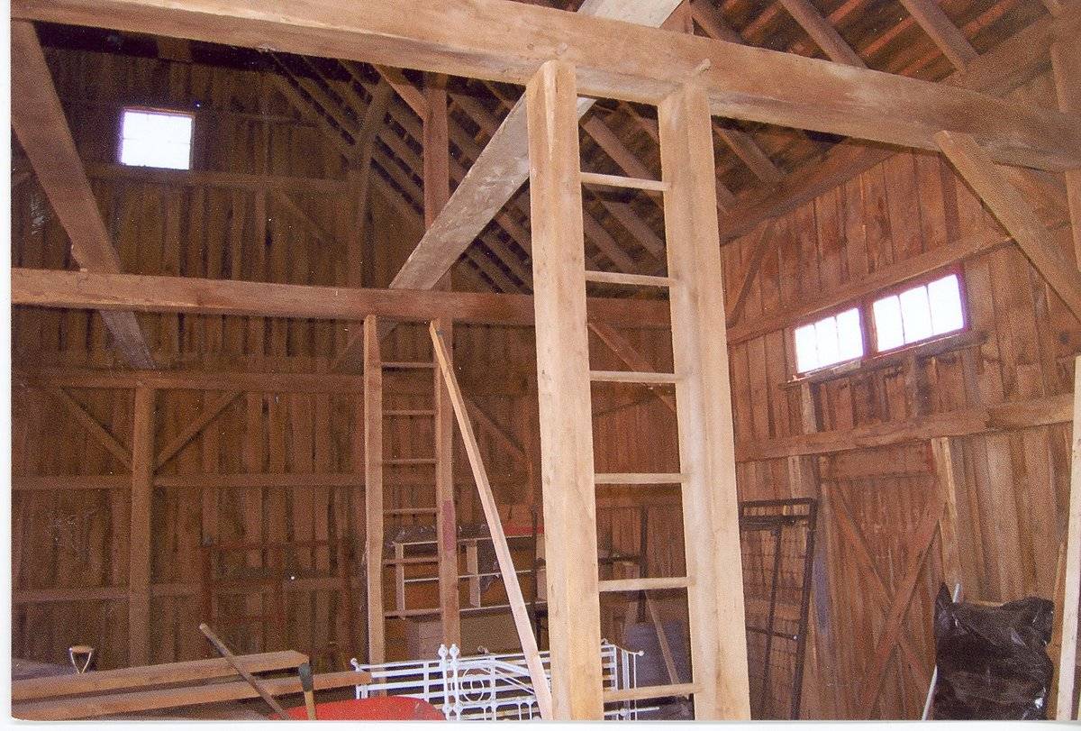
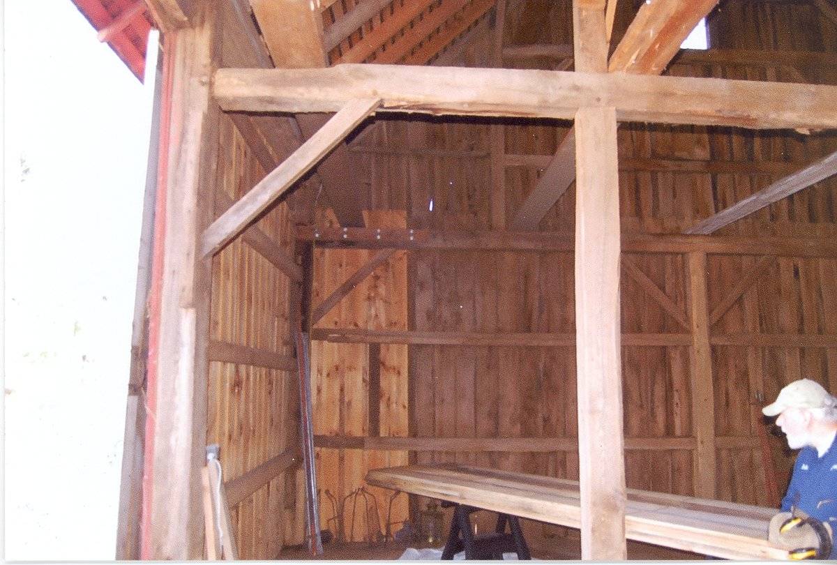
This is a 1 ½ - story three-bay eave-entry bank barn. The north eave-side of the barn faces Spielman Highway while the east gable-end faces Charolais Way. The ridge line of the barn runs east-west parallel to the highway. The three-bay north eave-side of the barn is the main façade with the main entrance centered in the middle bay through a pair of double-height exterior-hung horse-shoe track sliding wagon doors. The first bay from the east has a signboard displaying ‘Johnnycake Mountain Farm’. The east gable-end of the barn is blank with the grade level gradually declining towards the south along the mortared stone masonry foundation. The gable attic lined by deep soffit is separated from the rest gable-end by a distinct dropped girt siding divide line and has a six-pane window insert at the center. The low grade level wraps the barn to form the bank level along the three-bay south eave-side. The three-bay south eave-side of the barn has an entrance at the center to access the bank which appears to be through an exterior-hung sliding pass-through door. The mortared stone masonry of the bank level has four window openings equally spaced towards the east of the sliding door while the portion towards the west is covered is covered by vegetation. The first floor level of the south eave-side of the barn has an exterior-hung hooded horse-shoe track sliding hay door at the center with three bracket-like projections above it. Two closely spaced three-pane windows can be seen above the hay door.
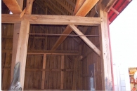
The wooden frame of the barn is supported on mortared field-stone masonry foundation which continues to form the bank. The barn has asphalt shingle roofing and red painted vertical siding with white corner boards.
Historical significance:The oldest barns still found in the state are called the “English Barn,” “side-entry barn,” “eave entry,” or a 30 x 40. They are simple buildings with rectangular plan, pitched gable roof, and a door or doors located on one or both of the eave sides of the building based on the grain warehouses of the English colonists’ homeland. The name “30 by 40” originates from its size (in feet), which was large enough for 1 family and could service about 100 acres. The multi-purpose use of the English barn is reflected by the building’s construction in three distinct bays - one for each use. The middle bay was used for threshing, which is separating the seed from the stalk in wheat and oat by beating the stalks with a flail. The flanking bays would be for animals and hay storage.
The 19th century saw the introduction of a basement under the barn to allow for the easy collection and storage of a winter’s worth of manure from the animals sheltered within the building. The bank barn is characterized by the location of its main floor above grade, either through building into a hillside or by raising the building on a foundation.
This innovation, aided by the introduction of windows for light and ventilation, would eventually be joined by the introduction of space to shelter more animals under the main floor of the barn.Field Notes
The barn is located towards the northwest of the main residence at 447 Spielman History: Originally part of the Hinman farm (Pine Hill) which is across the road. The dairy barn was moved to this location.
- Use & Accessibility
Use (Historic)
Use (Present)
Exterior Visible from Public Road?
Yes
Demolished
n/a
Location Integrity
Moved
- Environment
Related features
Environment features
Relationship to surroundings
The barn is located towards the immediate north of the residence at 447 Spielman Highway, Account number – 30190200 and MBLU number- 5/11 / 3/1 / /. It is a corner plot located towards the south of Spielman Highway and the west of Charolais Way. The property is located in a predominantly residential area of rural character with individual plots separated by woodland and parcels of farmland. Residential plots can be seen towards the west while farm land with barn can be seen towards the north, across the highway. Dense woodland covers the area towards the south while a stream of water can be seen flowing towards further south.
The barn is located in the northeast corner of the road abutting to Spielman Highway. The ridge line of the barn runs east-west parallel to the road. The main residence of 447 Spielman Highway is located towards its southwest while a garage is located towards its immediate west.
- Typology & Materials
-
Building Typology
Materials
Structural System
Roof materials
Roof type
Approximate Dimensions
n/a
- Source
-
Date Compiled
05/24/2011
Compiled By
T. Levine and M. Patnaik, reviewed by CT Trust
Sources
Field notes provided by: Ann Mazeau, 04/13/2011.
Assessors’ information retrieved on May 24th, 2011 from website http://data.visionappraisal.com/BurlingtonCT/search.asp.
Photograph/Information retrieved on May 24th, 2011 from website http://www.google.com
Photograph/Information retrieved on May 24th, 2011 from website http://www.bing.com.
Photograph/Information retrieved on May 24th, 2011 from website http://www.zillow.com.
Sexton, James, PhD; Survey Narrative of the Connecticut Barn, Connecticut Trust for Historic Preservation, Hamden, CT, 2005, http://www.connecticutbarns.org/history.
Visser, Thomas D.,Field Guide to New England Barns and Farm Buildings, University Press of New England, 1997.
- PhotosClick on image to view full file
-