Barn Record Plymouth
RETURN TO ‘FIND BARNS’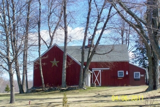
- Overview
-
Designations
n/a
Historic Significance
Architectural description:
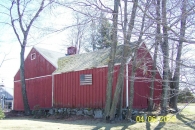
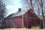
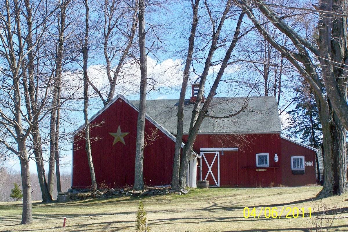
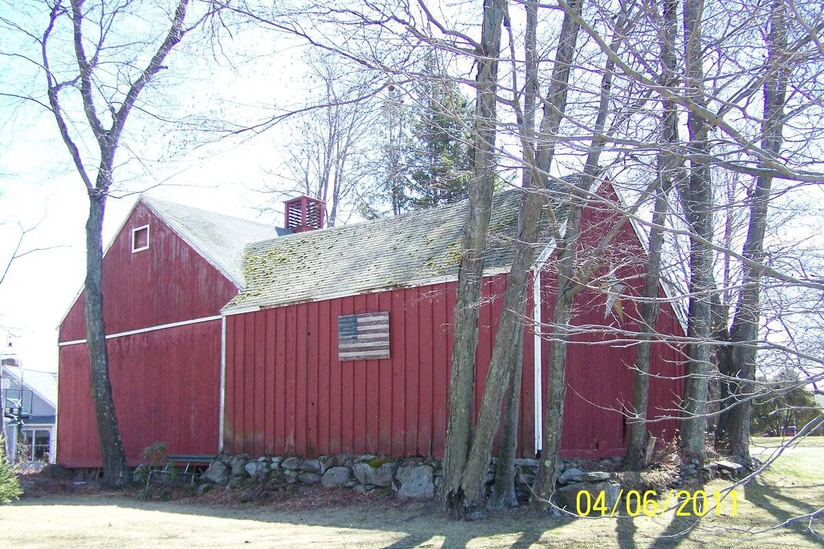
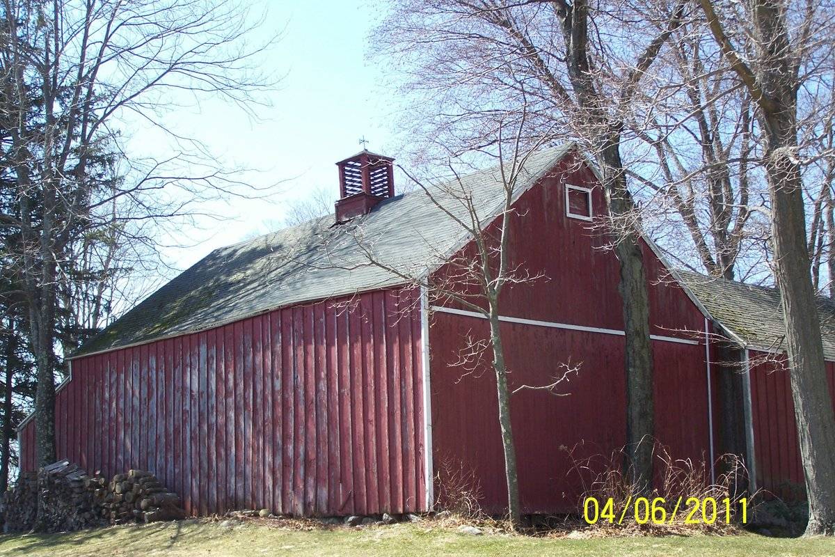
This is a L-shaped barn complex in a corner plot towards the east of Burger Road and the south of Preston Road. The complex comprises of a 1 ½ - story three-bay eave-entry barn with an intersecting gable-roof addition on its west eave-side in the first bay from the north and a shed-roof addition encompassing the entire length of its south gable-end. The south eave-side of the intersecting gable-roof addition has a salt-box roof addition encompassing the entire length and covering almost half of the west eave-side of the main barn from the north. The ridge line of the main barn runs north-south parallel to Burger Road but perpendicular to Preston Road while that of the intersecting gable-roof addition runs east-west.
The three-bay west eave-side of the main barn facing Burger Road is the main façade of the complex with the main entrance in the middle bay off-centered towards the south through a double-height exterior-hung X-braced hooded sliding door. The first bay from the south of the main west eave-façade has a six-pane window at the center with a horizontal ledge at the sill level supported by brackets. A display board shaped as a milk bottle can be seen towards the south of the six-pane window. The west side-wall of the shed-roof addition on the south gable-end of the main barn is flush with the west eave-façade and has a similar six-pane window at the center with the plot number displayed towards its south. The first bay from the north of the main west eave-façade of the barn is intersected by the gable-roof addition. The grade level along the west gable-end of the intersecting gable-roof addition gradually declines towards the north revealing the field stone masonry foundation of the barn while a large star can be seen centered in the gable attic. The north eave-side of the intersecting gable-roof addition has a band of exposed un-coursed un-mortared field stone masonry foundation along the grade level and a USA flag centered at the first floor level. The north gable-end of the main barn has a continuous trim at the distinct dropped girt siding divide line separating the gable attic which has a window just below the apex of the roof. The east eave-side of the main barn is flush with the east side-wall of shed-roof addition on the south gable-end. The gable-roof of the main barn has a louvered cupola centered along the ridge line.
The wooden frames of the main barn and the intersecting gable-roof addition are supported on un-coursed un-mortared field stone masonry foundation. The barn complex has asphalt shingles roofing and red painted vertical siding walls with white painted corner boards apart from the west eave-side of the main barn and the north eave-side of the intersecting gable-roof addition which have red painted board-and-batten siding.
Historical significance:The oldest barns still found in the state are called the “English Barn,” “side-entry barn,” “eave entry,” or a 30 x 40. They are simple buildings with rectangular plan, pitched gable roof, and a door or doors located on one or both of the eave sides of the building based on the grain warehouses of the English colonists’ homeland. The name “30 by 40” originates from its size (in feet), which was large enough for 1 family and could service about 100 acres. The multi-purpose use of the English barn is reflected by the building’s construction in three distinct bays - one for each use. The middle bay was used for threshing, which is separating the seed from the stalk in wheat and oat by beating the stalks with a flail. The flanking bays would be for animals and hay storage.
Field Notes
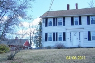
The house was built circa 1800. The property is located in a wooded residential area. The barn is an English style with an asphalt shingle roof and vertical siding.
- Use & Accessibility
Use (Historic)
Use (Present)
Exterior Visible from Public Road?
Yes
Demolished
n/a
Location Integrity
Unknown
- Environment
Related features
Environment features
Relationship to surroundings
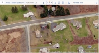
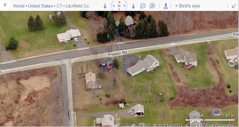
The 0.76 acres property, Account Number- 022-011-001 and Map-block-lot number- 00084400, is a corner plot located towards the east of Burger Road and the south of Preston Road. The property is located in a pre-dominantly residential area of sub-urban character with individual plots separated by woodland and parcels of open land. Residential plots can be seen towards the east, south and the north of the property across Preston Road while the area towards the west across Burger Road is open land with cluster of trees.
The L-shaped barn complex is located in the northeastern corner of the property abutting to Preston Road. The ridge line of the main barn runs north-south parallel to Burger Road but perpendicular to Preston Road. The circa 1800 colonial main residence of the property is located towards the southwest of the barn. The property is accessed by a drive way towards the north of the main residence which continues eastwards approaching the barn. The rest of the plot has open land dotted with cluster of trees.
- Typology & Materials
-
Building Typology
Materials
Structural System
Roof materials
Roof type
Approximate Dimensions
Barn: 24X36 Sqft, Circa 1900; Barn: 21X25 Sqft, Circa 1900; Shed: 7X24 Sqft, Circa 1900;
- Source
-
Date Compiled
06/14/2011
Compiled By
T. Levine and M. Patnaik, reviewed by CT Trust
Sources
Field notes and photographs provided by: Cherie Robinson, 04/24/2011.
Assessors’ records retrieved on June 14th, 2011 from website http://plymouth.univers-clt.com/index.php
Photograph/Information retrieved on June 14th, 2011 from website http://www.google.com
Photograph/Information retrieved on June 14th, 2011 from website http://www.bing.com.
Photograph/Information retrieved on June 14th, 2011 from website http://www.zillow.com.
Sexton, James, PhD; Survey Narrative of the Connecticut Barn, Connecticut Trust for Historic Preservation, Hamden, CT, 2005, http://www.connecticutbarns.org/history
Visser, Thomas D.,Field Guide to New England Barns and Farm Buildings, University Press of New England, 1997.
- PhotosClick on image to view full file
-