Barn Record Cromwell
RETURN TO ‘FIND BARNS’- Building Name (Common)
- n/a
- Building Name (Historic)
- n/a
- Address
- 142 North Road, Cromwell
- Typology

- Overview
-
Designations
n/a
Historic Significance
Architectural description:
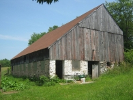
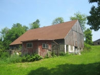
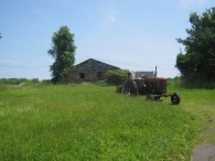
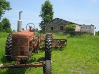
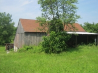
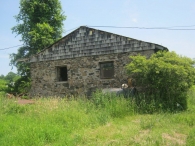
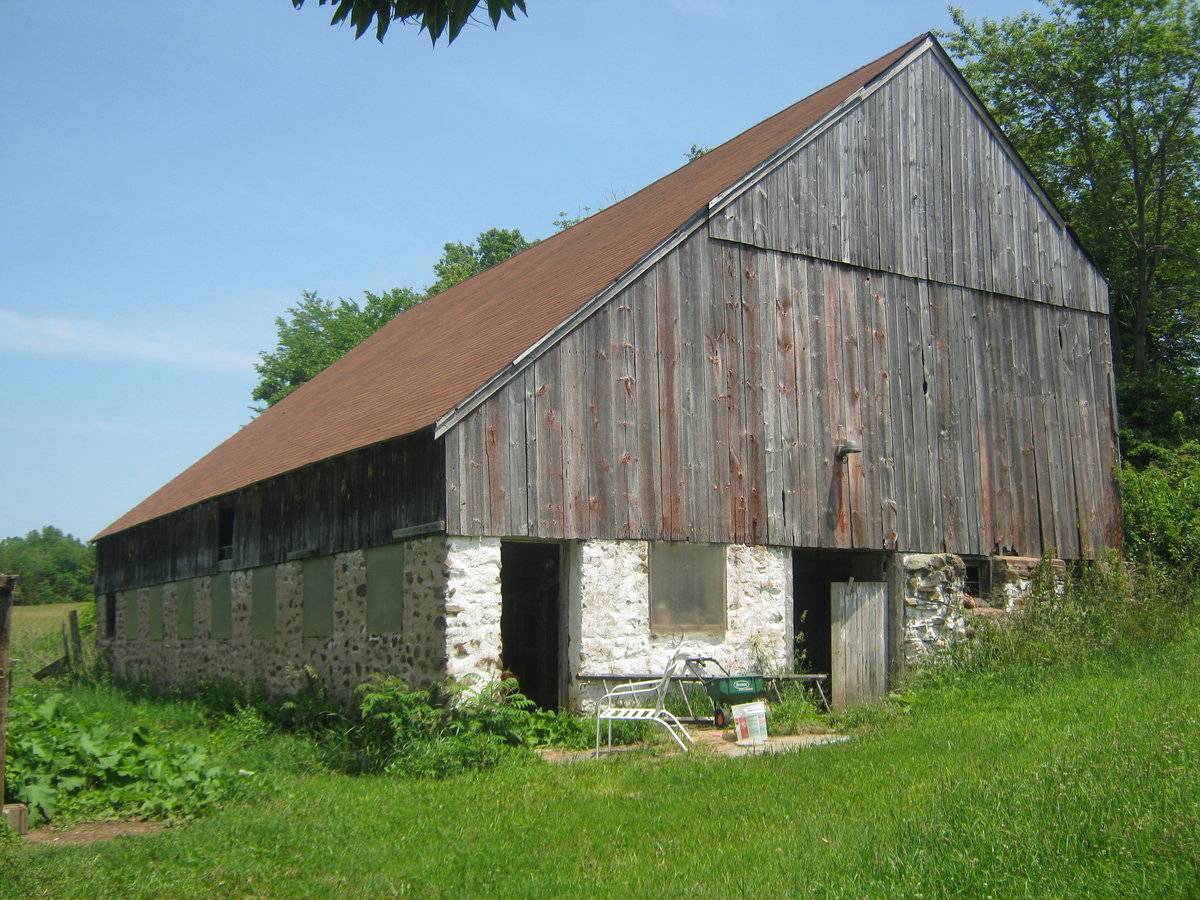
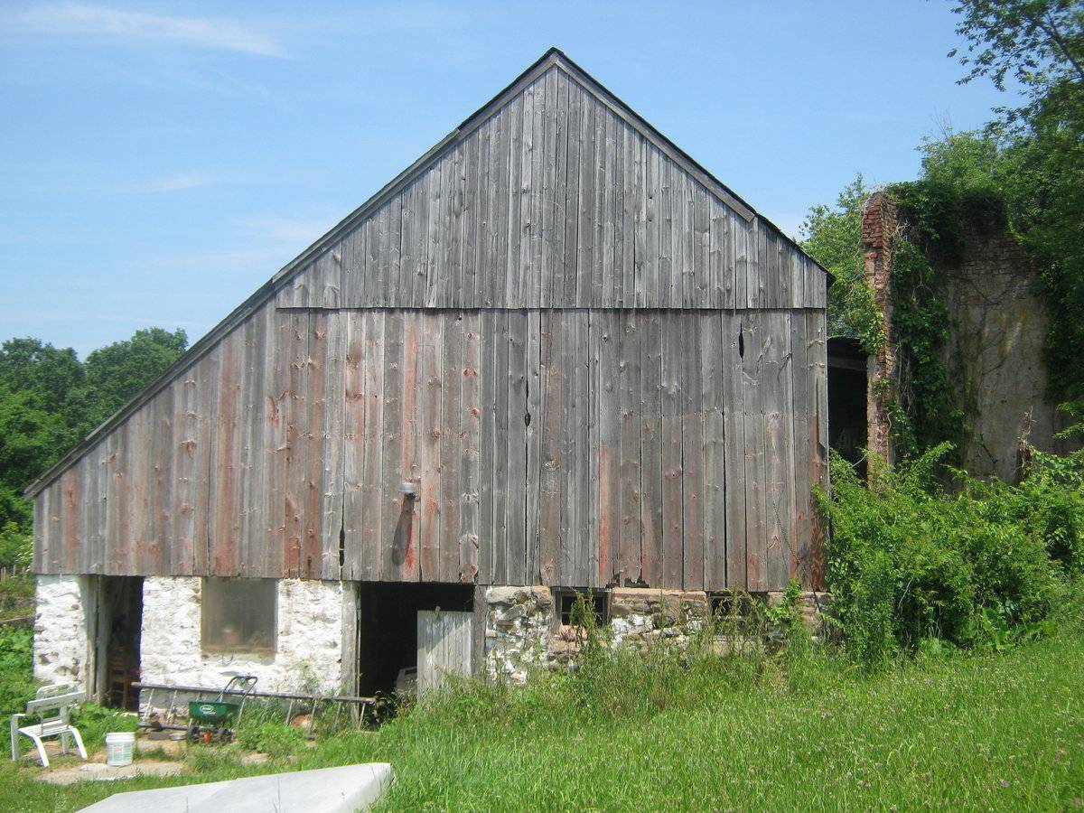
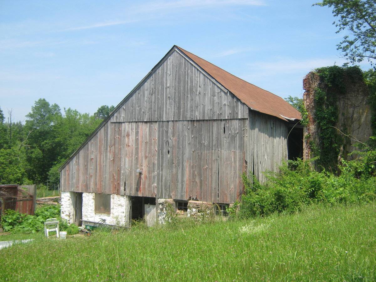
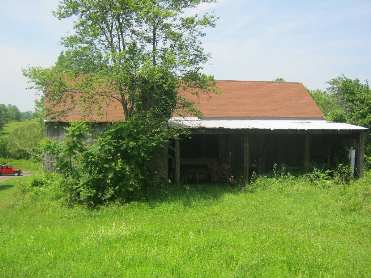
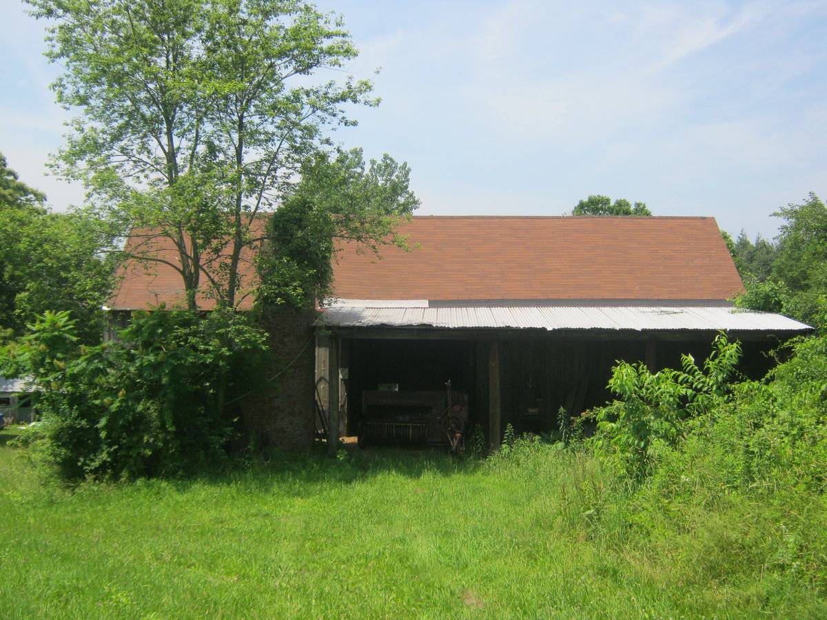
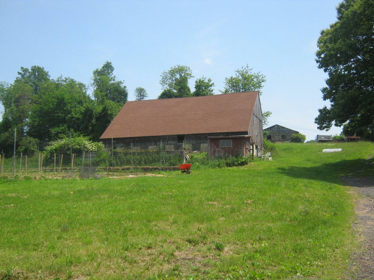
This is a 1 1/2-story eave-entry bank barn with a saltbox-roof addition. The main facade faces east and the ridgeline of the barn is parallel to this portion of North Road which runs roughly north-south. The road ends just west of the barn. The main entry is an open bay beneath a lean-to in the center of the north eave-facade. The lean-to covers the middle and west bay of the main facade. The rest of the facade is blank. Just north of the barn are the remains of a brick silo. The grade on the east gable-end of the barn declines, revealing a basement level and a mortared fieldstone foundation. In the basement level of the east gable-end of the barn are two four-pane windows in the north half of the feildstone. Off-center to the south is an open bay. Further south are a window opening and pass-through door, both beneath the saltbox portion of the roof. The rest of the east gable-end the barn is blank. The west eave-side of the barn is encompassed entirely by the saltbox-roof addition. The sides of the addition are flush with the gable-ends of the barn. The mortared fieldstone west wall of the addition has a series of eight window openings, apparently boarded over with plexiglass. A single square opening is centered in the west eave-side of the addition, in the section above the fieldstone, although it may just be missing siding. The barn is clad in unpainted vertical board siding, although there appears to be the remnants of very faded red paint. The foundation is mortared fieldstone. The roof is covered with asphalt shingles.
Historical significance:The oldest barns still found in the state are called the “English Barn,” “side-entry barn,” “eave entry,” or a 30 x 40. They are simple buildings with rectangular plan, pitched gable roof, and a door or doors located on one or both of the eave sides of the building based on the grain warehouses of the English colonists’ homeland. The name “30 by 40” originates from its size (in feet), which was large enough for 1 family and could service about 100 acres. The multi-purpose use of the English barn is reflected by the building’s construction in three distinct bays - one for each use. The middle bay was used for threshing, which is separating the seed from the stalk in wheat and oat by beating the stalks with a flail. The flanking bays would be for animals and hay storage.
A saltbox roofed barn is a wood framed building with a short roof pitch on one side and a long roof pitch, sweeping close to the ground, on the other side.
Field Notes
n/a
- Use & Accessibility
Use (Historic)
Use (Present)
Exterior Visible from Public Road?
Yes
Demolished
n/a
Location Integrity
Unknown
- Environment
Related features
Environment features
Relationship to surroundings
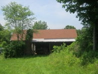
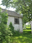
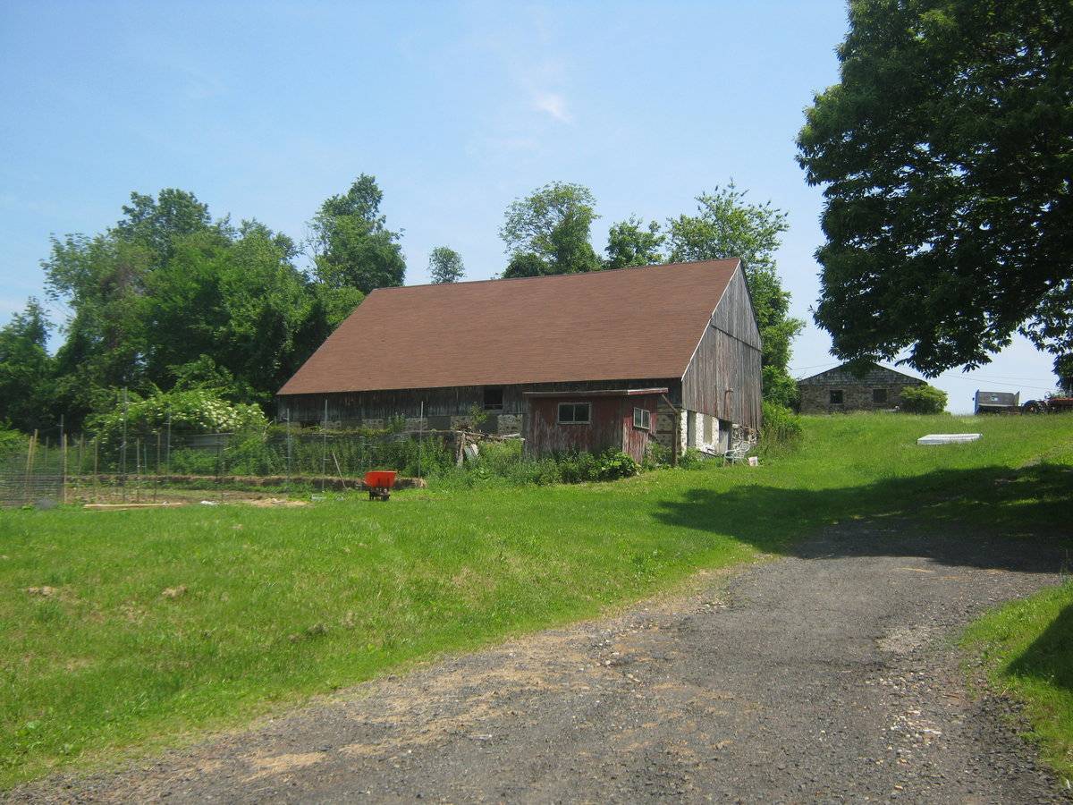
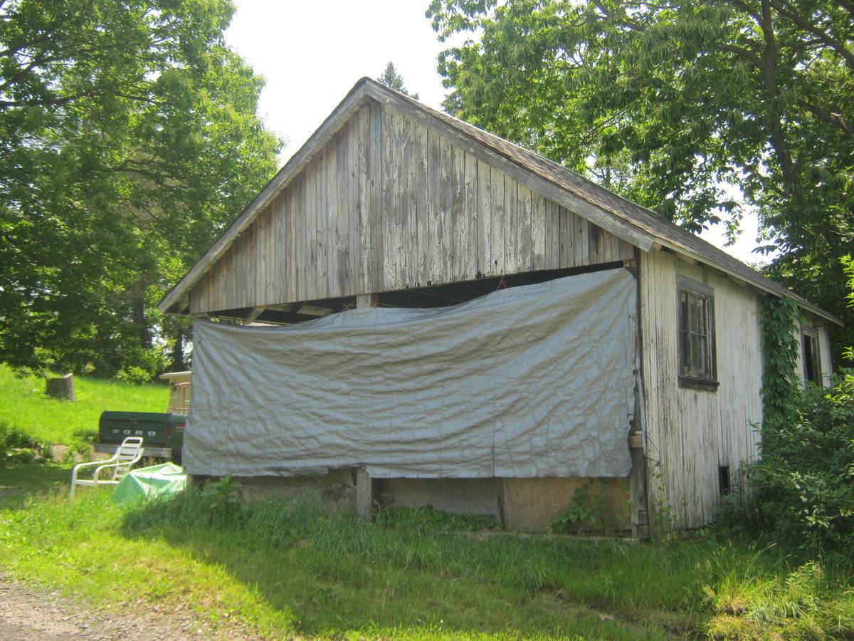
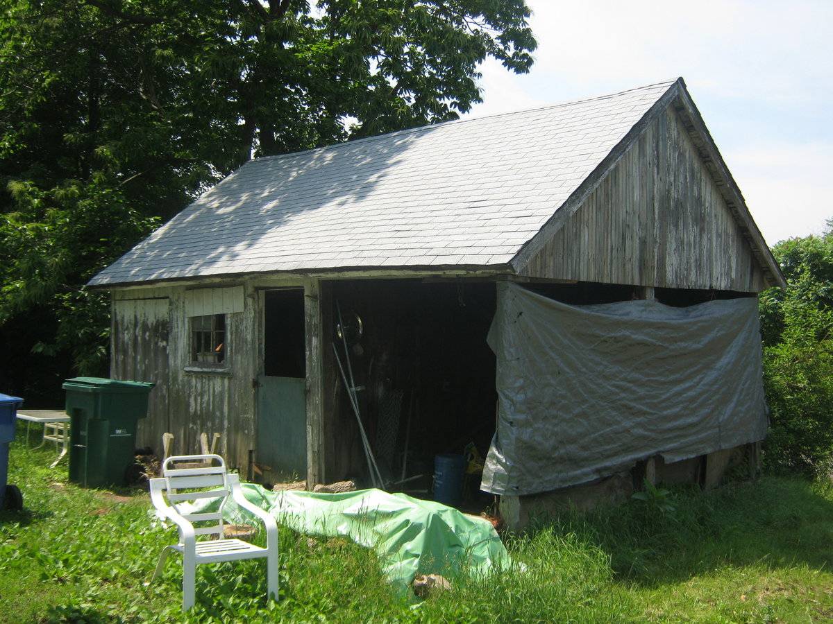
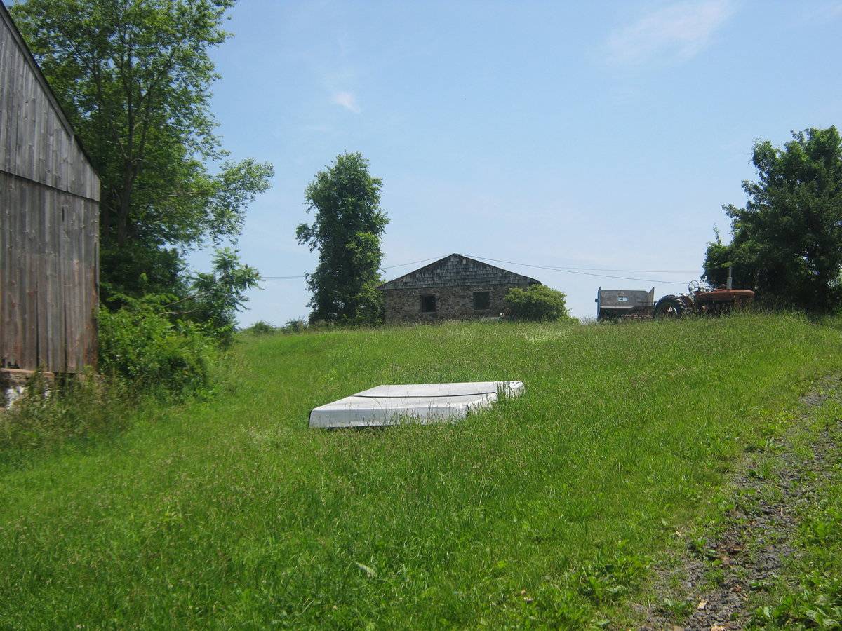
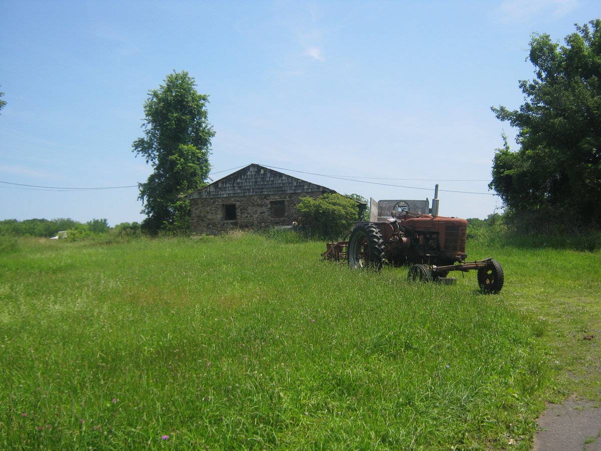
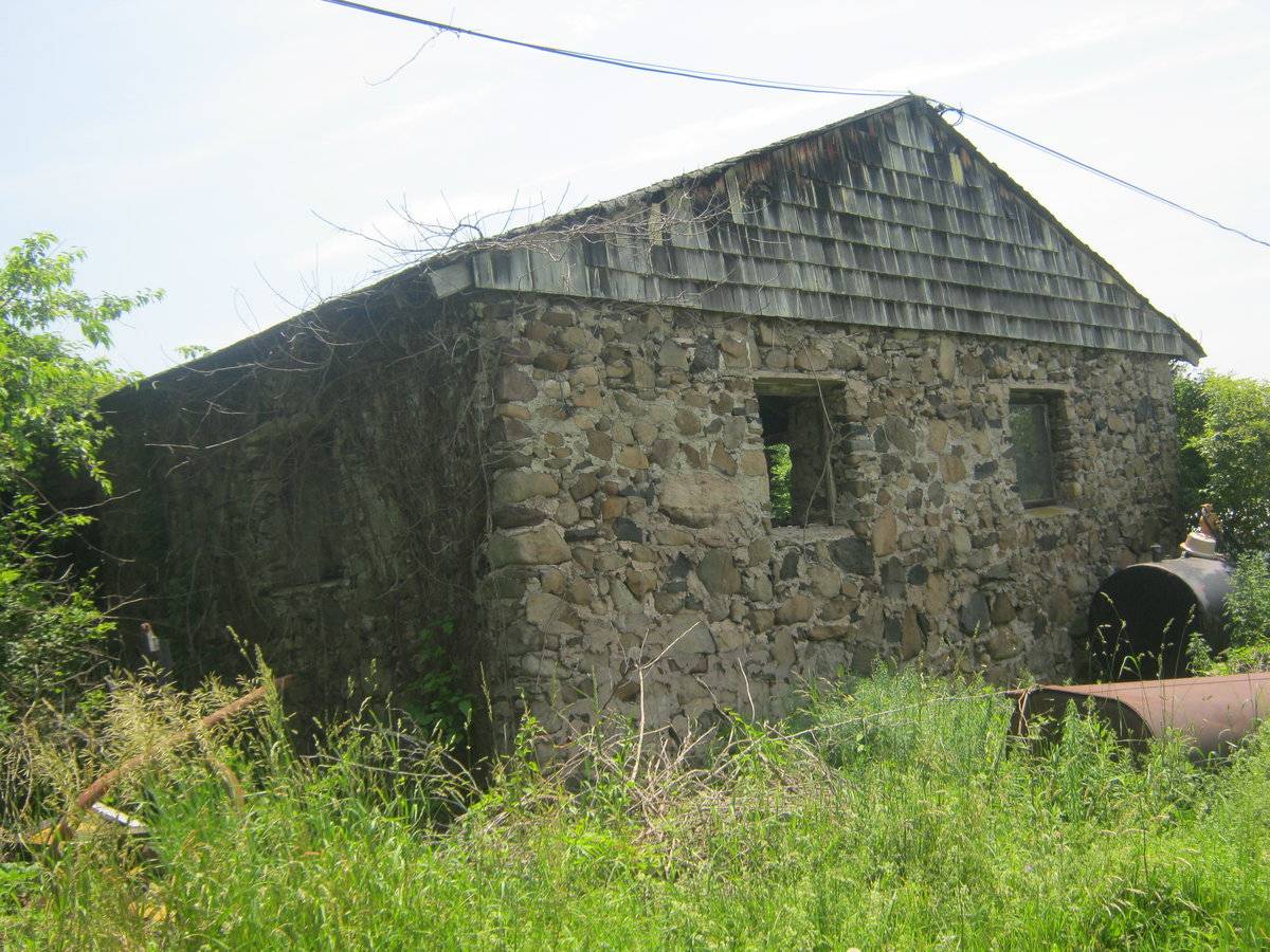
The barn is the heart of a former farming complex that appears to still be farmed, although the building itself appears unused. The barn is to the north and slightly behind the house with which it is associated. An access driveway leads between the house and the barn, from the end of North Road to the west, up and around the barn to the northeast, accessing a very large track of farmland. The assessors card lists the parcel of land with the house as only 1.28 acres. A rectangular nine acre lot adjacent to the south of the house is owned by the same family. No information was available for the lot to north, which holds all of the farm buildings as well as obviously farmed land. To the east of the barn is the remains of a brick silo. Further east, up the hill, is a two-bay, gable-roof stone structure, with open bays to the south. To the south of the stone structure is a long gable-roof structure. To the northwest of the house is a gable-roof shed. The area surrounding the site is open space, active agriculture, light residential and woodland.
- Typology & Materials
-
Building Typology
Materials
Structural System
Roof materials
Roof type
Approximate Dimensions
n/a
- Source
-
Date Compiled
06/22/2011
Compiled By
Todd Levine, reviewed by the Connecticut Trust
Sources
Photographs by Todd Levine.
Town of Cromwell Assessor’s Record: http://host.appgeo.com/CromwellCT/Map.aspx
Property ID: 00228300
Aerial Mapping:
http://www.bing.com/maps accessed 6/22/2011.Harris, Cyril M., Illustrated Dictionary of Historic Architecture, Dover, 1977.
Sexton, James, PhD, Survey Narrative of the Connecticut Barn, Connecticut Trust for Historic Preservation, Hamden, CT, 2005, http://www.connecticutbarns.org/history.
Visser, Thomas D., Field Guide to New England Barns and Farm Buildings, University Press of New England, 1997.
- PhotosClick on image to view full file
-