Barn Record Ansonia
RETURN TO ‘FIND BARNS’- Building Name (Common)
- n/a
- Building Name (Historic)
- n/a
- Address
- 40 Franklin Street (Rte 334), Ansonia
- Typology

- Overview
-
Designations
n/a
Historic Significance
Architectural description:
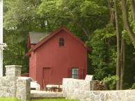
This is a 1 ½-story, eave-entry, gable-roof, carriage barn with a gable wall-dormer. The main façade faces southwest and the ridge-line is parallel with Franklin Street, which at this point runs approximately northwest to southeast.
The main entries are spaced evenly across the southwest eave-façade of the barn and consist of two pairs of side-hinged doors with diagonal boards and iron hinges. The southern most entry is topped with a pediment. In the gable wall-dormer is a beveled, side-hinged, hay-door with trim.
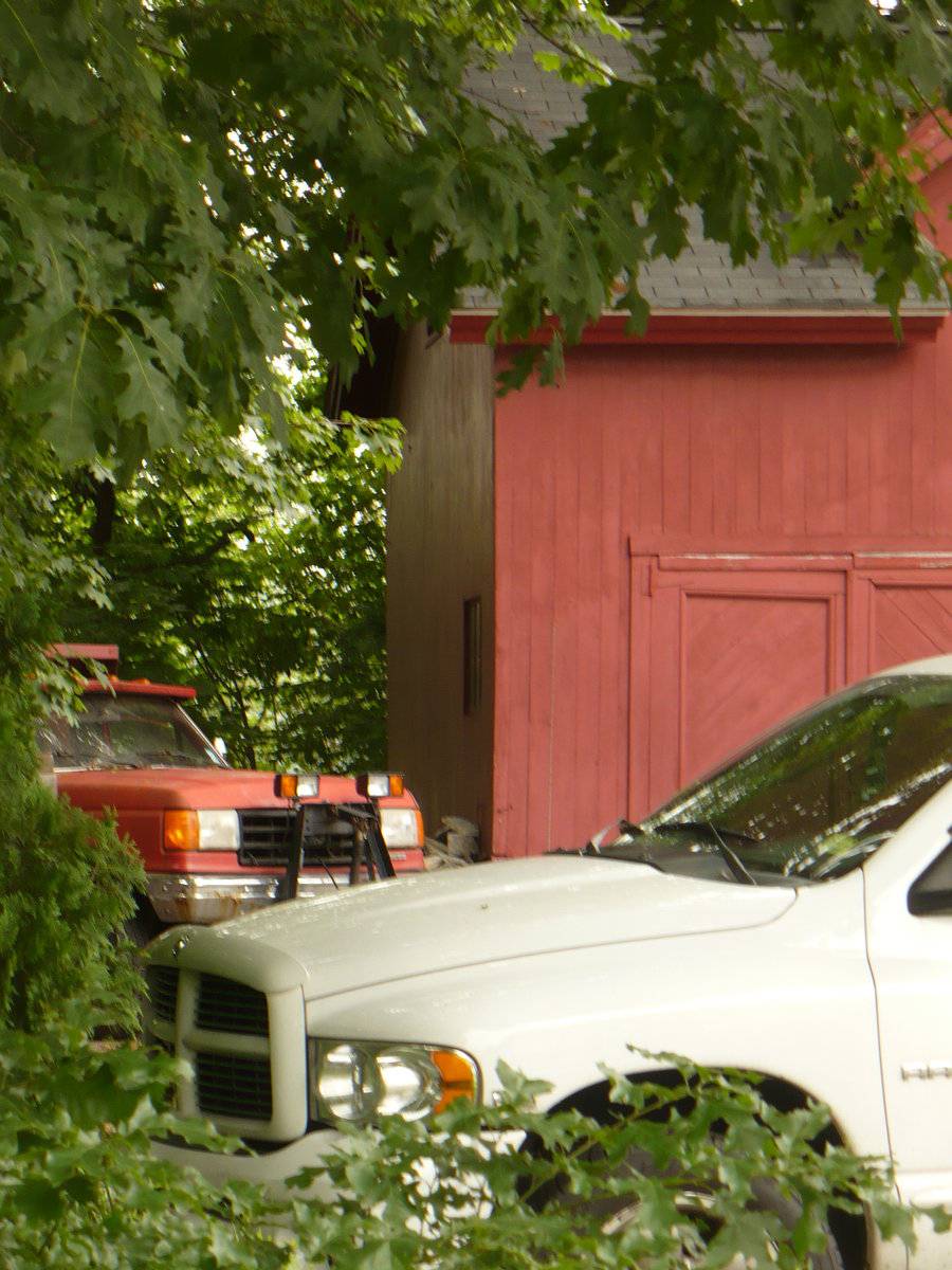
Near the south corner of the southeast gable-end of the barn is a paneled, side-hinged, pass-through door with a pediment. To the east, near the east corner is a six-over-six, double-hung window with trim, a pediment and shutters. Located in the gable-attic of the southeast gable-end of the barn is a four-pane, beveled window with trim. There are no other features on this side.
Dense tree growth precludes a visual description of the northeast eave-side of the barn for the purposes of a Historic Resource Inventory. On the west corner of the northwest gable-end of the barn is a four-pane window. Located in the gable-attic of the northwest gable-end of the barn appears to be a window with trim. There appear to be no other openings on this side.
The barn is clad in vertical flush-board siding painted red with red trim. The gable-roof had overhanging eaves and is clad in asphalt shingles.
Historical significance:Until the 1830s, the horses used for riding and driving carriages were often kept in the main barn along with the other farm animals. By the 1850s, some New England farmers built separate horse stables and carriage houses. Early carriage houses were built just to shelter a carriage and perhaps a sleigh, but no horses. The pre-cursor to the twentieth-century garage, these outbuildings are distinguished by their large hinged doors, few windows, and proximity to the dooryard.
The combined horse stable and carriage house continued to be a common farm building through the second half of the nineteenth century and the first decade of the twentieth century, until automobiles became common. Elaborate carriage houses were also associated with gentlemen farms and country estates of the late 19th and early 20th centuries. Another form of carriage barn, the urban livery stable, served the needs of tradespeople.
Field Notes
Property across from First United Methodist Church.
- Use & Accessibility
Use (Historic)
Use (Present)
Exterior Visible from Public Road?
Yes
Demolished
n/a
Location Integrity
Unknown
- Environment
Related features
Environment features
Relationship to surroundings
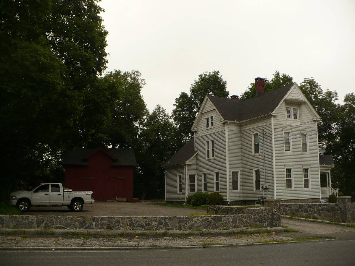
This barn sits on 0.4 acres of land directly to the east of the intersection of Franklin Street and Holbrook Place. The barn is to the northwest of the house, whose main façade faces southeast. A stone wall boarders the property on the south, north and east sides, and a line of trees boarder the property on the west side. Across the street, directly to the southwest is the First United Methodist Church. Directly to the northeast of the property is a large industrial complex with the Naugatuck River to the east of the complex. To the east of the river is what appears to be a large factory and industrial complex. Nolan Field is to the northwest of the property, and to the north is woodland and Coe Pond. The property is surrounded by dense residential, commercial and industrial areas with some woodland to the north.
Parcel No. 02100830000
- Typology & Materials
-
Building Typology
Materials
Structural System
n/a
Roof materials
Roof type
Approximate Dimensions
30 x 20
- Source
-
Date Compiled
06/28/2011
Compiled By
K. Young & T. Levine, reviewed by CT Trust
Sources
Field notes and photographs by Kristen Young - 6/27/2011.
Aerial Mapping: Ansonia Maps
http://www.bing.com/maps - accessed 6/28/2011.Town of Ansonia GIS Maps and Assessor’s Records:
http://www.ansoniagis.com/ - accessed 6/28/2011.Sexton, James, PhD, Survey Narrative of the Connecticut Barn, Connecticut Trust for Historic Preservation, Hamden, CT, 2005, http://www.connecticutbarns.org/history.
Visser, Thomas D., Field Guide to New England Barns and Farm Buildings, University Press of New England, 1997.
- PhotosClick on image to view full file
-