Barn Record Columbia
RETURN TO ‘FIND BARNS’- Building Name (Common)
- n/a
- Building Name (Historic)
- n/a
- Address
- 419 Middletown Road (Rte 66), Columbia
- Typology

- Overview
-
Designations
n/a
Historic Significance
Architectural description:
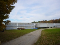
This is a long, two story chicken coop with a shed-roofed addition. The main facade faces roughly south, with the eaves perpendicular to this portion of Middletown Road (Route 66), which runs approximately southwest-northeast. The main entry is through a pass-through door in the center of the south-eave facade. Both the main level and the second level are identical except for the main entry; they have a series of boarded poultry windows and door openings. A long hooded divides the levels. The north eave-facade has a shed-roofed addition opposite the main entry. Both the main level and the second level are identical except for the shed-roofed addition with a chimney; they have a series of top-hinged poultry windows. The structure has vertical siding with a concrete block masonry foundation and the roof is asphalt shingles.
Historical significance:
Poultry farming grew in popularity during the second half of the 19th century, and by the early 20th century most farms had small chicken coops. These lightly-built structures often feature a gabled or shed roof and large windows on the south side. Often chicken coops have a small stove and chimney for heat to protect young chicks during cold weather. Small openings near the ground provide the fowl with access to the yard. Inside are nesting boxes for the laying hens. During the 1930s and 1940s, poultry farming was adopted by many farmers in New England as a replacement for dairy farming.
By the 1930s, large two-and three-story poultry barns were being built for raising broilers and capons for meat and pullets for eggs. These often have a shallow-pitched gable or shed roof and many windows on the south side, which are often covered with wire mesh. Mineral-surfaced asphalt paper or shingles typically cover the roof and walls. Housing thousands of birds, these large structures became virtual factories, with automatic, clock-activated feeders and waterers to reduce labor.
Field Notes
n/a
- Use & Accessibility
- Environment
Related features
Environment features
Relationship to surroundings
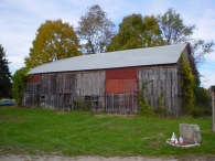
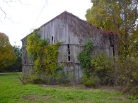
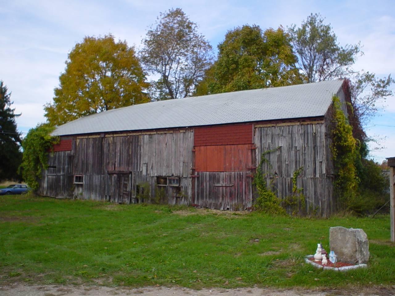
The barn is to the north and the side of the house it is associated with. The ridge-line of the house is perpendicular to Middletown Road (Route 66). North of the chicken coop is a track of open space. To the south west, fronting Middletown Road, is an English barn is poor condition (photographs 2 & 3). South of the English barn and house is a tract of open space. Further south and to the east is dense woodland. The total size of the site is 9.16 acres. The area is light residential with tracks of open space and dense woodland.
M/P = 035//091
- Typology & Materials
-
Building Typology
Materials
Structural System
n/a
Roof materials
Roof type
Approximate Dimensions
9450 S.F.
- Source
-
Date Compiled
07/29/2010
Compiled By
Todd Levine, reviewed by the Connecticut Trust
Sources
Photographs by Todd Levine.
Sexton, James, PhD; Survey Narrative of the Connecticut Barn, Connecticut Trust for Historic Preservation, Hamden, CT, 2005, http://www.connecticutbarns.org/history.
Visser, Thomas D.,Field Guide to New England Barns and Farm Buildings, University Press of New England, 1997.
Map of the Columbia, CT, retrieved on July 29, 2010 from website www.zillow.com.
Town of Columbia assessors office, 323 Route 87, Columbia, CT 06237.
- PhotosClick on image to view full file
-