Barn Record Columbia
RETURN TO ‘FIND BARNS’- Building Name (Common)
- Szegda Farm
- Building Name (Historic)
- n/a
- Address
- 4 Robinson Road, Columbia
- Typology
- Overview
-
Designations
n/a
Historic Significance
Architectural description:
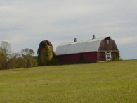
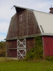
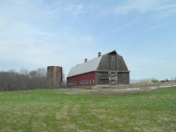
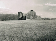
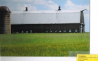
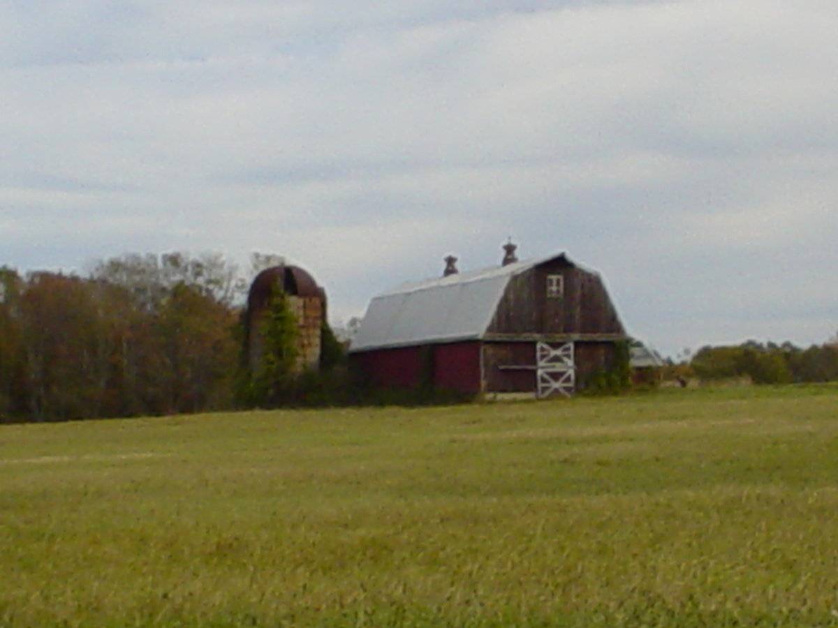
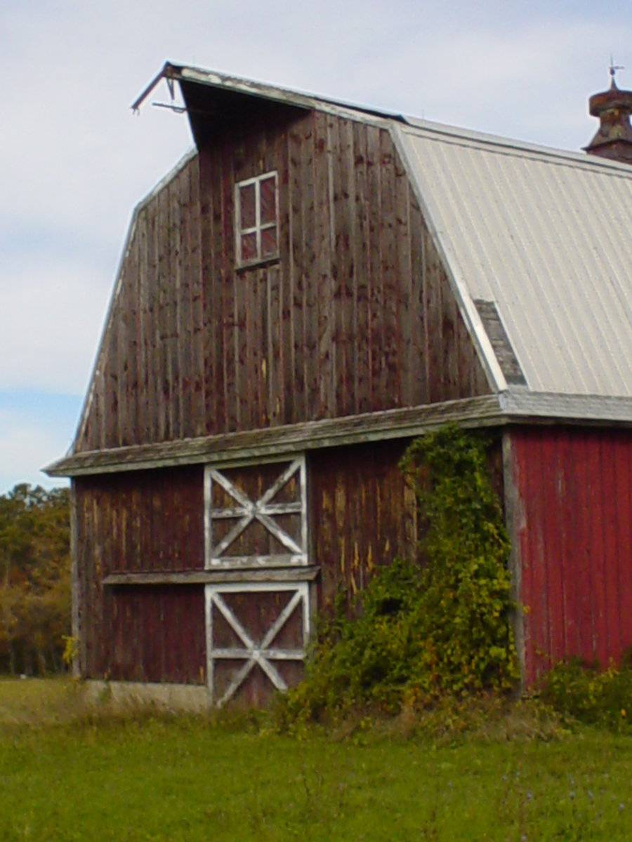
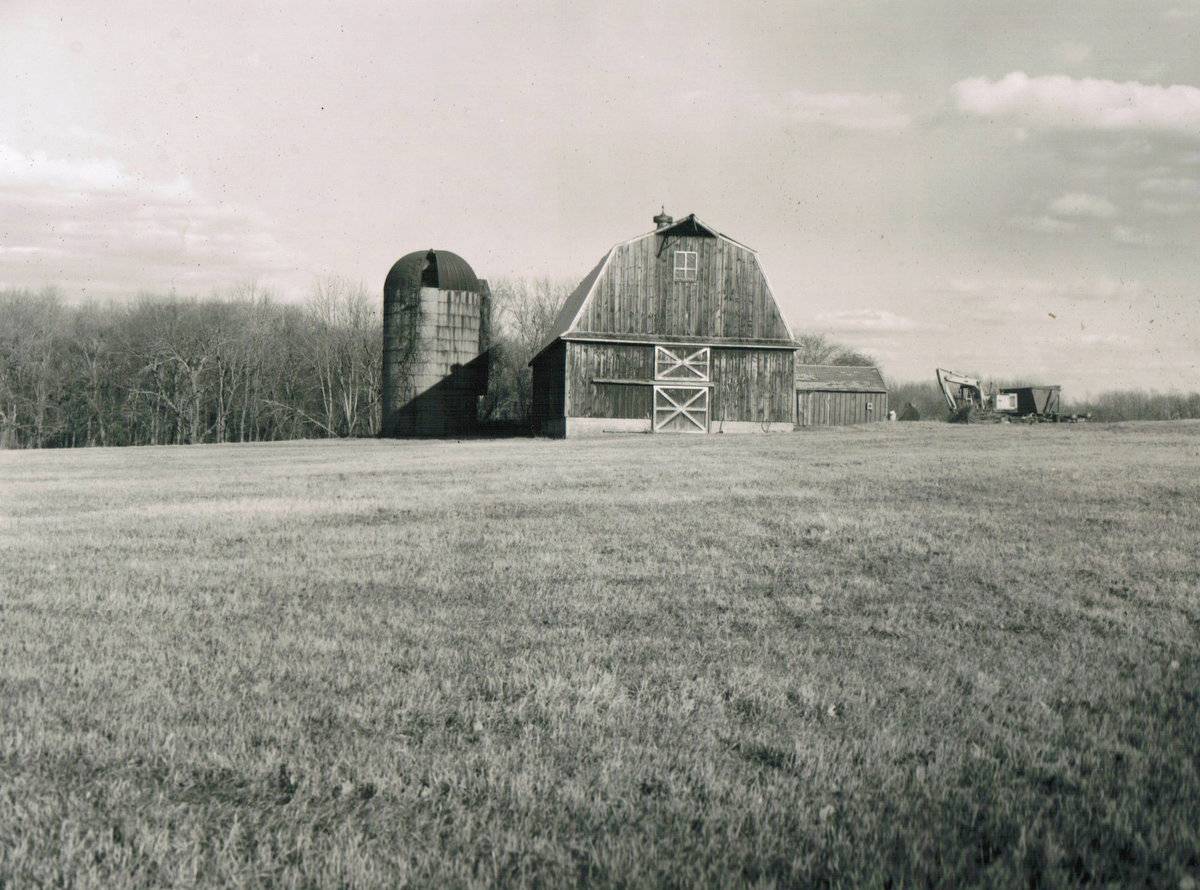
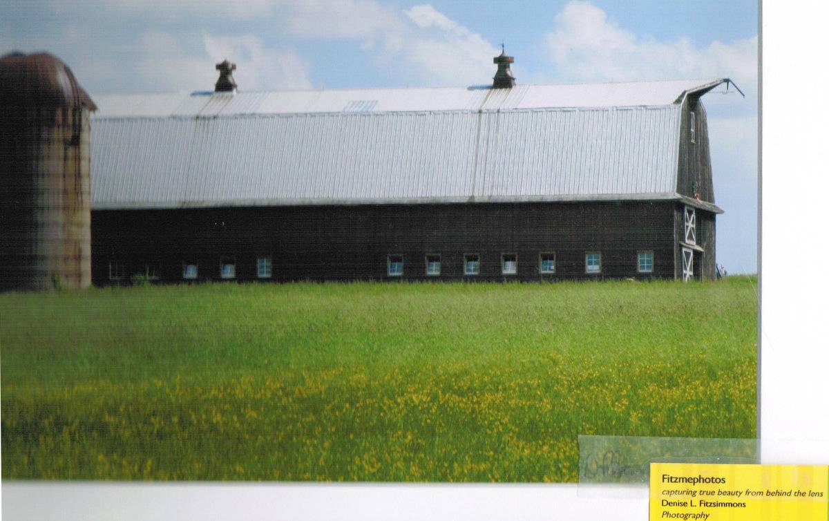
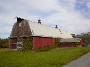
This is a 2 1/2-story gambrel-roofed gable-entry barn with a gable-roofed addition. The main facade faces west, parallel to Robinson Road, which runs approximately east-west. The main entry is an exterior sliding door, with the hooded tracks extending to the north. Above the door is a slightly smaller, similar hay door. Separating the main level from the second level is a hood that encompasses the entire barn. The second level is blank except for a hay door beneath a projecting hay hood at the apex of the roof. The north eave-facade of the barn has a series of hopper stable windows with a pass-through door near the center. The south eave-facade has a gable-roofed addition near the center. The barn has board-and-batten siding painted red on both eave-facades and unpainted on the west gable-facade. The foundation appears to be concrete block masonry. The roof is metal and has two metal ventilators.
Historical significance:
By the early 20th century agricultural engineers developed a new approach to dairy barn design: the ground-level stable barn, to reduce the spread of tuberculosis bacteria by improving ventilation, lighting, and reducing the airborne dust of manure. A concrete slab typically serves as the floor for the cow stables. Many farmers converted manure basements in older barns into ground-level stables with concrete floors. Some older barns were jacked up and set on new first stories to allow sufficient headroom. With the stables occupying the entire first story, the space above serves a a hayloft. By the 1920s most ground-level stable barns were being constructed with lightweight balloon frames using two-by-fours or two-by-sixes for most of the timbers. Tongue-and-groove beveled siding is common on the walls, although asbestos cement shingles also were a popular sheathing. Some barns have concrete for the first-story walls, either poured in place or built up out of blocks. The gambrel roof design was universally accepted as it enclosed a much greater volume than a gable roof did, and its shape could be formed with trusses.
Field Notes
Editors note: This is one of my favorite barn sites in the state. http://ctfarmland.org/ announced 6/25/2013: Entering Columbia from the west on Route 66, a rolling vista of pastures and fields greets the visitor: Ron Szegda's family farm has marked the gateway to the town for more than a century. Today, this farm has been protected by the joint efforts of The Connecticut Department of Agriculture (DoAg), The Town of Columbia, Joshua's Trust, and Connecticut Farmland Trust (CFT). The agricultural easement now jointly held by DoAg and CFT ensures that, while the land may change hands many times in the years to come, it will always be open to agriculture. The Szegda's have farmed this land since the early 1900s. They entered the dairy business in the 1950s. Ron Szegda has lived on and farmed the land there for his entire life. Concerned that the land might be lost and worried that he would have to sell out when he could no longer farm, in 2006 Mr. Szegda began searching for a way to protect his family's legacy. But it wasn't until 2010, when Mr. Szegda caught the attention of DoAg's Farmland Protection Program, that things began to come together."These things can take time," said Jim Gooch, Executive Director of CFT. "The family wants the best outcome - for their land and for their own future - the State and the Town need to be cautious about spending the people's money. Even CFT needs time to raise funds, do our due diligence, and reach a level of comfort with the farmer and the project partners. But at the end of the day, we all want the same thing: ensuring the future of Connecticut agriculture by protecting the land it relies on." With the State providing the bulk of the funding and the Town of Columbia committing town funds to the deal, Joshua's Trust and CFT contributed privately-raised capital. By agreeing to co-hold the easement, CFT also brought permanent stewardship to the deal: "We will visit this land every year, just to be sure the resource is being well-used. That's an obligation we legally assume forever," said Gooch. Szegda's land was a priority for all four partners because of the high quality of its soils. Connecticut's farms are home to some of the world's best growing soil, and protecting that resource for the future has been the aim of DoAg's Farmland Protection Program for more than 30 years. Today, that land support's Szegda's dairy operation with hay and corn production. When the Szegda's no longer farm it, that land will serve the next farmer, and the next."The Szegda Farm Development Rights purchase preserves local history, scenic views, the town's rural character and local agricultural resources. Columbia's border with Hebron will forever more be a beautiful gateway to our special town, " said Columbia First Selectman Carmen Vance. "Columbia thanks its local and state taxpayers, the Connecticut Farmland Trust, Joshua's Trust and the Connecticut Department of Agriculture's Farmland Preservation Program." Directly across the road from Robinson's 40-acre farm (also protected by the State), and within two miles of over 600 acres of active farmland, Szegda's farm is a key parcel in a patchwork of agricultural activity. "CFT intentionally works to foster agricultural nodes," said Gooch. "The more robust farming activity there is in a place, the healthier the agricultural economy of that place will be." As for Ron Szegda, the satisfaction is personal. "I am happy to preserve the land," he said, "because if I didn't, I'd have to sell it. Continuing to operate my small dairy in my retirement brings me great joy."
- Use & Accessibility
Use (Historic)
Use (Present)
Exterior Visible from Public Road?
Yes
Demolished
n/a
Location Integrity
Unknown
- Environment
Related features
Environment features
Relationship to surroundings
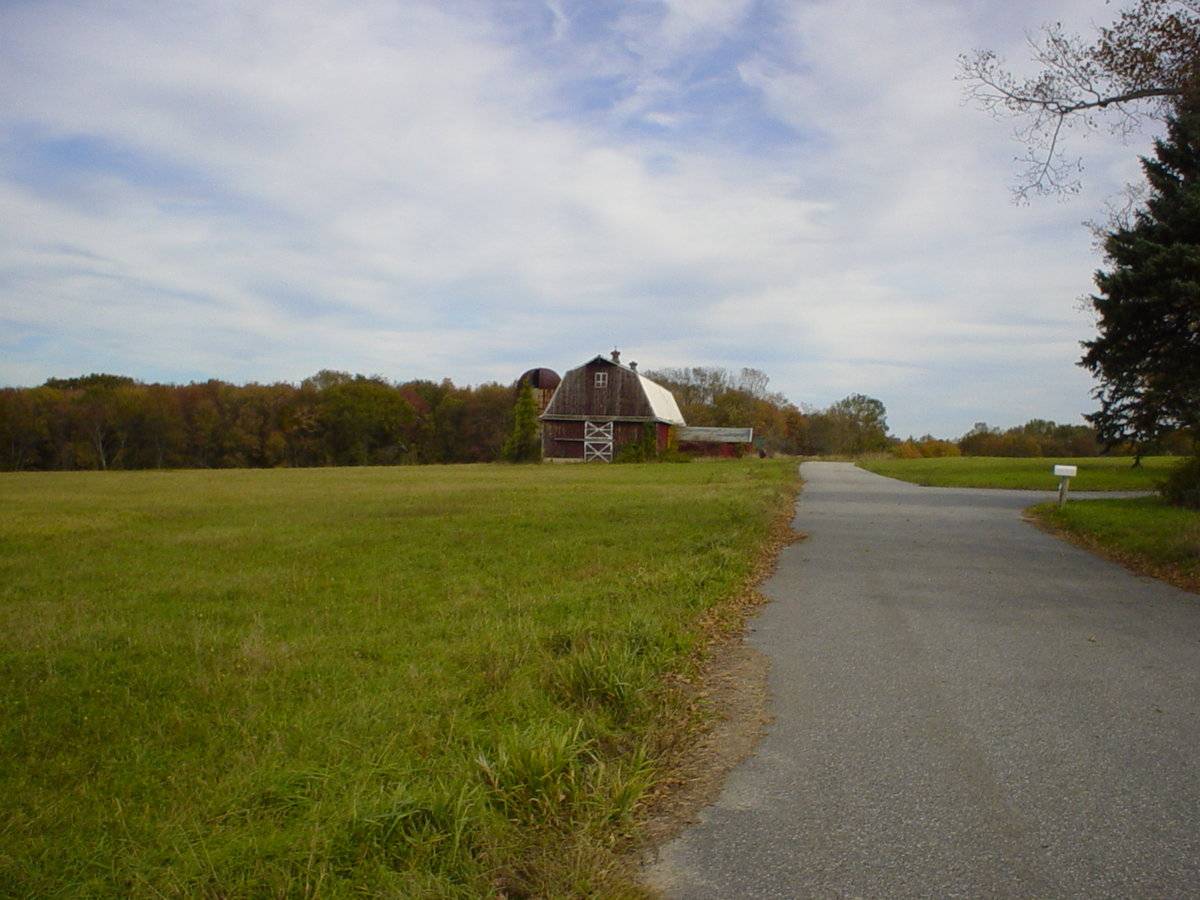
The barn is at the end of a dead-end side street. To the west of the barn is Route 66 and the ridge-line of the barn is perpendicular to this portion of Route 66, which runs approximately north-south. The barn sits on a hill overlooking Route 66 to the west. To the north of the barn is a poured concrete silo. To the northwest is open space. To the northeast is dense woodland. South of the barn are large tracts of open space. The area is active agriculture and scattered residential with open space and woodland.
- Typology & Materials
-
Building Typology
Materials
Structural System
n/a
Roof materials
Roof type
Approximate Dimensions
n/a
- Source
-
Date Compiled
07/29/2010
Compiled By
Todd Levine, reviewed by the Connecticut Trust
Sources
Photographs by Todd Levine and Judy Ortiz.
Sexton, James, PhD; Survey Narrative of the Connecticut Barn, Connecticut Trust for Historic Preservation, Hamden, CT, 2005, http://www.connecticutbarns.org/history.
Visser, Thomas D.,Field Guide to New England Barns and Farm Buildings, University Press of New England, 1997.
Map of Columbia, CT, retrieved on July 29, 2010 from website www.zillow.com.
- PhotosClick on image to view full file
-