Barn Record Bethany
RETURN TO ‘FIND BARNS’
- Overview
-
Designations
n/a
Historic Significance
Architectural description:
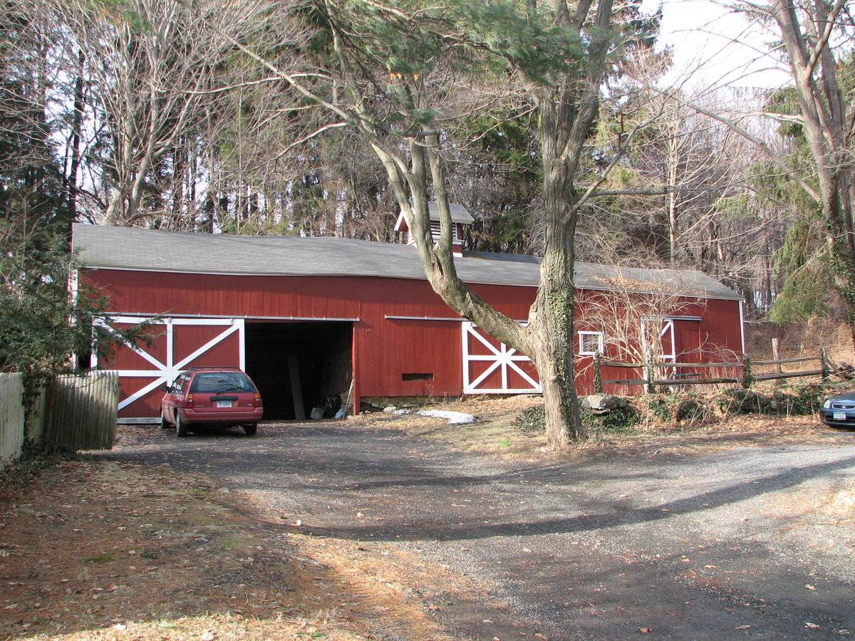
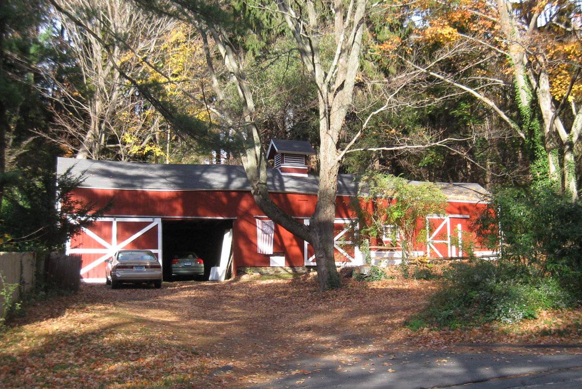
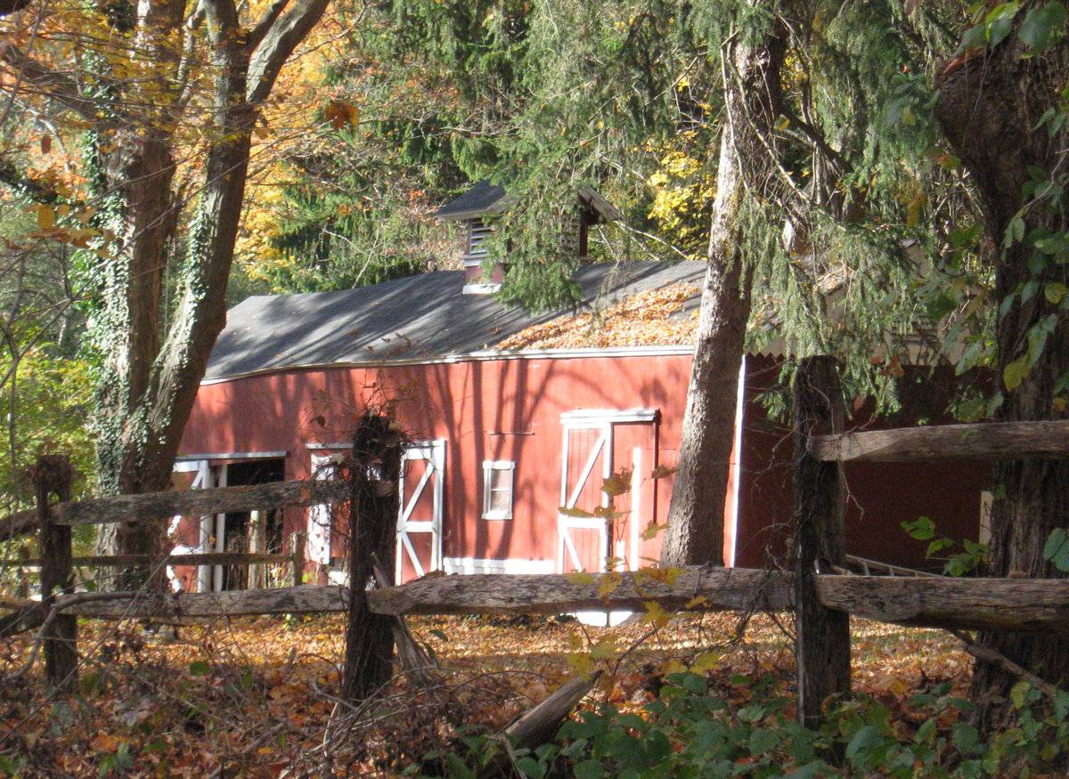
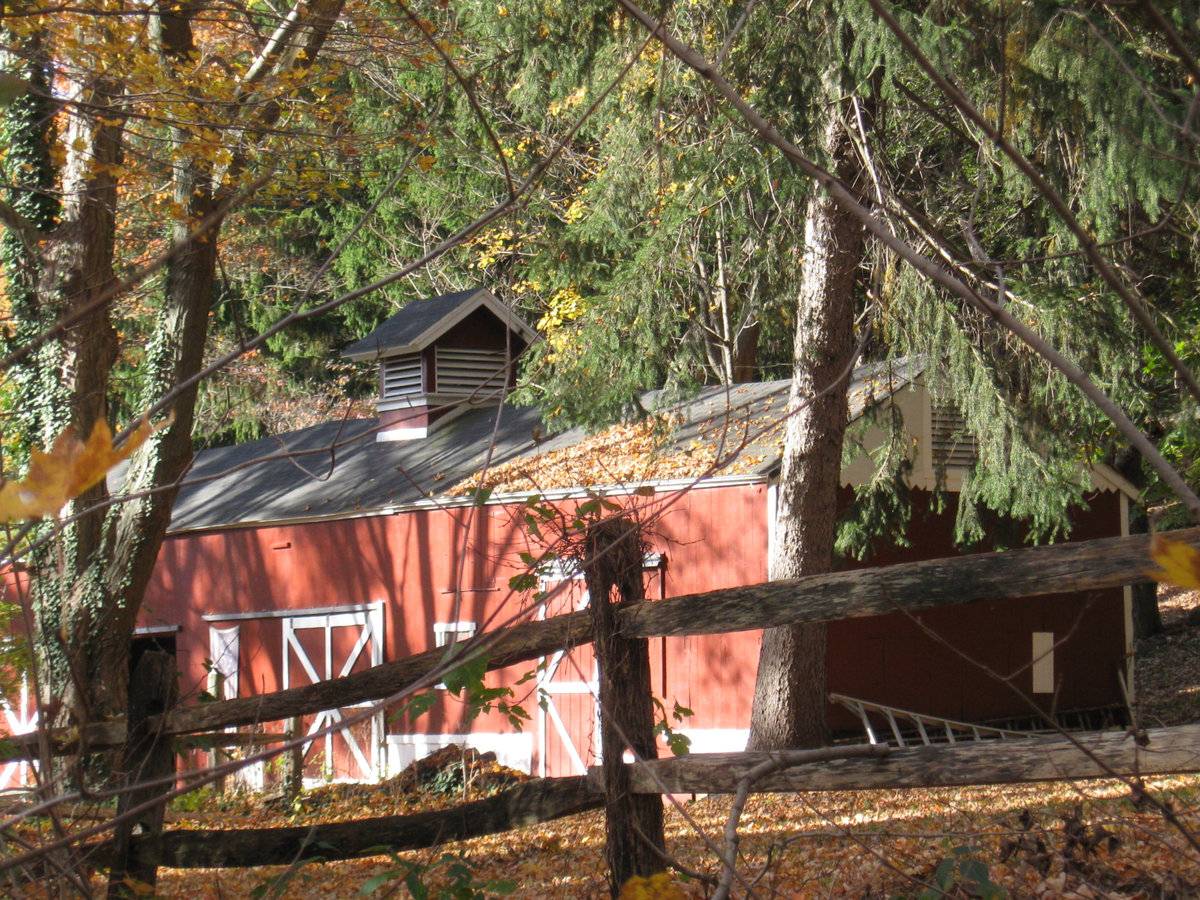
This is a 1 1/2-story eave-entry barn with a saltbox addition. The main facade faces east and the ridge-line of the barn is parallel to this portion of the Litchfield Turnpike (Route 69), which runs approximately north-south. The main entry is a broad exterior sliding door in the southernmost section of the east eave-facade of the barn. The middle and north sections are raised slightly to correspond with an elevation in grade. The middle section has a narrower exterior sliding door, which slides to the south. There is an oblong opening just above the mortared fieldstone foundation in the wall to the south of the door. The north section of the east eave-facade of the barn has a narrow, exterior sliding door which slides to the north and a fixed, two-paned window with trim between the doors of the middle and north sections. A hinged hay door sits above the window directly beneath the eaves. The lintel of the sliding door in the north section is higher than the other two sliding doors. The south gable-side of the barn appears to have a hinged hay door with an eight-pane window encased in its west wing. There is a saltbox-roof addition to the rear, west eave-side of the barn. The north gable-side of the barn has a louvered opening for ventilation beneath the gable peak. The girt-line is embellished with a zigzag molding. What appears to be a small opening or a repair is found in the west side of the main story of the north gable-side of the barn. A gable-roof cupola with louvers on all four sides rises above the asphalt-shingled roof. The vertical flush-board siding is painted red with white trim and X-shaped patterns on the sliding doors.
Historical significance:The oldest barns still found in the state are called the “English Barn,” “side-entry barn,” “eave entry,” or a 30 x 40. They are simple buildings with rectangular plan, pitched gable roof, and a door or doors located on one or both of the eave sides of the building based on the grain warehouses of the English colonists’ homeland. The name “30 by 40” originates from its size (in feet), which was large enough for 1 family and could service about 100 acres. The multi-purpose use of the English barn is reflected by the building’s construction in three distinct bays - one for each use. The middle bay was used for threshing, which is separating the seed from the stalk in wheat and oat by beating the stalks with a flail. The flanking bays would be for animals and hay storage.
Field Notes
According to Assessor's field card, the house was built in 1800.
- Use & Accessibility
Use (Historic)
Use (Present)
Exterior Visible from Public Road?
Yes
Demolished
n/a
Location Integrity
Unknown
- Environment
Related features
Environment features
Relationship to surroundings
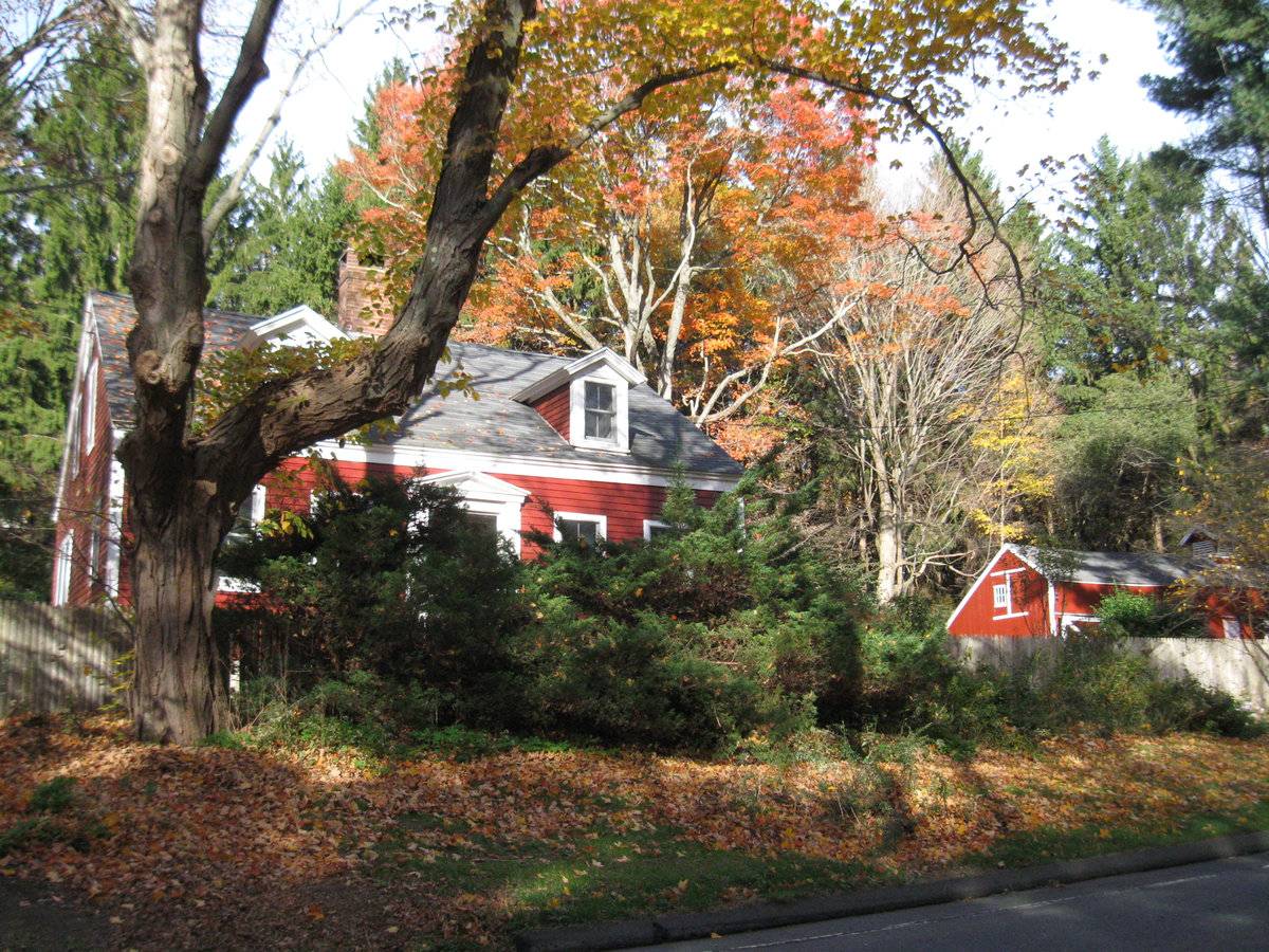
The barn is to north of the house with which it is associated. The ridge-line of the house is parallel to the ridge-line of the barn. The barn and house front the Litchfield Turnpike (Route 69) on a shallow, oblong lot 1.80 acres in size. The driveway leads directly to the south eave-facade of the barn. A sidewalk connects the driveway to the north gable-side of the house, which was built in ca. 1800. A wooden privacy fence runs along the Litchfield Turnpike in front of the house and a split-rail fence outlines a parking area in front of the north eave-facade of the barn continuing along the Turnpike to the north. The stone wall runs behind the split-rail fence in front of the barn. The lot has several mature trees so that the house and barn are well-shaded. A vinyl swimming pool is found on the south end of the lot. There appears to be a vegetable garden behind the pool. Lake Bethany is on the east side of the Litchfield Turnpike. The surrounding area is residential, agriculture, open space and woodland.
Map: 124/48
- Typology & Materials
-
Building Typology
Materials
Structural System
Roof materials
Roof type
Approximate Dimensions
VINYL POOL POOL 1978 560 FRAME BARN 1900 616 FRAME BARN 1900 525
- Source
-
Date Compiled
01/21/2011
Compiled By
Amy Prescher & Todd Levine, reviewed by CT Trust
Sources
Photographs and field notes by Melissa Antonelli.
Map of Bethany, CT, retrieved on January 21, 2011 from website
http://bing.com/maps/Map of Bethany, CT, retrieved on January 21, 2011 from website http://maps.google.com/
eQuality Valuation Servies, LLC Database
http://www.prophecyone.us/fieldcard.php?property_id=1826952Sexton, James, PhD; Survey Narrative of the Connecticut Barn, Connecticut Trust for Historic Preservation, Hamden, CT, 2005, http://www.connecticutbarns.org/history.
Visser, Thomas D.,Field Guide to New England Barns and Farm Buildings, University Press of New England, 1997.
- PhotosClick on image to view full file
-