Barn Record Middlefield
RETURN TO ‘FIND BARNS’- Building Name (Common)
- n/a
- Building Name (Historic)
- n/a
- Address
- 672 Main Street (Rte 147), Middlefield
- Typology
- Overview
-
Designations
n/a
Historic Significance
Architectural description:
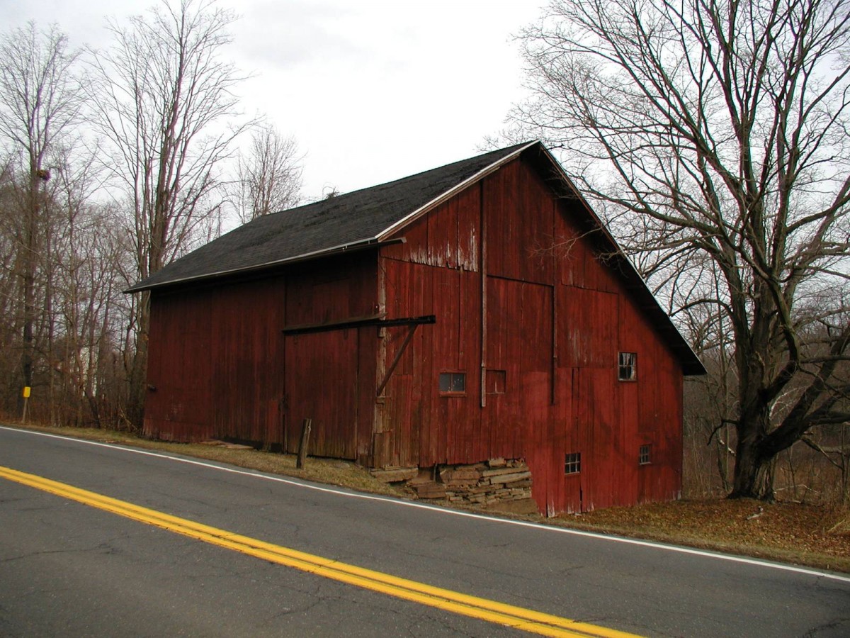
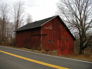
This is a 1 ½ - story three-bay eave-entry bank barn with a salt-box roof addition encompassing the entire length of its east eave-side. The ridge line of the barn runs north-south almost parallel to this portion of Main Street. The three-bay west eave-side of the barn facing the road is the main façade with the main entrance centered in the middle bay which appears to be through a double-height exterior-hung sliding wagon door. The barn has a second entrance in the first bay from the south through an exterior-hung sliding pass-through door with horse-shoe tracks that which projects out towards the south. The grade level along the south gable-end of the barn flush with the south side-wall of the salt-box roof addition declines towards the east to form the bank level. The bank level has exposed coursed un-mortared field-stone masonry towards the west while a hinged pass-through door can be seen towards the extreme east with two six-pane stable windows towards its west. The first floor level has a two-pane window towards the west followed by a boarded window while a four-pane window can be seen towards the east. The gable attic is separated from the rest of the gable-end by a distinct dropped girt siding divide line and appears to originally have a hay door at the center. The markings and discolorations of the siding suggest alterations to the original openings on the south gable-end of the barn.
The wooden frame of the barn is supported on coursed un-mortared field stone masonry foundation. The barn has asphalt shingles roofing and red painted vertical siding walls.
Historical significance:The oldest barns still found in the state are called the “English Barn,” “side-entry barn,” “eave entry,” or a 30 x 40. They are simple buildings with rectangular plan, pitched gable roof, and a door or doors located on one or both of the eave sides of the building based on the grain warehouses of the English colonists’ homeland. The name “30 by 40” originates from its size (in feet), which was large enough for 1 family and could service about 100 acres. The multi-purpose use of the English barn is reflected by the building’s construction in three distinct bays - one for each use. The middle bay was used for threshing, which is separating the seed from the stalk in wheat and oat by beating the stalks with a flail. The flanking bays would be for animals and hay storage.
The 19th century saw the introduction of a basement under the barn to allow for the easy collection and storage of a winter’s worth of manure from the animals sheltered within the building. The bank barn is characterized by the location of its main floor above grade, either through building into a hillside or by raising the building on a foundation. This innovation, aided by the introduction of windows for light and ventilation, would eventually be joined by the introduction of space to shelter more animals under the main floor of the barn.
Field Notes
Number approximate - across from 671 Bank barn with shed across from Lyman Orchard's store on Rte 147. Fieldstone foundation. Near the intersection of Main Street and Reeds Gap Road.
- Use & Accessibility
Use (Historic)
Use (Present)
Exterior Visible from Public Road?
Yes
Demolished
n/a
Location Integrity
Unknown
- Environment
Related features
Environment features
Relationship to surroundings
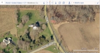
The property is located towards the east of Main Street, across plot number 671 Main Street, Account Number- 00125300 and Map number- 17/ / 5/ / /. The property is located in a predominantly residential area with individual plots separated by parcels of farmland and woodland. Residential plots can be seen towards the west of the property across Main Street and towards the north beyond the dense woodland. Parcels of farmland can be seen towards the south while Lyman Orchards can be seen towards the south-west, across the road.
The barn is located in the northwest corner of the property abutting to Main Street. The ridge line of the barn runs north-south parallel to this portion of the road. Dense woodland can be seen towards the north and the northwest of the barn while parcels of farm land surround it towards the east and the south.
- Typology & Materials
-
Building Typology
Materials
Structural System
Roof materials
Roof type
Approximate Dimensions
n/a
- Source
-
Date Compiled
06/21/2011
Compiled By
T. Levine and M. Patnaik, reviewed by CT Trust
Sources
Field notes and photographs provided by: vin scamporino.
Assessors’ records retrieved on June 21st, 2011 from website http://data.visionappraisal.com/MiddlefieldCT/DEFAULT.asp
GIS Map and information retrieved on June 21st, 2011 from website http://host.appgeo.com/prospectct/Map.aspxPhotograph/Information retrieved on June 21st, 2011 from website http://www.google.com
Photograph/Information retrieved on June 21st, 2011 from website http://www.bing.com.
Photograph/Information retrieved on June 21st, 2011 from website http://www.zillow.com.
Sexton, James, PhD; Survey Narrative of the Connecticut Barn, Connecticut Trust for Historic Preservation, Hamden, CT, 2005, http://www.connecticutbarns.org/history
Visser, Thomas D.,Field Guide to New England Barns and Farm Buildings, University Press of New England, 1997.
- PhotosClick on image to view full file
-