Barn Record Mansfield
RETURN TO ‘FIND BARNS’- Building Name (Common)
- Phenix Farm
- Building Name (Historic)
- Parker Farm
- Address
- 53 Old Turnpike Road, Mansfield
- Typology

- Overview
-
Designations
Historic Significance
Architectural description:
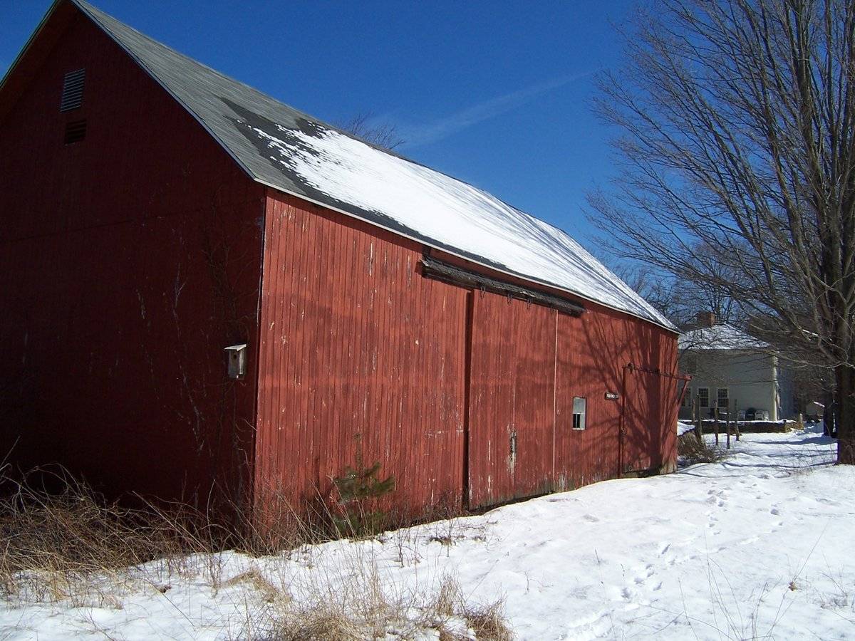
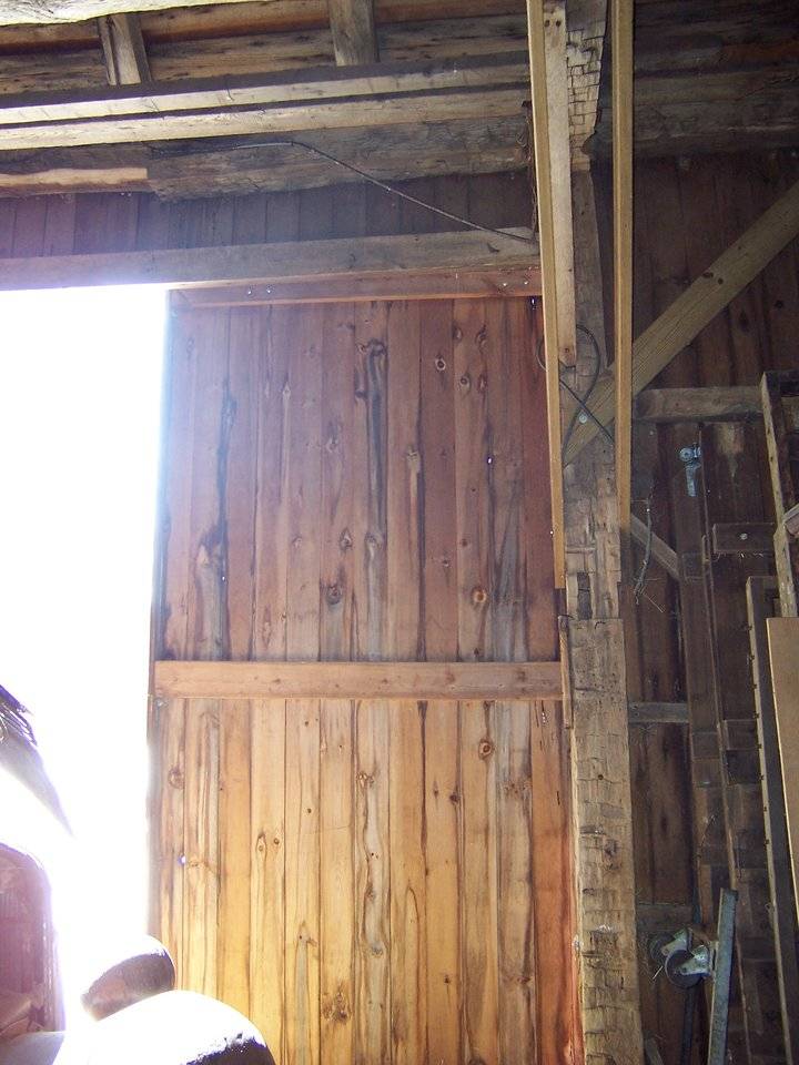
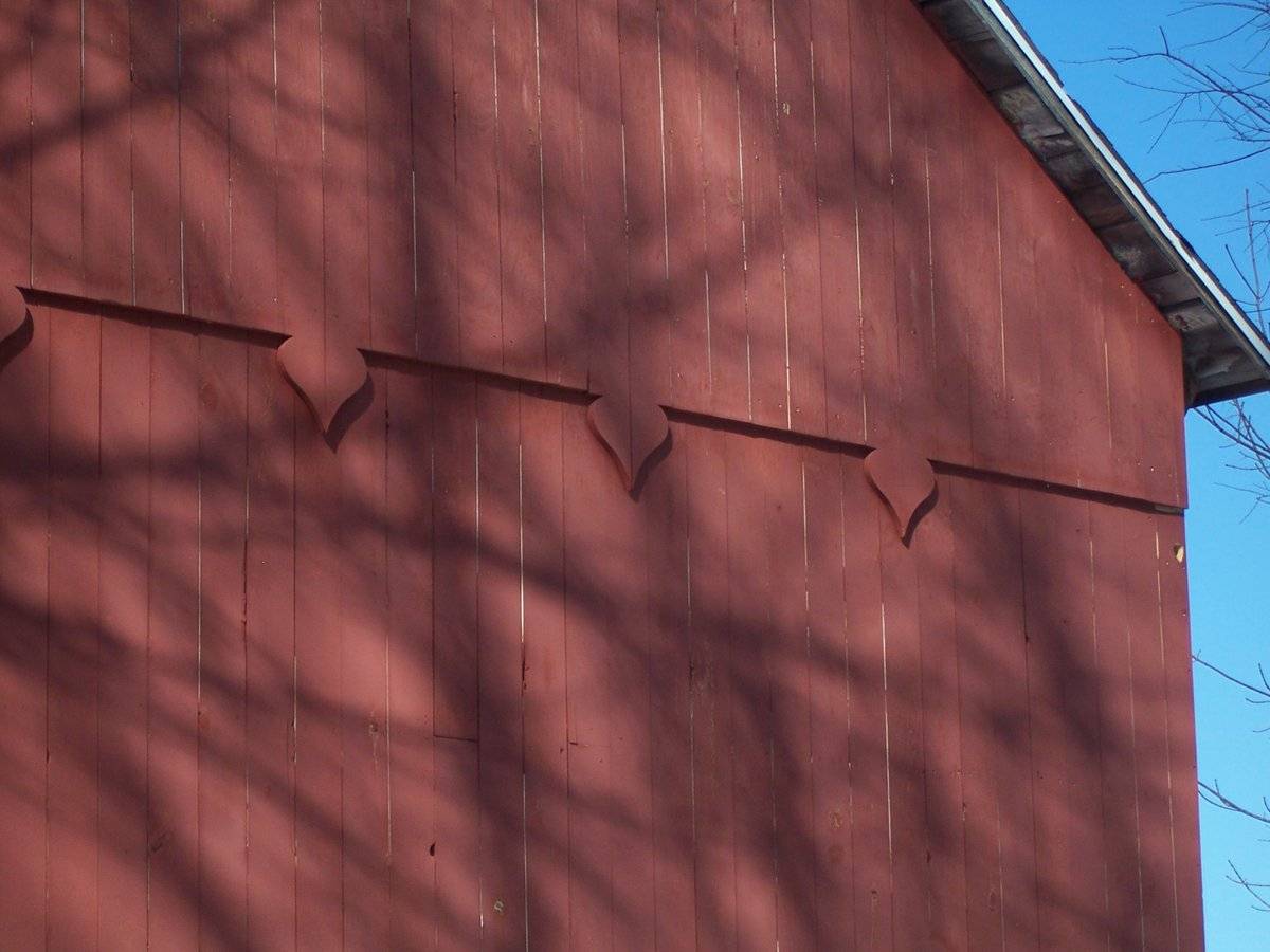
This is a 1 1/2-story eave-entry bank barn. The main facade faces west and the ridge-line of the barn is perpendicular to this portion of Old Turnpike Road, which runs approximately east-west. The main entry is a pair of double-height, hooded, exterior sliding doors in the middle bay of the original structure. A fourth bay was added to the south gable-end. The north bay of the west eave-facade is blank. The south bay of the original structure has a centered six-pane window. The additional bay has a smaller, centered exterior sliding door. The track extends past the gable-end to the south. The grade at the south gable-end of the barn declines slightly to the east, revealing a partial basement level. The partial basement level of the south gable-end of the barn has a window opening towards the east corner and a basement window off to the west. The rest of the south gable-end appears blank except for a vent just beneath the apex of the roof and a series of upside-down spade motifs along the dropped girt line siding divide. The grade at the east eave-side of the barn declines further, revealing a full basement level. A mortared stone retaining wall extends to the south at the southeast corner. There are two open door spaces on the basement level of the east eave-side of the barn in the south half. There is a series of five windows with a pass-through door towards the north corner in the basement level of the east eave-side of the barn. The main level of the barn is blank except a nine-pane window centered in the middle bay of the original structure. The north gable-end of the barn is blank except for a vent centered beneath the apex of the roof and a smaller vent just below it and to the west. The girt line siding divide is straight; there are no motifs. The barn has vertical flush-board siding painted red. The roof has a projecting overhang and exposed rafter tails. It is covered with asphalt shingles. The foundation is mortared field-stone.
Historical significance:The oldest barns still found in the state are called the “English Barn,” “side-entry barn,” “eave entry,” or a 30 x 40. They are simple buildings with rectangular plan, pitched gable roof, and a door or doors located on one or both of the eave sides of the building based on the grain warehouses of the English colonists’ homeland. The name “30 by 40” originates from its size (in feet), which was large enough for 1 family and could service about 100 acres. The multi-purpose use of the English barn is reflected by the building’s construction in three distinct bays - one for each use. The middle bay was used for threshing, which is separating the seed from the stalk in wheat and oat by beating the stalks with a flail. The flanking bays would be for animals and hay storage.
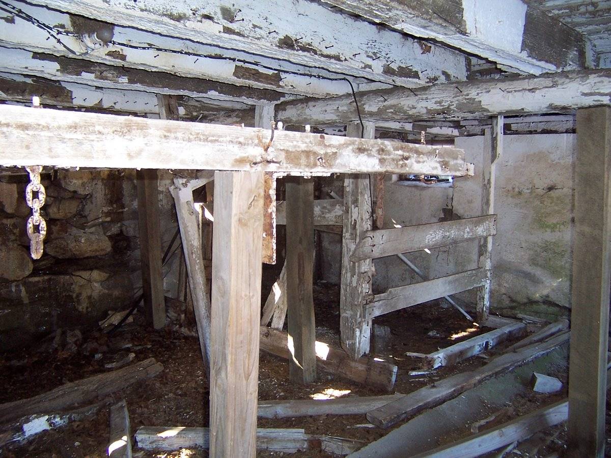
The 19th century saw the introduction of a basement under the barn to allow for the easy collection and storage of a winter’s worth of manure from the animals sheltered within the building. The bank barn is characterized by the location of its main floor above grade, either through building into a hillside or by raising the building on a foundation.
This innovation, aided by the introduction of windows for light and ventilation, would eventually be joined by the introduction of space to shelter more animals under the main floor of the barn.Field Notes
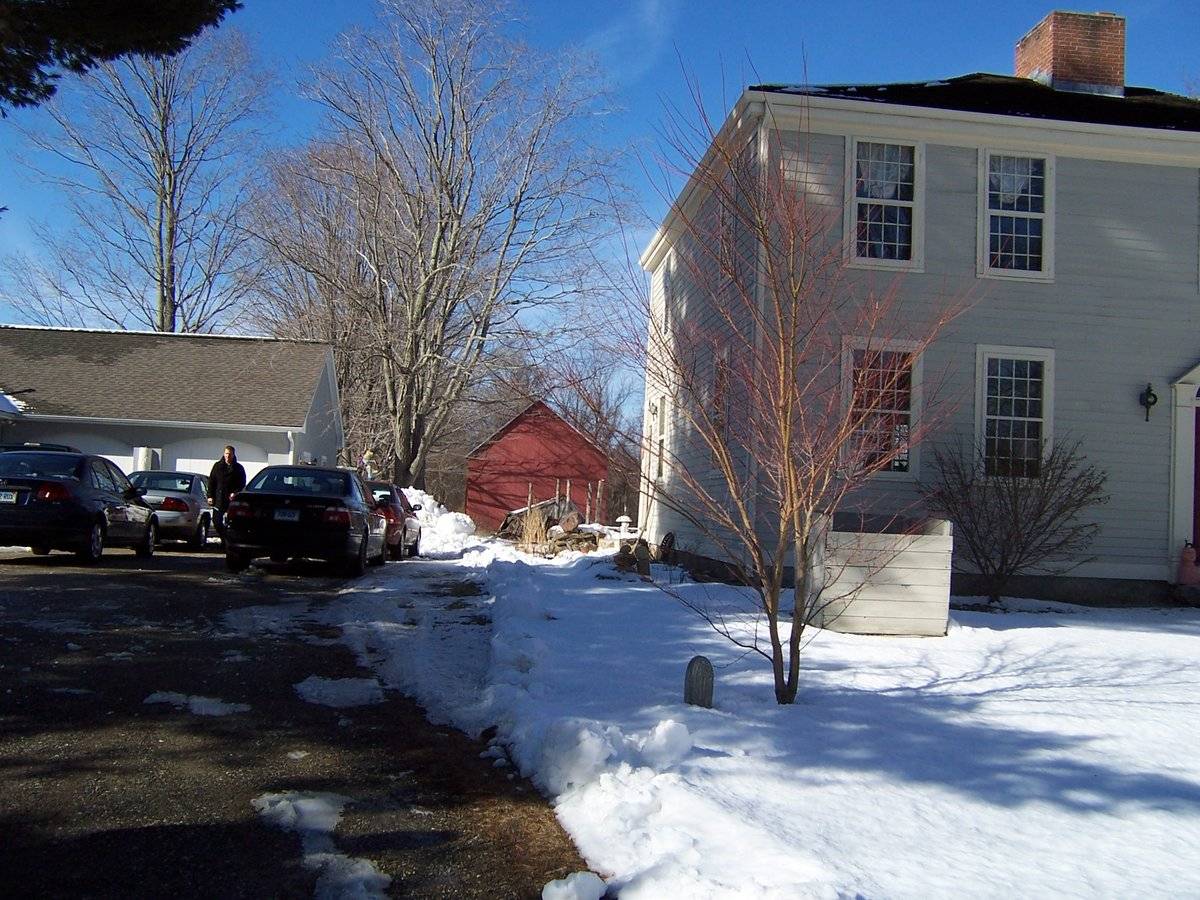
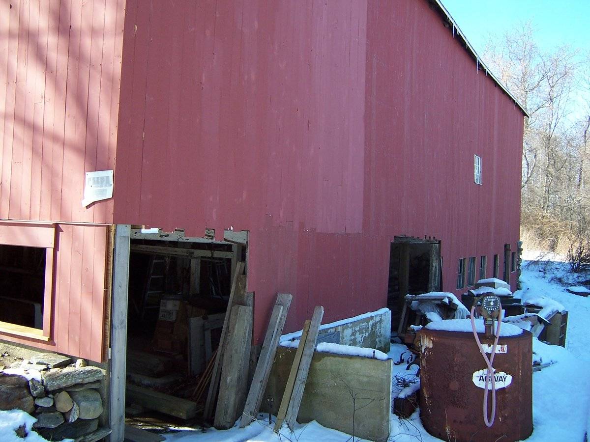
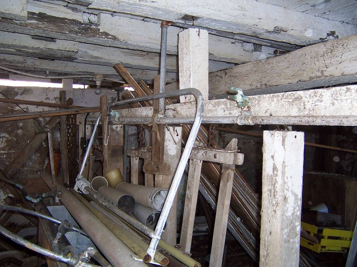
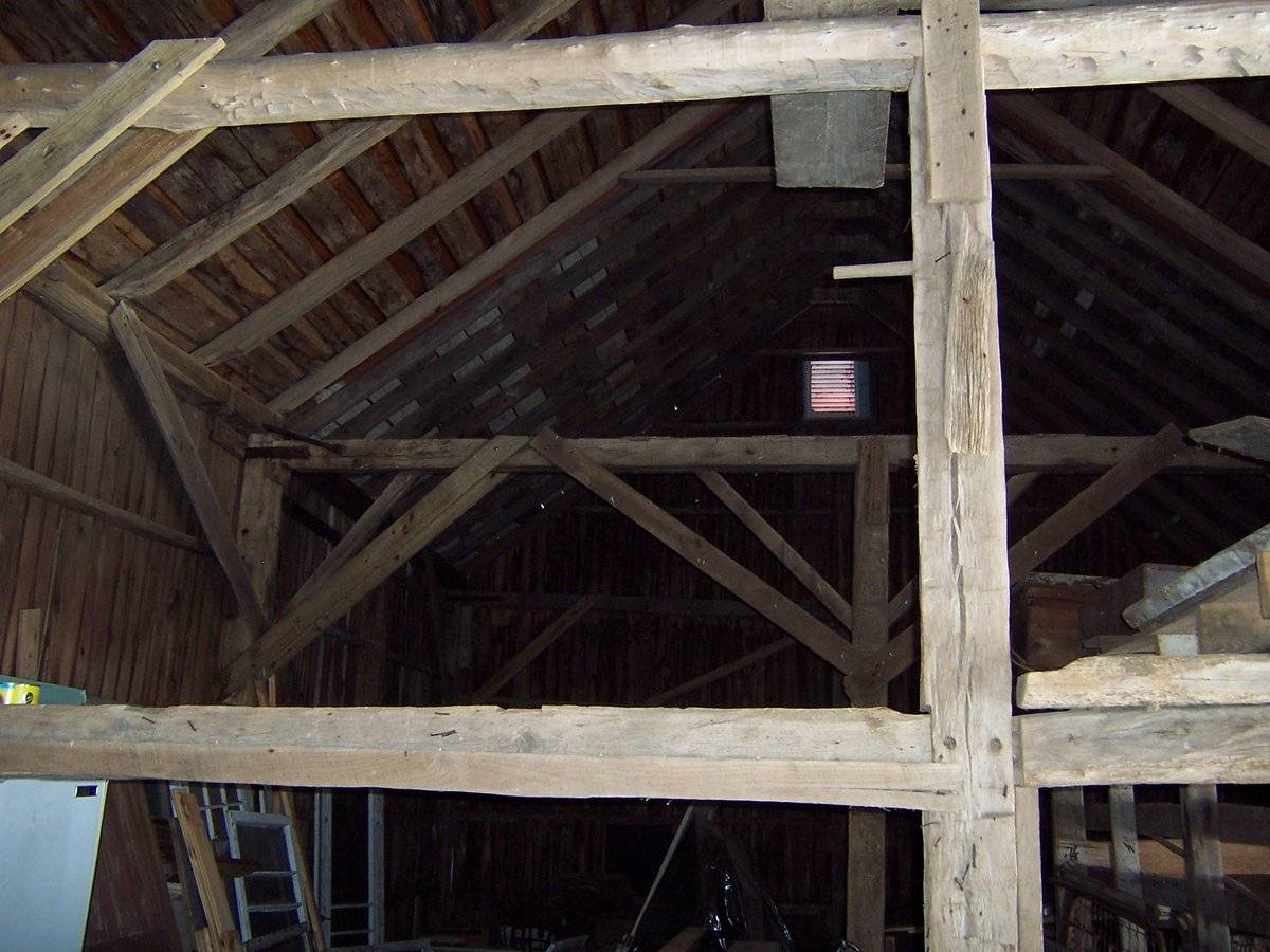
Listed on the State Register of Historic Places, 4/03/2014. FORM: English (modified in 20th C) DIMENSIONS: 57 x 25 overall ROOF: Gable-to-the road (N-S orientation), asphalt shingles SIDING: vertical boards, painted red FOUNDATION: field stone, some modern reinforcement in lower level MAIN DOORS: sliders (evidence that they are replacements for conventional hinged doors) FRAMING: Post-and-beam, some open mortises suggesting alterations; some modern reinforcement timbers RIDGE: The ridge board is flat and narrow, not five-sided (possibly a new roof system?) SITE HISTORY: The site was owned and developed as a farm in the 1750s by Reverend Daniel Welch, minister of the North Society Church from 1751-1781 (died). His son Moses took over the pulpit and the house (1781-1825, died). The property was sold. The original house burned to the ground in 1812 and the present hipped-roof Federal-style mansion was built on the site. The barn originally stood on the south side of the road (a break in stone fencing indicates the access path), part of a large dairy operation. In 1836 Martin Hibbard Parker of Coventry and wife Edna Mason Parker bought the property. Their son Mason Parker farmed it into the 1980s. It then passed to the present owners. During the Parker ownership the barn was moved from the south side of the road to the north side of the house. It sits well to the rear of the house with its east facade roughly in the plane of the dwelling's west facade. BARN ALTERATIONS: The barn was significantly altered when it was moved. (1) It was placed on sloping terrain and turned into a bank barn, with stanchions on the lower level. White washing is still evident, as is milking stall apparatus and concrete manure troughs. (2) A bay was added to the south end of the barn, with its own slider doors plus a "person scale" door. By the time the current owners acquired the property in the 1990s, the barn had seriously deteriorated. They had it pulled back upright and reinforced. They had it resided (a photo detail shows hearts added at plate level on gable ends, the carpenter's added touch). It also has a relatively new asphalt shingle roof. THREATS: The barn has significant water leakage along the west facade into the lower level (gap between siding and foundation stones is significant). It appears there is serious sill deterioration on this side. SITE: (1) In the 1930s another barn was constructed on the site at right angles to this barn, creating a protected barn yard. It was demolished in a storm in the 1980s. (2) Also in the 20th C a shed was built immediately to the south of this barn; since fallen down (use not clear). The barn was part of an extensive and enduring farming and and eventually dairy operation (1750s-1980s). The owners want to restore it for agricultural (dairy) use. Photographs 5-9: See Part 1 - Report already mailed in; attached are additional photographs 5. birthing stall in NW corner of lower level, which was added when the barn was moved in 1900 6. south facade, showing decorative detail added when the barn was resided in the 1990s 7. empty mortise in post on north side of central drive bay (by door); corresponds to empty mortise on an interior post 8. evidence on lower level of 20th-century milking stanchions (area was known for its dairies) 9. framing of south side of center drive bay
- Use & Accessibility
Use (Historic)
Use (Present)
Exterior Visible from Public Road?
1
Demolished
n/a
Location Integrity
Moved
- Environment
Related features
Environment features
Relationship to surroundings
The barn is behind and to the northwest of the house with which it is associated. The ridge-line of the hipped roof of the house is perpendicular to the ridge-line of the barn. To the west of the house is an ell-shaped cottage. Between the cottage and the house is a driveway. To the north of the cottage is the barn. A line of tree demarcated the east border of the 10 acre site. A stone wall runs east-west along Old Turnpike Road to the south. A small portion of the north end of the site is demarcated to the north by Route 44A. An ell-shaped tract of land is to the west of the barn. The area surrounding the site is scattered residential, light open space and woodland.
PROPERTY ID: 3.10.11- Typology & Materials
-
Building Typology
Materials
Structural System
Roof materials
Roof type
Approximate Dimensions
57' x 25'
- Source
-
Date Compiled
12/17/2010
Compiled By
Todd Levine, reviewed by the Connecticut Trust
Sources
Photographs and field notes by Holly V. Izard.
Mansfield’s online assessor card database: http://www.mainstreetmaps.com/CT/Mansfield/
Map of Storrs, CT, retrieved on December 17, 2010 from website www.bing.com.
Sexton, James, PhD; Survey Narrative of the Connecticut Barn, Connecticut Trust for Historic Preservation, Hamden, CT, 2005, http://www.connecticutbarns.org/history.
Visser, Thomas D.,Field Guide to New England Barns and Farm Buildings, University Press of New England, 1997.
- PhotosClick on image to view full file
-