Barn Record Newtown
RETURN TO ‘FIND BARNS’- Building Name (Common)
- n/a
- Building Name (Historic)
- n/a
- Address
- 4 Covered Bridge Road, Newtown
- Typology

- Overview
-
Designations
n/a
Historic Significance
Architectural description:
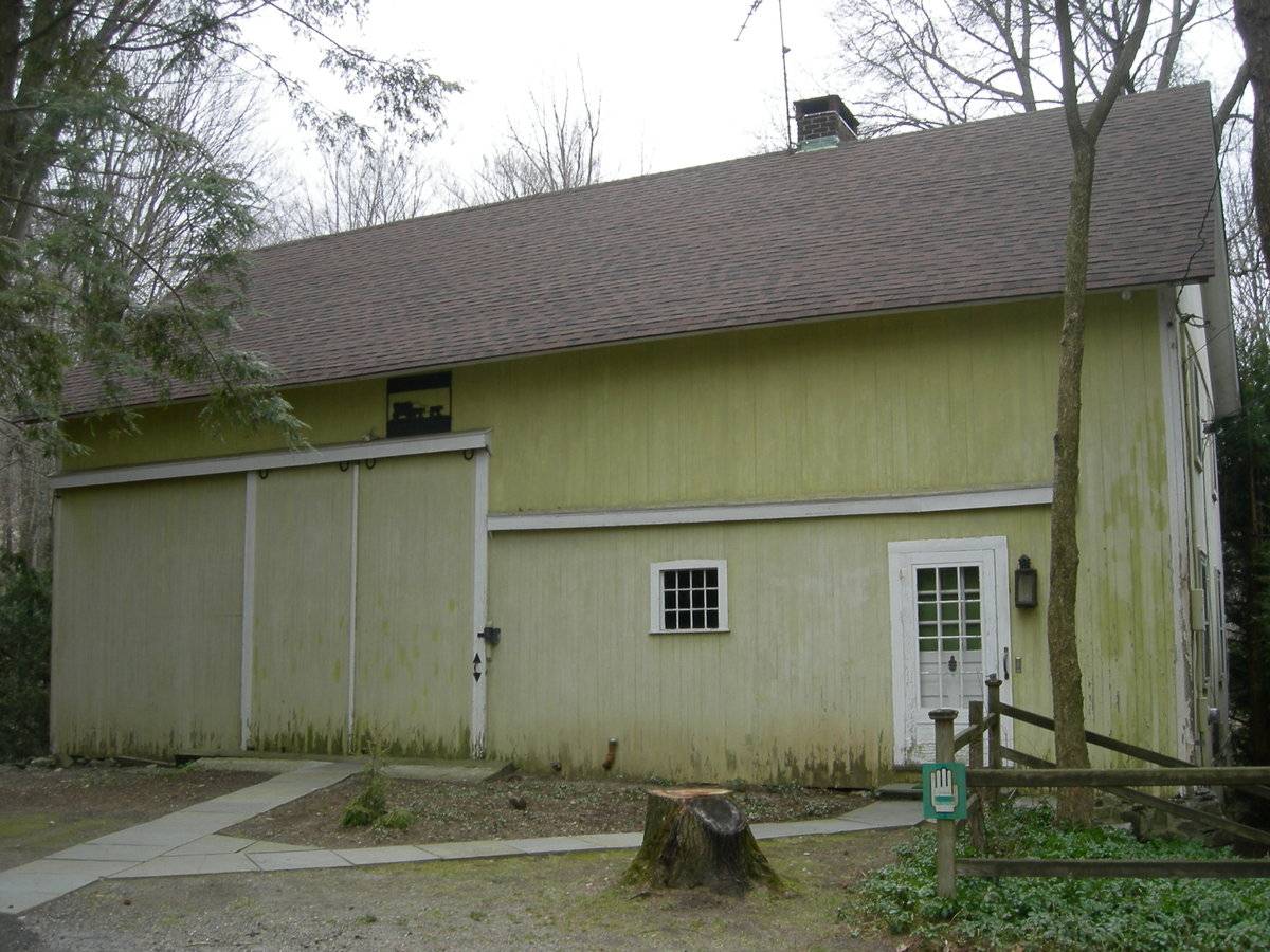
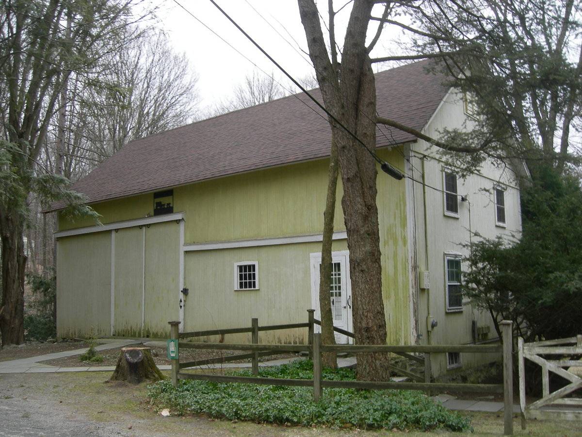
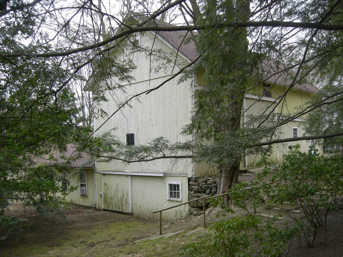
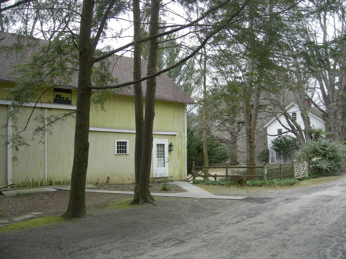
This is a 1 1/2-story eave-entry bank barn. The primary façade of this barn faces east, toward Covered Bridge Road, which runs generally north to south in front of this property. The ridgeline is parallel to the street. A single-story gable-roof addition is present on the basement level extending to the west at the southwest corner.
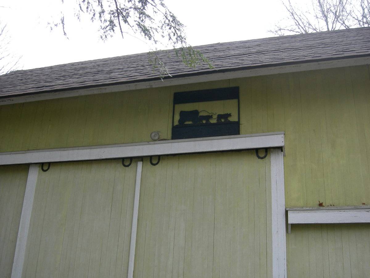
The primary façade is four bays in width and includes two entries: a wooden pass-through door is present in the north bay, and an oversize exterior hung sliding door is present in the second bay from the east end. The pass-through door includes a wooden panel door with twelve window lights. A frosted glass exterior lamp is present beside the pass-through door. A fixed twelve-pane window is present in the bay between the pass-through and oversize sliding doors. A pent roof is present above the first floor in the northern two bays. Another pent roof is present over the track over the sliding door. A portion of the fieldstone foundation is exposed at both the northeast and southeast corners. The north façade exposes about half of the lower level. The windows are arranged in two columns on the north gabled end. Two double-hung windows, each with a 6-over-6 glass pattern, are present on each the main and second stories. Two three-light windows are present in the partially exposed lower level, beneath the windows in the floors above. A single louvered vent is present in the attic, immediately beneath the roof ridgeline. The west eave-side features two double-hung windows on the second story, and a single double-hung window on the first story. Windows on the west gable-end of the lower level addition are present but their arrangement cannot be determined. The south gable-end of the barn shows the full height of the structure. A single window is present in the attic gable, centered beneath the ridgeline. No openings are present on the second story. A single 6-paned window is present off-center to the west on the first story. On the fully-exposed lower level, a single 6-paned window is present near the southeast corner. A large sliding door is present on the west half of the south gable side on this lower level. Two double-hung windows are present on the south eave-side of the addition.
The exterior of this structure is clad in vertical wooden flush-board, painted light yellow. All trim is painted white. The gable roof is clad in reddish-brown asphalt shingling. A brick chimney is present on the ridgeline slightly off-center in the north half of the structure. This barn appears to have been converted into a residence.
Historic significance:
The oldest barns still found in the state are called the “English Barn,” “side-entry barn,” “eave entry,” or a 30 x 40. They are simple buildings with rectangular plan, pitched gable roof, and a door or doors located on one or both of the eave sides of the building based on the grain warehouses of the English colonists’ homeland. The name “30 by 40” originates from its size (in feet), which was large enough for 1 family and could service about 100 acres.
The multi-purpose use of the English barn is reflected by the building’s construction in three distinct bays - one for each use. The middle bay was used for threshing, which is separating the seed from the stalk in wheat and oat by beating the stalks with a flail. The flanking bays would be for animals and hay storage.The 19th century saw the introduction of a basement under the barn to allow for the easy collection and storage of a winter’s worth of manure from the animals sheltered within the building. The bank barn is characterized by the location of its main floor above grade, either through building into a hillside or by raising the building on a foundation.
This innovation, aided by the introduction of windows for light and ventilation, would eventually be joined by the introduction of space to shelter more animals under the main floor of the barn.
Field Notes
Dropped girt line siding divide Date of house (No. 9): 1800 “In addition to the yellow barn and the house, see the covered bridge over Pond Brook built by the owners from a design by Eric Sloane ...Still visible through the bridge, is the roadbed of the Danbury-Norwalk Railroad which connected with the Shepaug Railroad in Hawleyville.” - Mitchell & Goodrich p. 112. Now owned by a church which has applied for zoning to build a new facility - unknown whether this threatens the existing structures. Sources: "Touring Newtown’s Past: the Settlement and Architecture of an Old Connecticut Town;" Mary Mitchell and Albert Goodrich, Newtown Historical Society, Newtown, Connecticut, 1996, p. 112, 122-3 pre-1826 House Inventory. Newtown Assessor’s Records.
- Use & Accessibility
Use (Historic)
Use (Present)
Exterior Visible from Public Road?
Yes
Demolished
n/a
Location Integrity
Unknown
- Environment
Related features
n/a
Environment features
Relationship to surroundings
Environmental Information:
This barn is situated parallel to Covered Bridge Road and the primary façade faces east. The barn is built into the side of a hill which slopes downward to the west from Covered Bridge Road. The farmhouse associated with this barn is located just to the north of the barn. A gravel area separates the barn from the road, and a concrete sidewalk is present leading to both the pass-through and oversize sliding doors on the east eave-side. Pond Brook (a small creek) is present to the south and west of this barn, which pools into a small pond immediately west of the barn. A covered bridge, built in 1959, is present crossing Pond Brook just south of the barn, on the old grade of the Danbury-Norwalk Railroad. The land surrounding the barn is primarily woodland, with a few residences mixed in.
- Typology & Materials
-
Building Typology
Materials
Structural System
n/a
Roof materials
Roof type
Approximate Dimensions
Main barn is 24' x 48'.
- Source
-
Date Compiled
02/01/2011
Compiled By
N. Nietering & T. Levine, reviewed by CT Trust
Sources
Field notes and photographs by Charlotte Hitchcock.
Newtown, CT Covered Bridge: http://www.dalejtravis.com/bridge/connecti/htm/07001a.htm
Sexton, James, PhD; Survey Narrative of the Connecticut Barn, Connecticut Trust for Historic Preservation, Hamden, CT, 2005, http://www.connecticutbarns.org/history.
“Touring Newtown’s Past: the Settlement and Architecture of an Old Connecticut Town;” Mary Mitchell and Albert Goodrich, Newtown Historical Society, Newtown, Connecticut, 1996, p. 112.
Visser, Thomas D.,Field Guide to New England Barns and Farm Buildings, University Press of New England, 1997, 213 pages.
Map of Newtown, CT, retrieved on January 17, 2011 from website www.bing.com.
Newtown Assessor’s Records - Vision Appraisal online - http://data.visionappraisal.com/NewtownCT - PhotosClick on image to view full file
-