Barn Record Stonington
RETURN TO ‘FIND BARNS’- Building Name (Common)
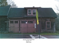
- Denison Homestead Museum
- Building Name (Historic)
- Captain George Denison Homestead
- Address
- 120 Pequotsepos Road, Stonington
- Typology

- Overview
-
Designations
Historic Significance
Architectural description:
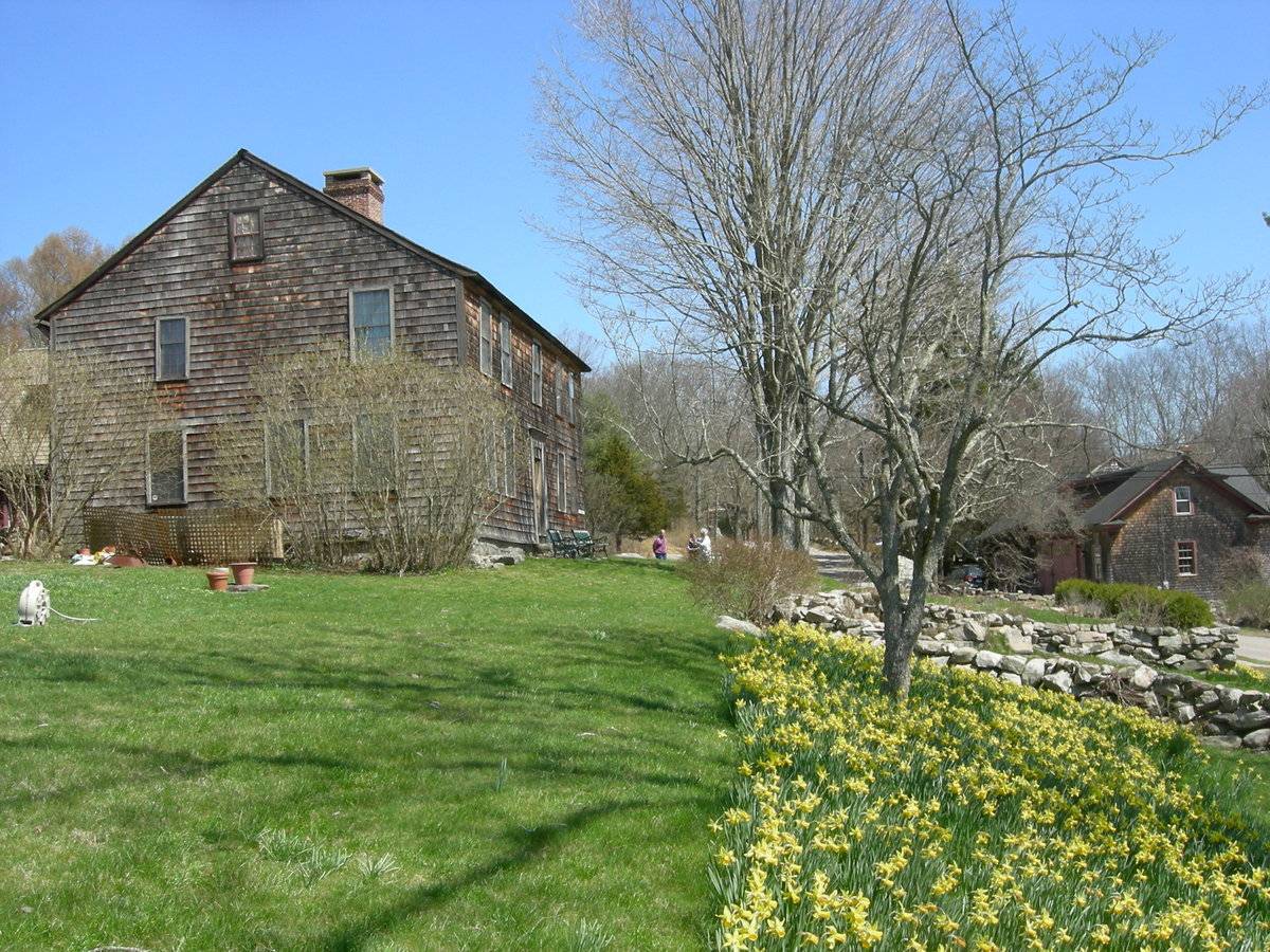
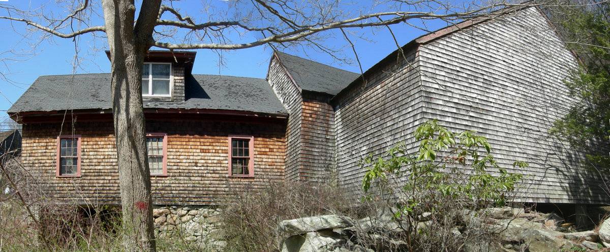
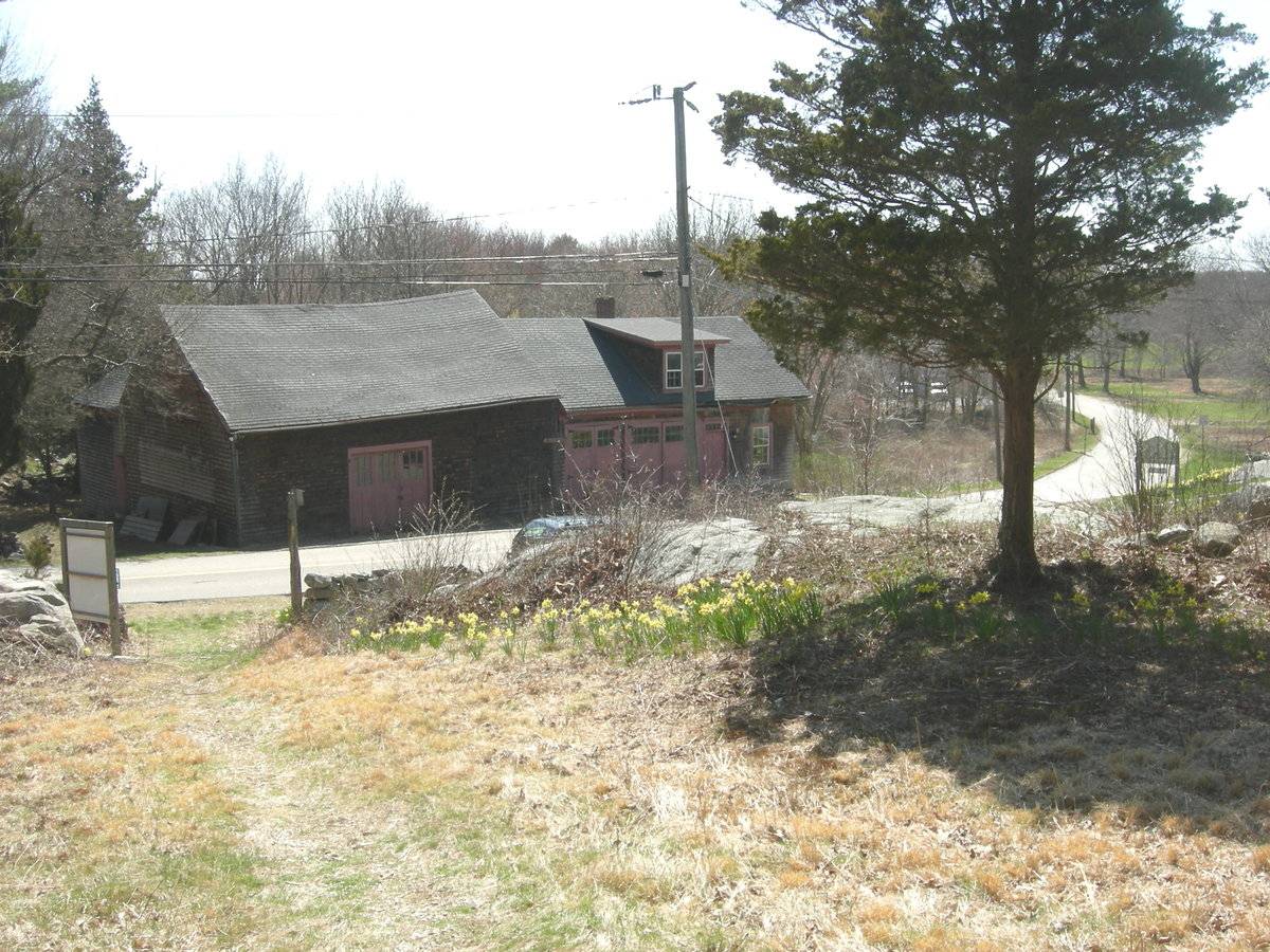
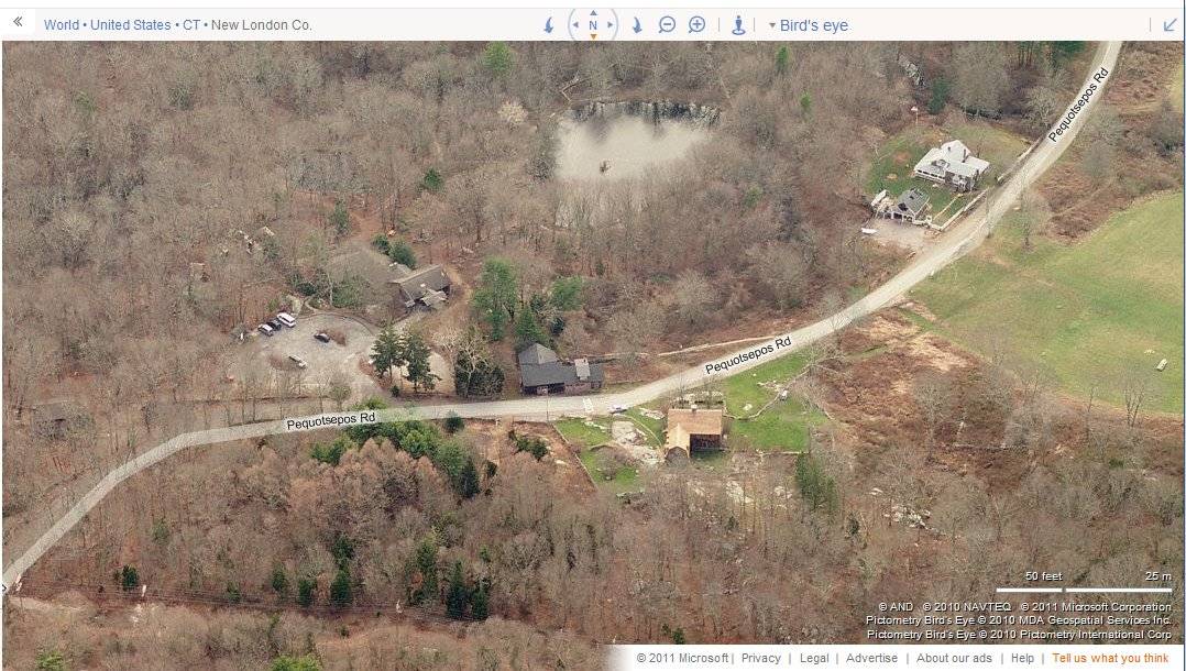
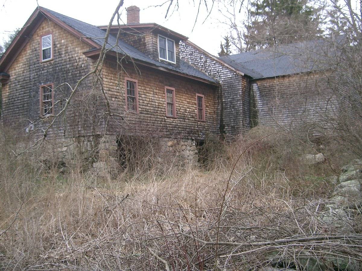
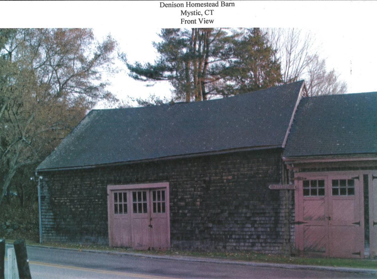
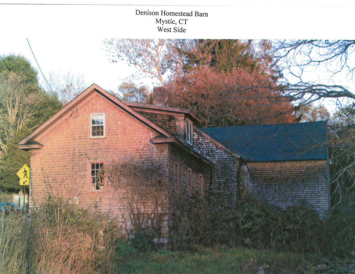
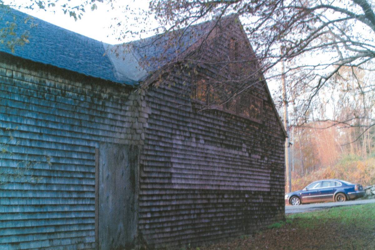
This is a 1 ½-story eave-entry barn with a cross-gable addition on the south side, and a 1 ½-story parallel bank addition attached gable-end to gable-end to the west. All roof structures are gable-style. The primary façade of the main barn is the north eave-side, which directly fronts Pequotsepos Road. Pequotsepos Road passes in front of this barn at an east to west angle. The historic house on this property is located immediately to the northwest of the barn, across the street. This is the historic homestead of Captain George Denison, one of the founders of Stonington, and it has been listed on the National Register of Historic Places.
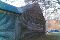
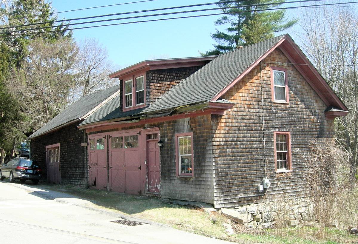
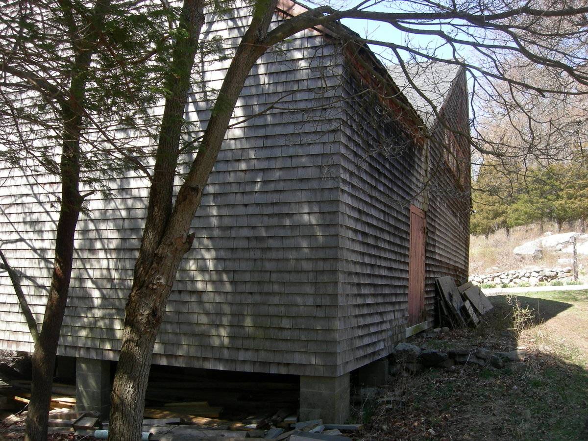
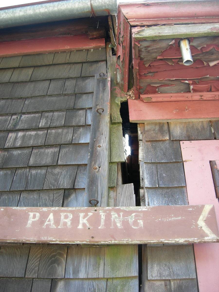
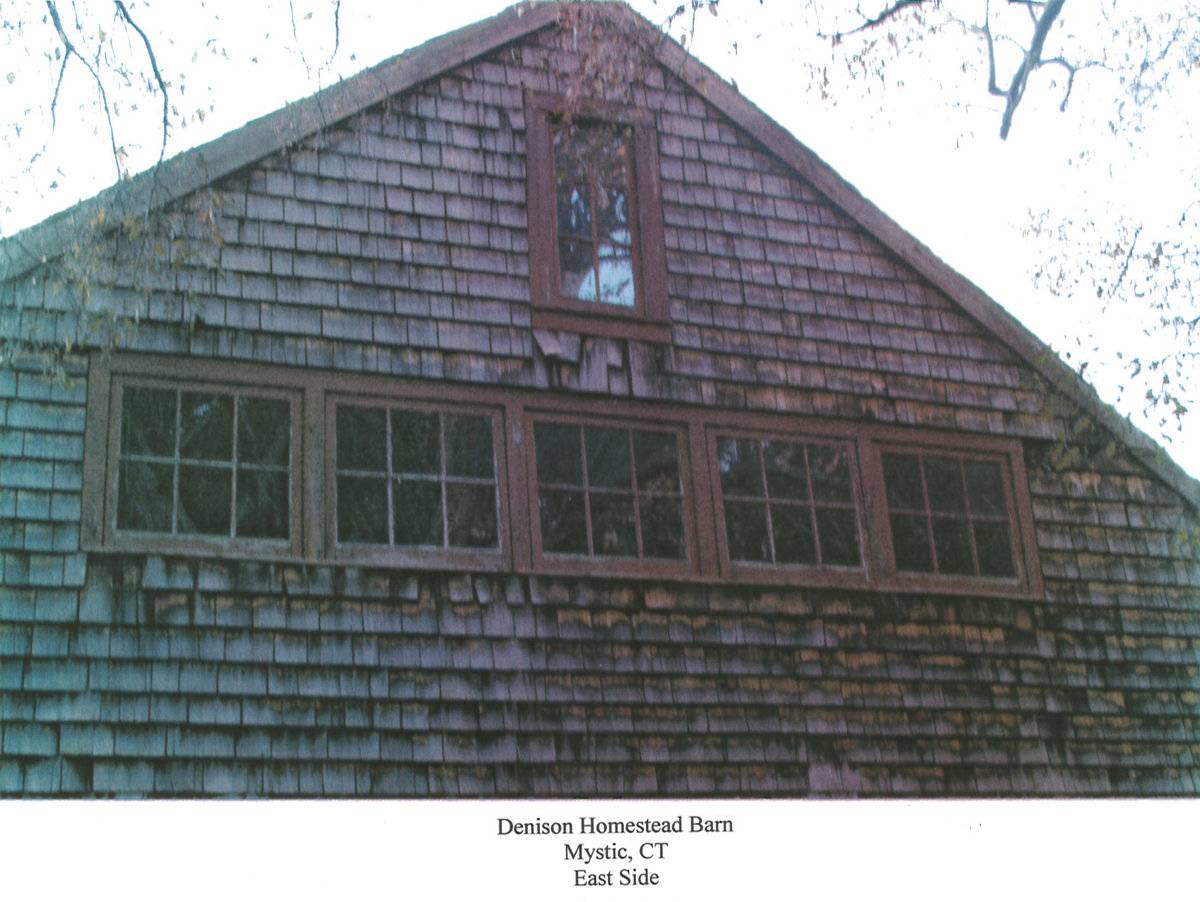
The primary façade of this barn is the north eave-side. The main entry on this side consists of a nearly-centered oversize opening, containing a three-part panel door of wood construction. Each part contains six window panes in the upper portion. No other openings are present on the façade. Within the east gable-attic is a horizontal run of five six-pane windows. A vertical rectangular window opening is located above this run of windows, centered beneath the roof ridgeline on this gable-end. The south eave-side is completely covered by the south-cross-gable addition, and the west gable-end primarily covered by the west parallel addition. The exposed portion of the west-end and south-side, at the southwest corner, is blank.
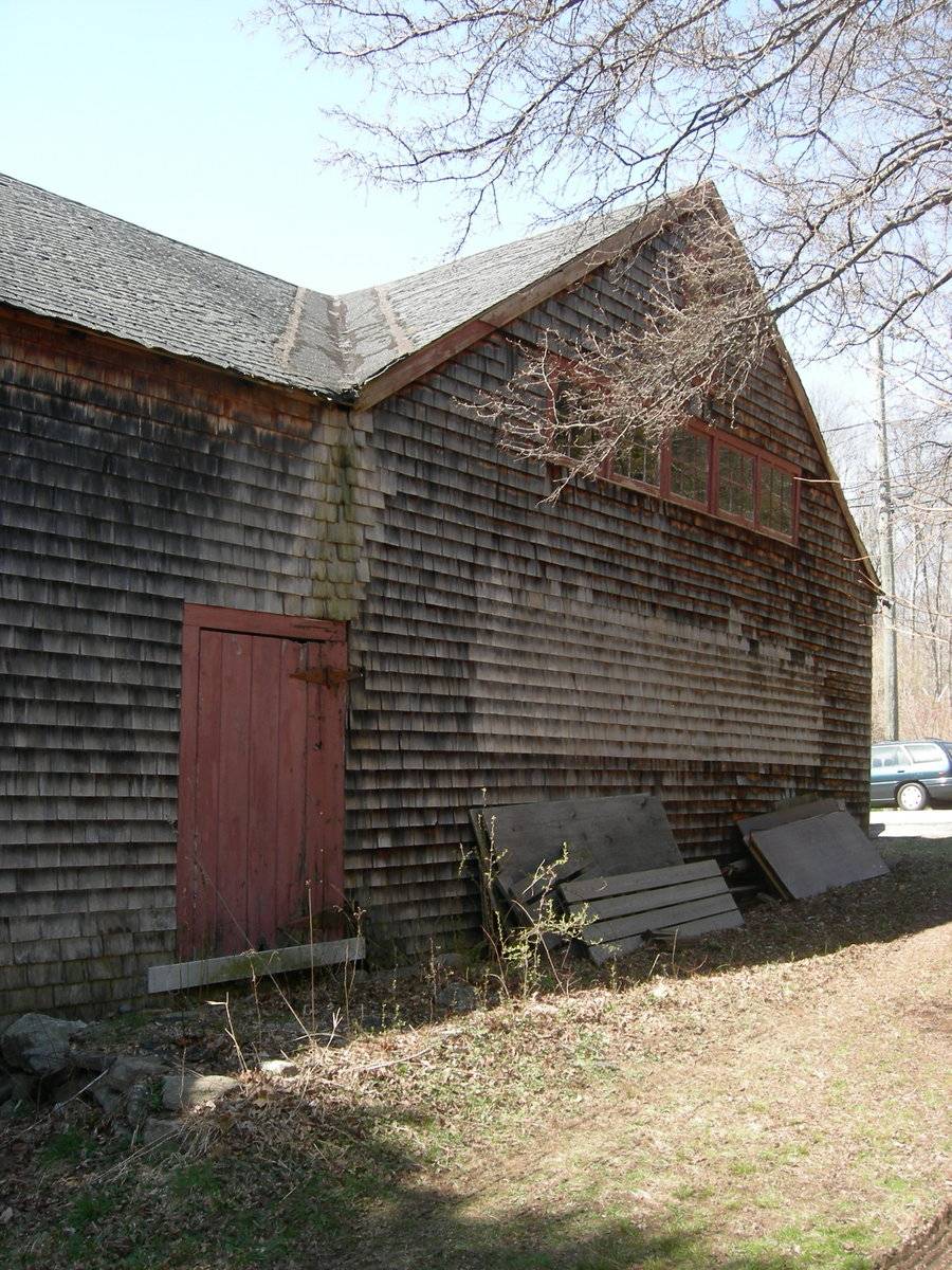
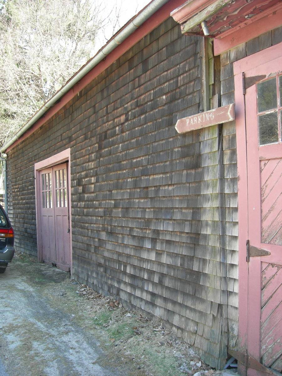
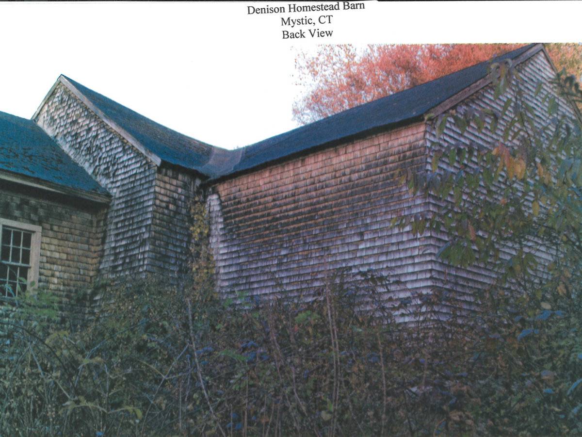
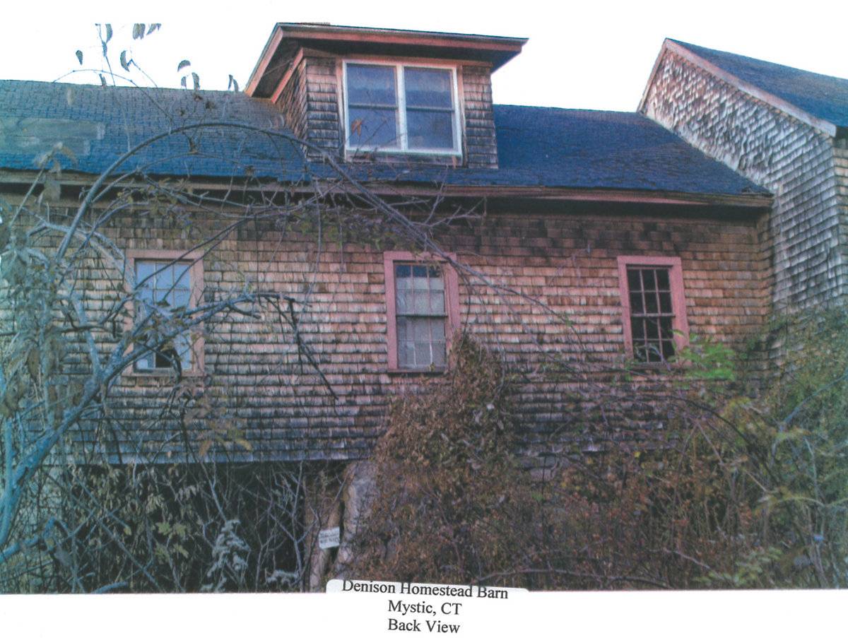
The south cross-gable-addition is built up on masonry block pillars, with an open crawl-space beneath. The east eave-side contains a single wood-plank pass-through door beneath the cross-gable roof valley on the first-story. The south gable-end first-story wall and gable-end are blank. The west eave-side of the cross-gable addition is also blank.The west gable-end addition is parallel with the main barn and is attached gable-end to gable-end. Like the main barn, the north eave-side directly fronts Pequotsepos Road. The eastern and central bays of this addition each contain a pair of large hinged wood panel doors, creating two unequal single-car bays. The eastern bay is narrower than the central bay. The upper portions of both door pairs contain window panes, six in each of the eastern doors, and ten in each of the central doors. The western bay contains a wood panel pass-through door with transom light above toward the center of the structure, and a six-over-six double-hung window near the northwest corner. Centered on the roof on this side is a shed-roof dormer, which contains two six-over-six double-hung windows on the north side.
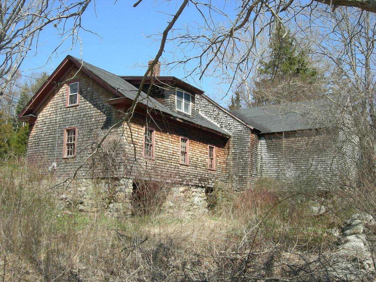
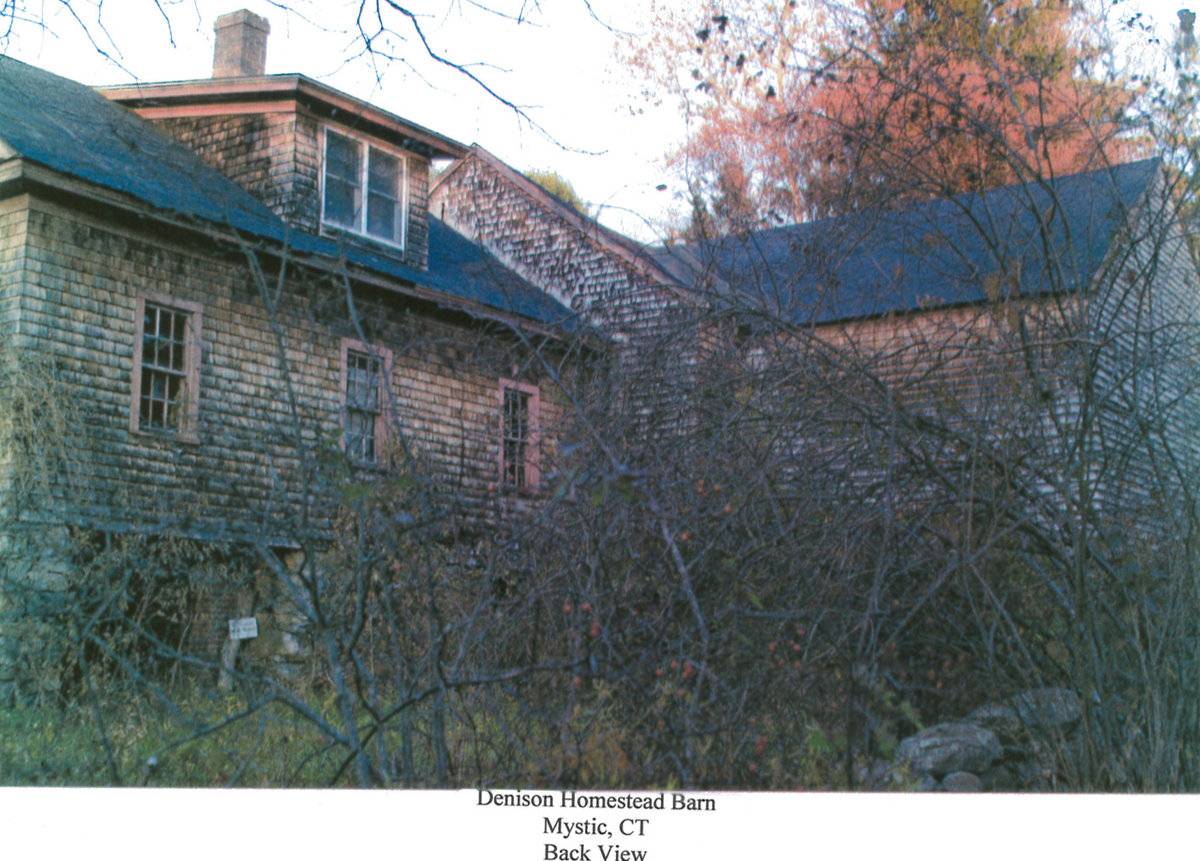
The west gable-end contains a single six-over-six double-hung window centered on the first-story. An additional six-over-six double-hung window is located directly above, centered within the gable-attic. Cornice returns are prominent on this gable-end. The ground level slopes down to the south along this side, revealing the mortared fieldstone foundation. The full basement level is revealed along the south eave-side. Two oversize openings are located near the outer corners on this side, with no doors apparent. The first-story contains three evenly-spaced six-over-six double-hung windows along its length. As on the north side, a shed-roof dormer is centered on the south eave-side, containing a pair of double-hung windows within.
The exterior walls of the main barn and two additions are clad in wooden shingles, unpainted. The foundation of the main barn is not visible, but the south cross-gable is on masonry piers, and the west parallel addition is on mortared fieldstone. The roof surfaces appear to be covered with asphalt shingles. A brick chimney projects from the shed-roof dormer on the south eave-side of the west parallel addition.
Historical significance:The oldest barns still found in the state are called the “English Barn,” “side-entry barn,” “eave entry,” or a 30 x 40. They are simple buildings with rectangular plan, pitched gable roof, and a door or doors located on one or both of the eave sides of the building based on the grain warehouses of the English colonists’ homeland. The name “30 by 40” originates from its size (in feet), which was large enough for 1 family and could service about 100 acres. The multi-purpose use of the English barn is reflected by the building’s construction in three distinct bays - one for each use. The middle bay was used for threshing, which is separating the seed from the stalk in wheat and oat by beating the stalks with a flail. The flanking bays would be for animals and hay storage.
The 19th century saw the introduction of a basement under the barn to allow for the easy collection and storage of a winter’s worth of manure from the animals sheltered within the building. The bank barn is characterized by the location of its main floor above grade, either through building into a hillside or by raising the building on a foundation.
This innovation, aided by the introduction of windows for light and ventilation, would eventually be joined by the introduction of space to shelter more animals under the main floor of the barn.
Historical background:
These barns are associated with the historic Captain George Denison Manor, constructed in 1717. Denison was one of the founders of Stonington, and the Denison family resided on the property from 1654 until 1941. This is the third house on the site, with the prior two examples both being destroyed centuries ago by fire. The manor and homestead site is today owned and maintained as a museum by The Denison Society. The property was listed on the National Register of Historic Places in 1979. See the Sources section of this Historic Resource Inventory for a link to the official National Register nomination form.
Field Notes
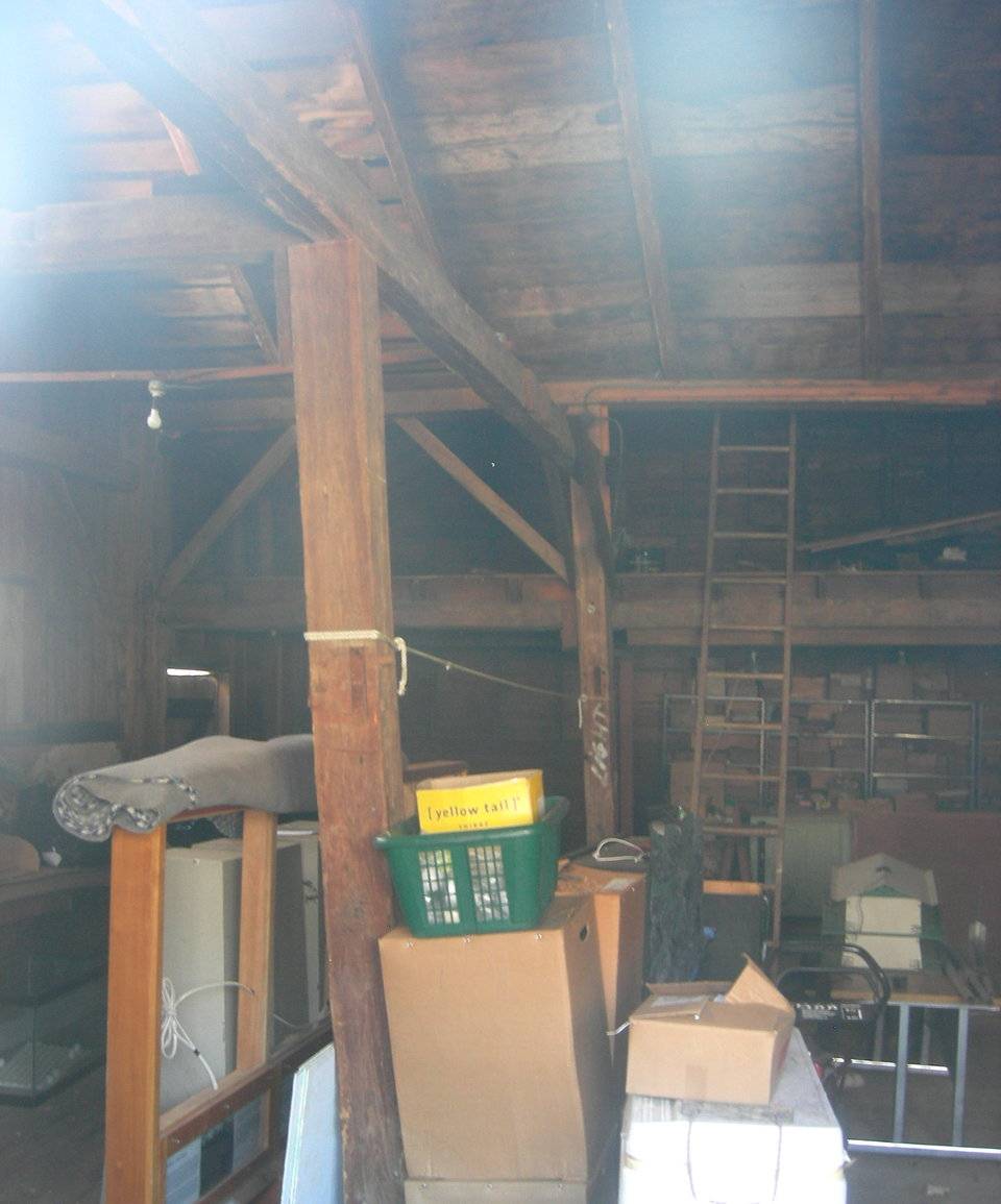
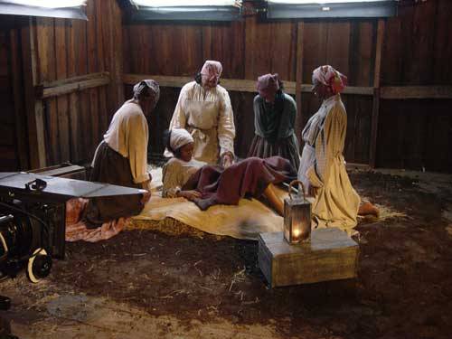
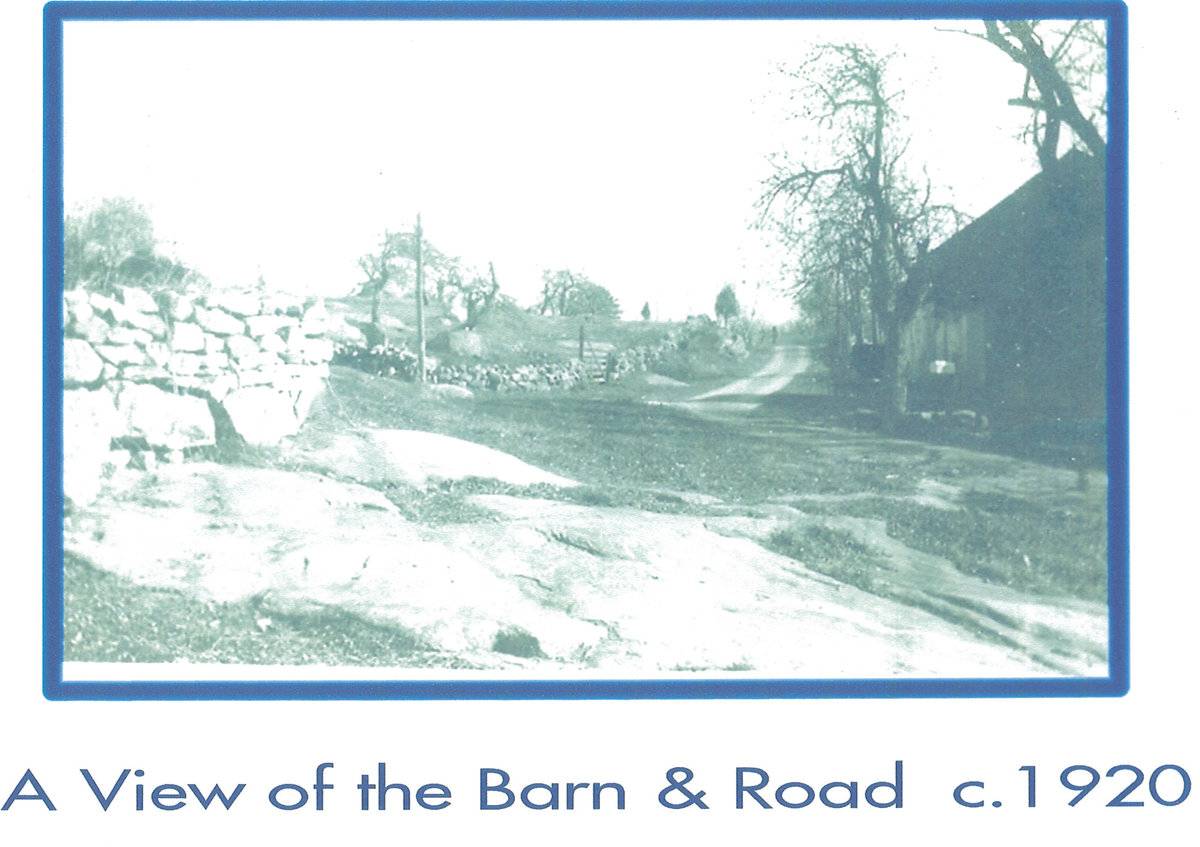
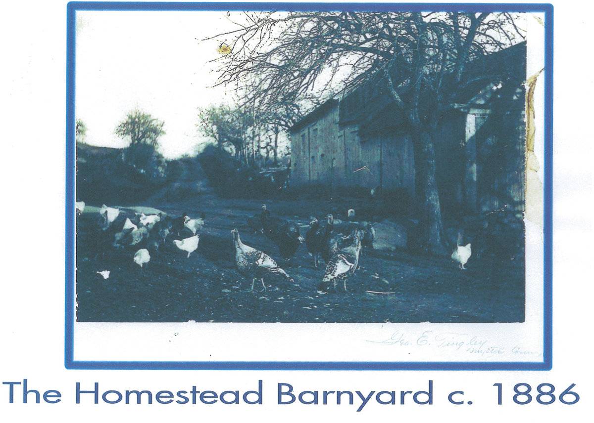
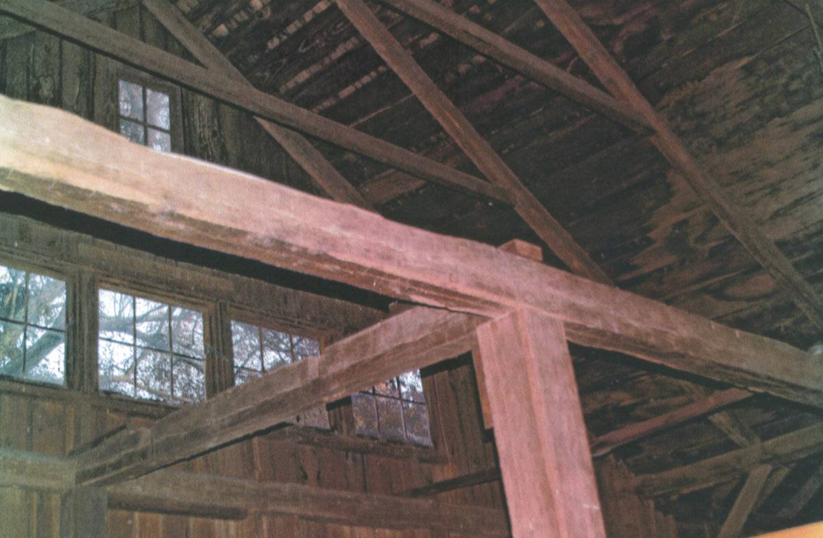
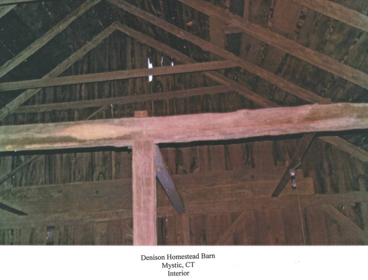
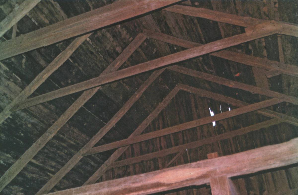
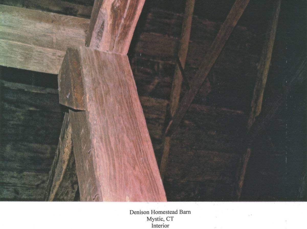
George Denison house built in 1717. Dates of barns unknown. Barns consists of two sections: the older English barn to the east, with a perpendicular wing extending south at the rear; and a later structure with shed dormer, to the west. The Denison Homestead was listed on the National Register of Historic Places in 1979. The property includes 140 acres of the original 200-acre land grant of 1654; much of it is now second-growth forest crossed by remnants of old stone walls and granite quarries. The Denison Pequotsepos Nature Center also operates on the property. The Denison Homestead is open to the public seasonally; for information and history see website: http://www.denisonsociety.org/ Additional photographs: The older English Barn 1 is in poor structural condition, east end sagging and leaning. Some diagonal frame members may be missing in interior. The east end of the Barn (c. 1800) is in very fragile condition. A newer section is on the west side. The roof is about to cave in and we need about $20,000. to fix the roof. we were amazed it made it through the winter. Both the DPNC and Homestead usse it for storage presently. 2012 Barns Grant pre-application. The unique and picturesque Denison Homestead barn is located opposite the Denison Homestead Museum. It is included on the National Register of Historic Places as part of the Denison Homestead. The barn consists of two sections. The east end of the barn is c. 1800. In the 1940s the Denison Society held meetings and luncheons in this section of the barn. The Pequotsepos Wildlife Sanctuary had their first museum in there. In 2008, this second was used for a CPTV documentary about Fredrick Douglas. The west section of the barn is a newer addition probably built in the early 1900s. It is now used for storage. The land that the barn and the Denison Homestead are located on, have been in the Denison family since 1654. The Homestead is now a museum which connects the local community and Denison descendants with the history, land, and environment of our historic family farm.
- Use & Accessibility
Use (Historic)
Use (Present)
Exterior Visible from Public Road?
Yes
Demolished
n/a
Location Integrity
Unknown
- Environment
Related features
Environment features
Relationship to surroundings
This barn is situated immediately along the south side of the right-of-way of Pequotsepos Road. The historic Denison farmhouse is located across the street from the barn, to the northwest. The house is surrounded by a grassy lawn dotted with boulders and large trees. Stone walls mark the lawn boundaries. The barn is surrounded by trees to the immediate south, west, and east. The grade drops from north to south through the depth of this barn and continues to the south, to a small pond located to the southwest of the barn. The parking lot for the Denison House Museum is located to the east of the barn on the south side of Pequotsepos Road. Pequotsepos Road makes a sharp curve to the south immediately to the west of the barn. Several fields of open land/active agriculture are located on the adjoining land down the road. The property is surrounded by woodland to the north and east.
2.98 acres, ID 151-2-1.
- Typology & Materials
-
Building Typology
Materials
Structural System
Roof materials
Roof type
Approximate Dimensions
2165 square feet
- Source
-
Date Compiled
06/28/2011
Compiled By
N. Nietering & T. Levine, reviewed by CT Trust
Sources
Photographs by Charlotte Hitchcock 5/07/2008.
Additional photographs and fieldnotes by Missy Evans - 11/15/2011.
Sexton, James, PhD; Survey Narrative of the Connecticut Barn, Connecticut Trust for Historic Preservation, Hamden, CT, 2005, http://www.connecticutbarns.org/history.
Visser, Thomas D., Field Guide to New England Barns and Farm Buildings, University Press of New England, 1997, 213 pages.
Map of Stonington, CT, retrieved on June 26, 2011 from website www.bing.com.
Stonington Assessor’s Records - Southeastern Connecticut Council of Governments online - http://host.appgeo.com/sccog/Map.aspx
“Pequotsepos Manor - Denison Homestead” National Register Nomination Form No. 77001403, National Park Service, 1979. Available from the web: http://pdfhost.focus.nps.gov/docs/NRHP/Text/79002650.pdf
- PhotosClick on image to view full file
-