Barn Record Guilford
RETURN TO ‘FIND BARNS’- Building Name (Common)
- Frederick R. Griffing (House)
- Building Name (Historic)
- Frederick R. Griffing (House)
- Address
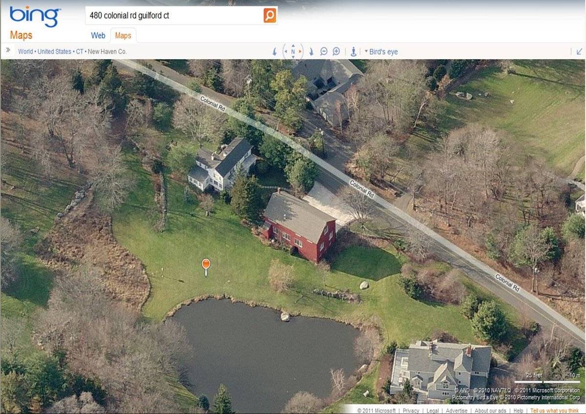
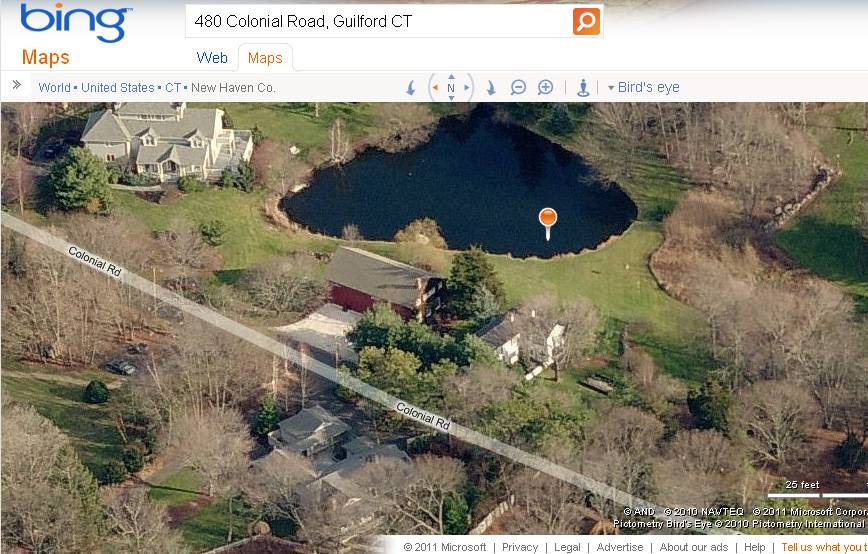
- 480 Colonial Road, Guilford
- Typology

- Overview
-
Designations
n/a
Historic Significance
Architectural description:
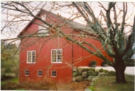
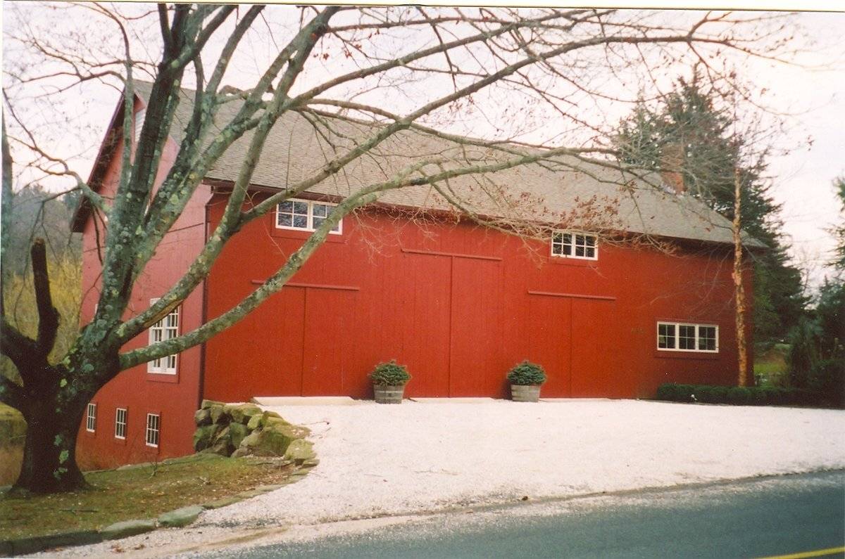
This is a 2 1/2-story four-bay side- or eave-entry bank barn. The main facade faces northwest and the ridge-line of the barn is parallel to this portion of Colonial Road, which runs approximately southwest-northeast. The main entry is a pair of swinging hinged doors just off-center to the left (north) in the northwest eave-facade of the barn. Pairs of shorter, swinging hinged doors are located on either side flanking the main entry. Above each of these pairs of doors is a side-by-side pair of four-pane wood window sashes. A horizontal set of three four-pane wood window sashes is located in the right (west) half of the northwest eave-side of the barn, at the first-floor level.
The grade of the northeast gable-end of the barn declines sharply toward the southeast, revealing a basement level on the northeast gable-end. There are three, six-pane, fixed-sash, wood windows spaced roughly evenly across the basement level of the northeast gable-end of the barn. At the first-floor level, there are two pairs of six-over-nine, double-hung, wood window sash, indicating a residential current use. There is a hay door opening in the gable attic now filled by a 24-pane window, and a vent in the gable peak. The southeast eave-side of the barn has a small, 1-story, shed-roofed addition extending from its left (south) corner. There is a series of three triple casement windows at the first-floor level of the southeast eave-side of the barn. There appear to be three window openings located at the eave line of the southeast eave-side of the barn. The basement level appears to have no visible openings.
The grade at the southwest gable-end of the barn inclines sharply up to the main level. There appear to be a pass-through door at the left (north) corner and two residential windows on the main level, and a row of windows in the upper level of the southwest gable-end.
The barn has vertical flush-board painted red with white window trim. The foundation is not visible; however a retaining wall of massive boulder masonry supports the northeast edge of the driveway adjacent to the main entry doors on the northwest side. The roof is covered with asphalt shingles and a brick chimney is located on the northwest slope of the roof, at the extreme west end of the roof.
Historical significance:The oldest barns still found in the state are called the “English Barn,” “side-entry barn,” “eave entry,” or a 30 x 40. They are simple buildings with rectangular plan, pitched gable roof, and a door or doors located on one or both of the eave sides of the building based on the grain warehouses of the English colonists’ homeland. The name “30 by 40” originates from its size (in feet), which was large enough for 1 family and could service about 100 acres. The multi-purpose use of the English barn is reflected by the building’s construction in three distinct bays - one for each use. The middle bay was used for threshing, which is separating the seed from the stalk in wheat and oat by beating the stalks with a flail. The flanking bays would be for animals and hay storage.
The 19th century saw the introduction of a basement under the barn to allow for the easy collection and storage of a winter’s worth of manure from the animals sheltered within the building. The bank barn is characterized by the location of its main floor above grade, either through building into a hillside or by raising the building on a foundation. This innovation, aided by the introduction of windows for light and ventilation, would eventually be joined by the introduction of space to shelter more animals under the main floor of the barn.
Field Notes
House was built ca. 1835 Frame barn 1900 (according to current assessment): 1680 sq. ft.
- Use & Accessibility
Use (Historic)
Use (Present)
Exterior Visible from Public Road?
1
Demolished
n/a
Location Integrity
Unknown
- Environment
Related features
Environment features
Relationship to surroundings
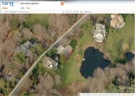
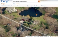
The barn is to the northeast of the c. 1835 2 1/2-story Greek Revival-style house with which it is associated. The ridge-line of the house is perpendicular to the road and to the ridge-line of the barn. A pond is located on the site, behind and to the southeast of the house and barn. A few short stretches of stone walls are located within the site. The 1.20-acre site is located near the intersection of Colonial Road with Uncas Point Road, on a neck of land known as Sachem Head that juts out into Long Island Sound. The area surrounding the site is light residential and woodland.
Parcel ID: 004027
- Typology & Materials
-
Building Typology
Materials
Structural System
Roof materials
Roof type
Approximate Dimensions
1680 square feet
- Source
-
Date Compiled
03/11/2011
Compiled By
J. M. Doherty & T. Levine; reviewed by CT Trust
Sources
Field notes and photographs by Nona Bloomer 05/18/2008.
Town of Guilford Assessor’s Record http://www.equalitycama.com/default.html
Town of Guilford Geographic Information System:
http://www.guilfordgis.com/
Map 004027Aerial Mapping:
http://www.bing.com/maps accessed 03/11/2011.Sexton, James, PhD, Survey Narrative of the Connecticut Barn, Connecticut Trust for Historic Preservation, Hamden, CT, 2005, http://www.connecticutbarns.org/history.
Visser, Thomas D., Field Guide to New England Barns and Farm Buildings, University Press of New England, 1997.
- PhotosClick on image to view full file
-