Barn Record Glastonbury
RETURN TO ‘FIND BARNS’- Building Name (Common)
- Harrod Barn
- Building Name (Historic)
- n/a
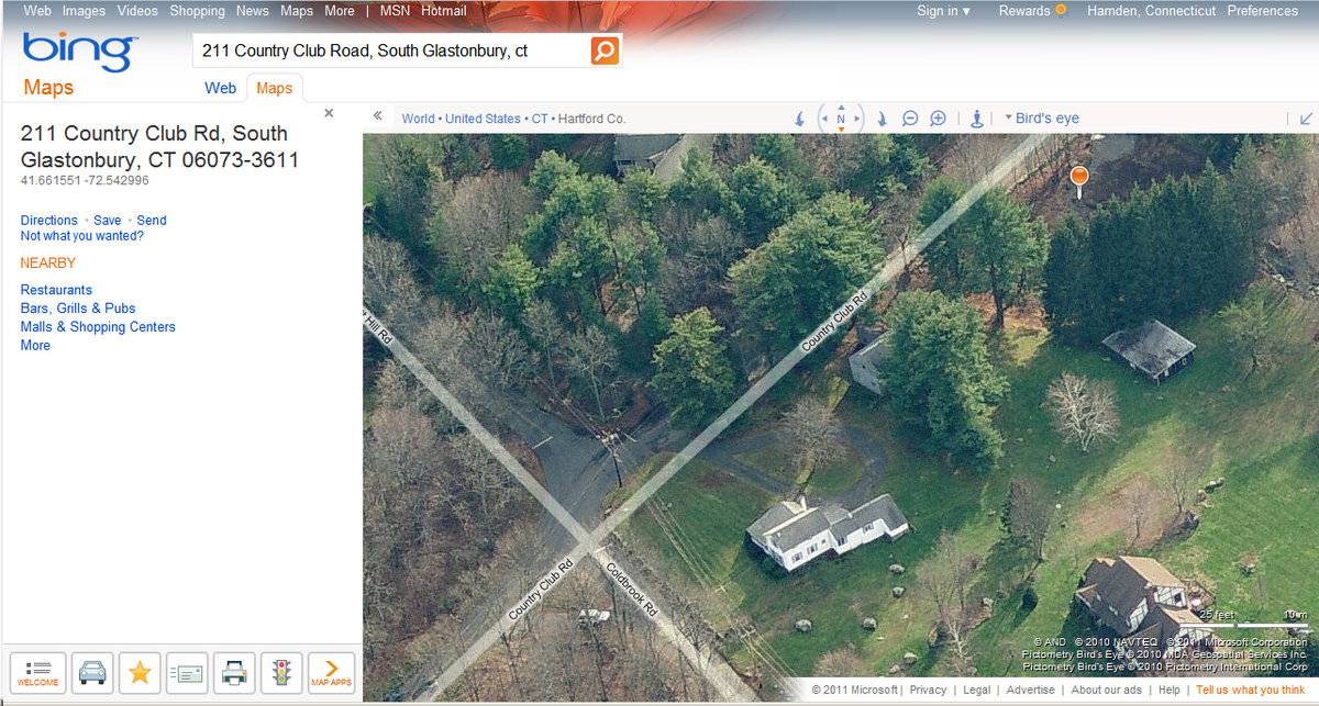
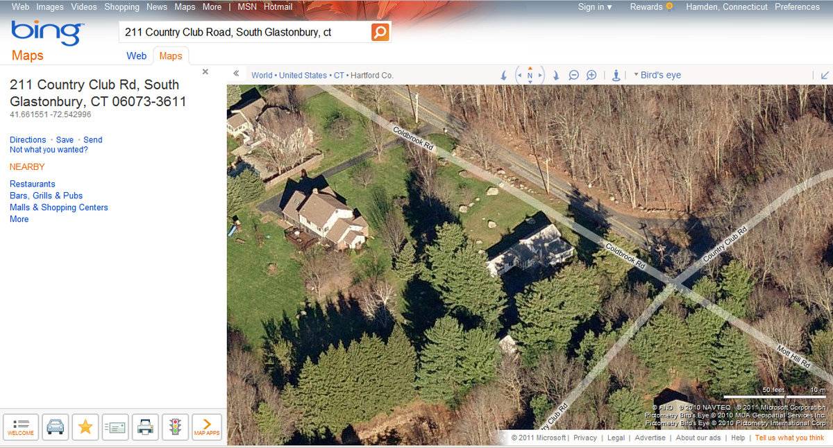
- Address
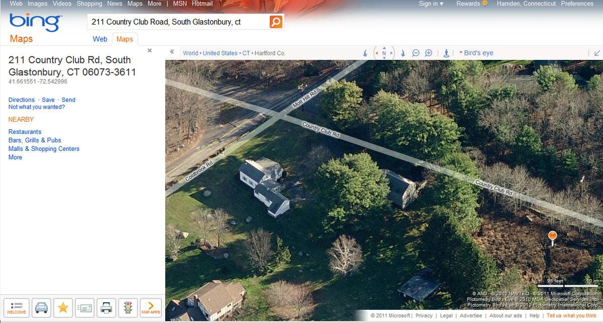
- 211 Country Club Road, Glastonbury
- Typology

- Overview
-
Designations
n/a
Historic Significance
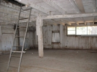
Architectural description:
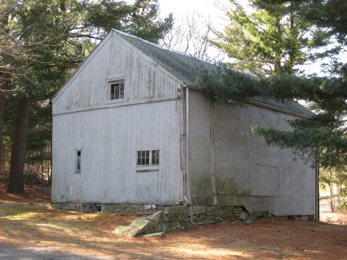
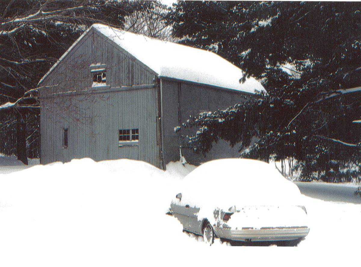
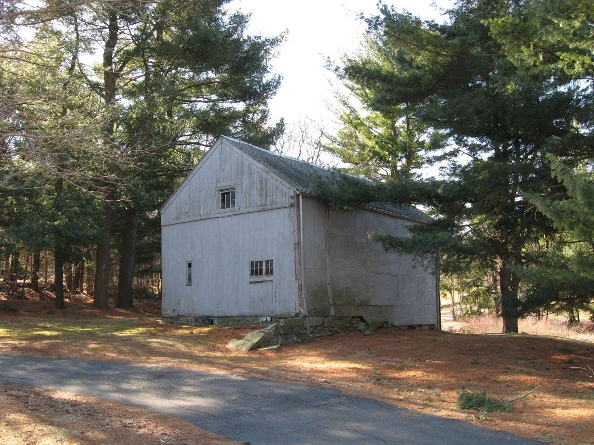
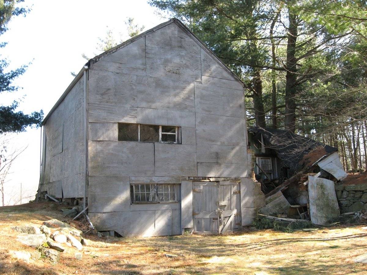
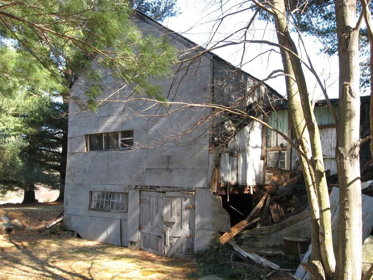
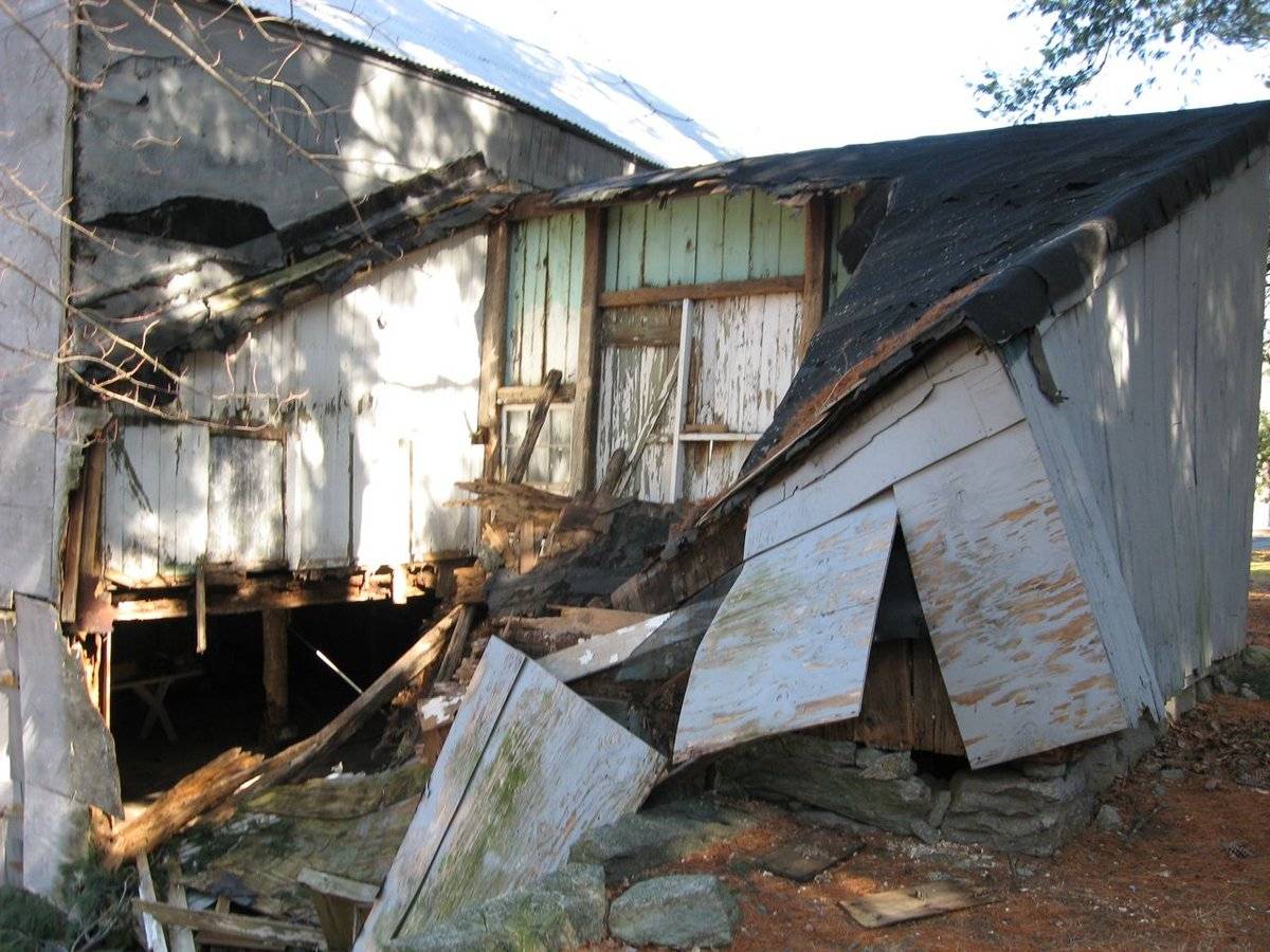
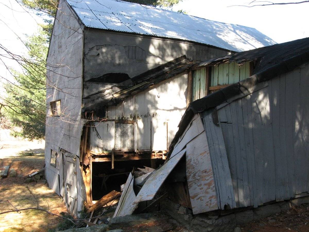
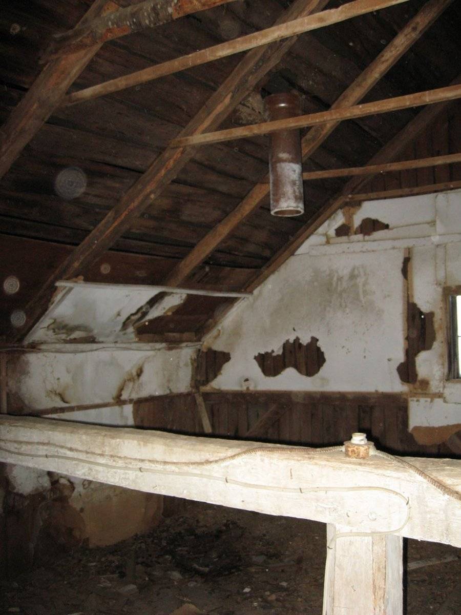
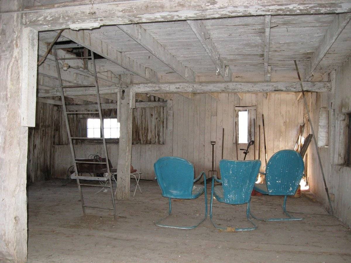
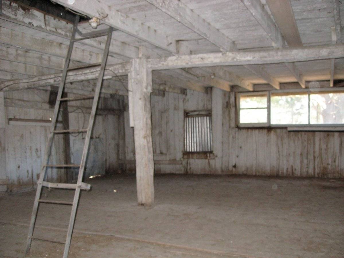
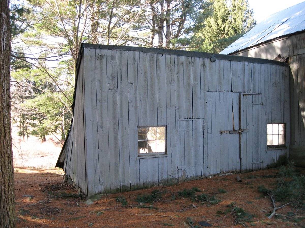
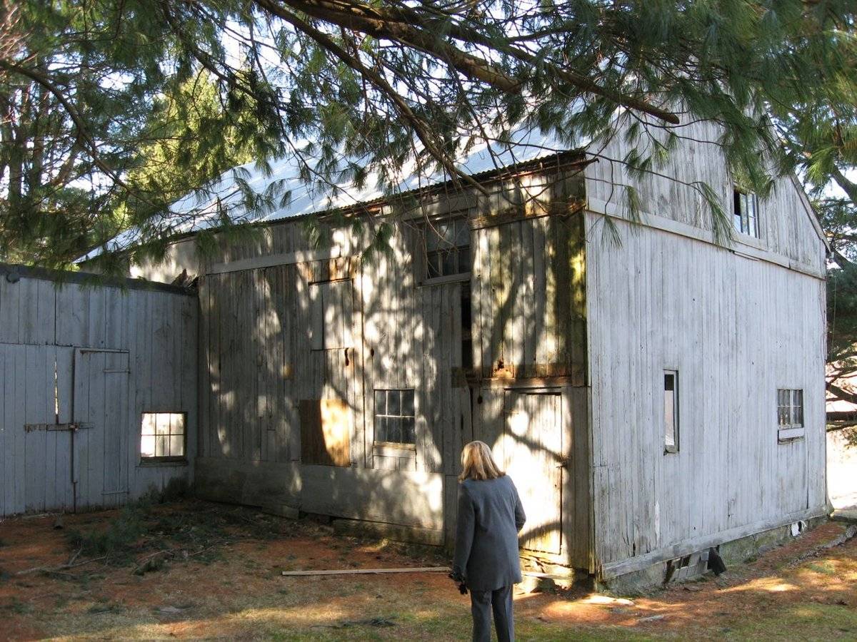
This is a 1 1/2-story eave-entry, gable-roof barn with a shed-roof addition. The main façade faces east and the ridge-line is parallel to Country Club Road which at this point runs approximately north to south.
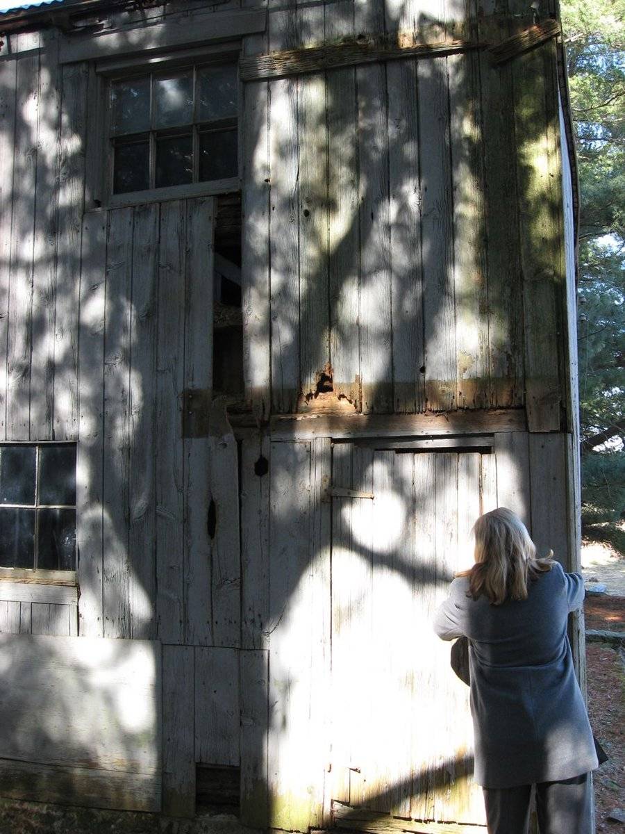
The main entry is now side-hinged pass-through door with iron strap hinges on the north corner of the east eave-façade of the barn. To the south of this is a six-pane fixed window. Located directly above the pass-through door is an exterior-hung, single-leaf sliding door. Directly to the south is a six-pane fixed window. It appears there are two window openings towards the south corner that are now boarded over. Extending to the east and attached to the south corner of the east eave-façade of the barn is the shed-roof addition.
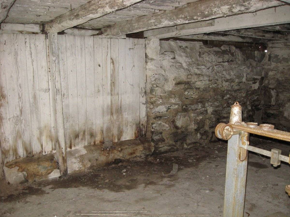
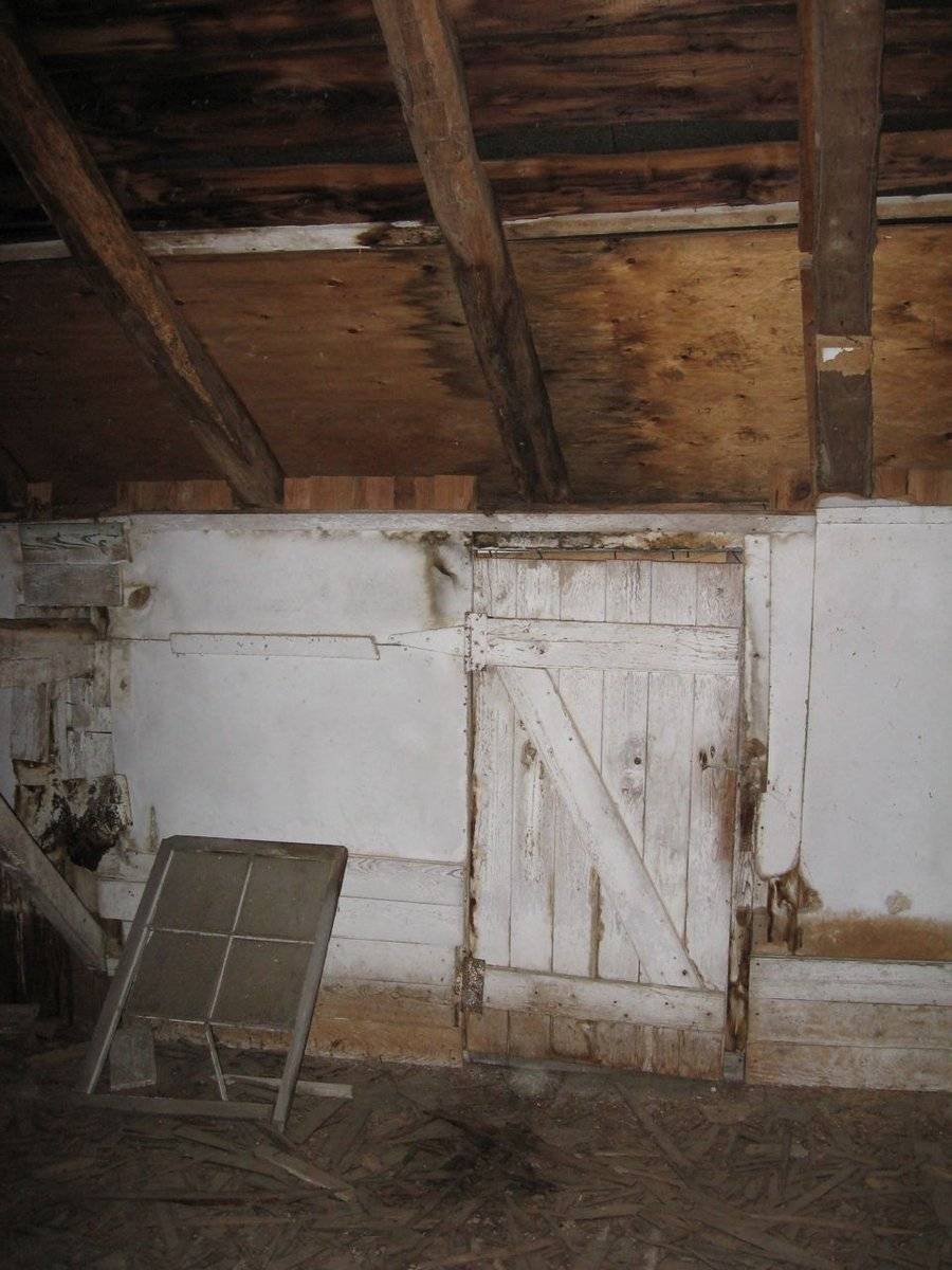
The grade drops along the south gable-end of the barn, revealing a full basement. On the east corner of the south gable-end of the barn is a pair of side-hinged doors with iron hinges. To the west is a pair of awning windows, a six-pane window on the east side and an eight-pane window on the west side. Above this, on the main level of the south gable-end of the barn is a ribbon of three windows, the east side window is a two-pane fixed window; the center and west side windows are single-pane fixed windows. There are no other openings on this side.
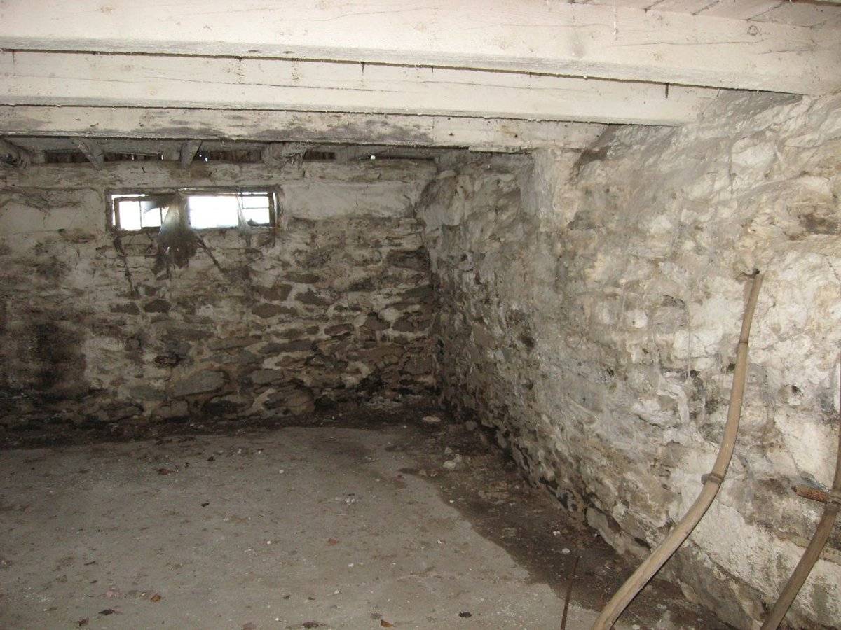
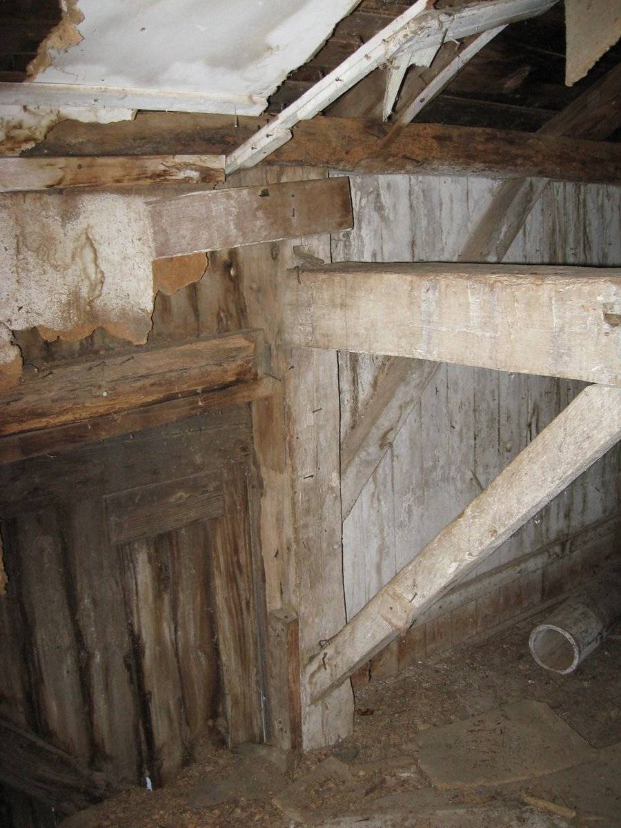
The grade inclines along the west eave-side of the barn, although the fieldstone foundation is visible on the north half of this side. The fieldstone foundation extends to the north and turns into a retaining wall. This was once the main façade of the barn that included the main entry. Today it has no openings as it is covered in plywood. A concrete foundation is visible along the north gable-end of the barn. There is a basement window set within the foundation wall. The north gable-end of the barn has a pair of windows on the west corner; a four-pane fixed window on the west side and a six-pane fixed window on the east side. Near the east corner is a single-pane, vertical window. Just above the girt line siding divide, in the gable-attic of the north gable-end of the barn is a six-pane fixed window.
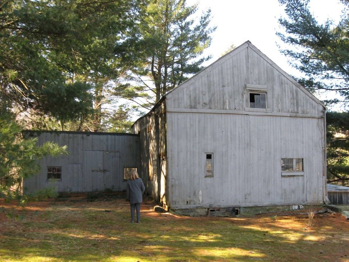
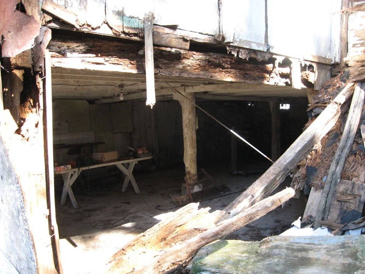
The shed-roof addition is attached to the south corner of the east eave-façade of the barn, and extends to the east. On the west corner of the north side of the barn is a six-pane fixed window with a sill. Just to the east is a side-hinged pass-through door with iron strap hinges. A smaller side-hinged pass-through door is just to the east of this. Near the east corner of the north side of the addition is a six-pane fixed window with a sill. There appear to be no openings on the east and south sides of the addition. The west side of the addition is attached to the barn which encompasses this entire side.
The barn is clad in vertical siding painted grey on the north gable-end and east eave-façade. On the south gable-end and the west eave-side of the barn is clad in plywood. The addition is clad in vertical siding painted grey. The gable roof is clad in tin roofing and the shed-roof is clad in rolled roofing. The foundation is of fieldstone and concrete.
The shed-roof addition collapsed sometime before December 2010.
Historical significance:The oldest barns still found in the state are called the “English Barn,” “side-entry barn,” “eave entry,” or a 30 x 40. They are simple buildings with rectangular plan, pitched gable roof, and a door or doors located on one or both of the eave sides of the building based on the grain warehouses of the English colonists’ homeland. The name “30 by 40” originates from its size (in feet), which was large enough for 1 family and could service about 100 acres. The multi-purpose use of the English barn is reflected by the building’s construction in three distinct bays - one for each use. The middle bay was used for threshing, which is separating the seed from the stalk in wheat and oat by beating the stalks with a flail. The flanking bays would be for animals and hay storage.
The 19th century saw the introduction of a basement under the barn to allow for the easy collection and storage of a winter’s worth of manure from the animals sheltered within the building. The bank barn is characterized by the location of its main floor above grade, either through building into a hillside or by raising the building on a foundation. This innovation, aided by the introduction of windows for light and ventilation, would eventually be joined by the introduction of space to shelter more animals under the main floor of the barn.
Field Notes
2008 Barns Grant pre-application. Shed-roof addition collapsed sometime before December 2010.
- Use & Accessibility
Use (Historic)
Use (Present)
Exterior Visible from Public Road?
Yes
Demolished
n/a
Location Integrity
Original Site
- Environment
Related features
Environment features
Relationship to surroundings
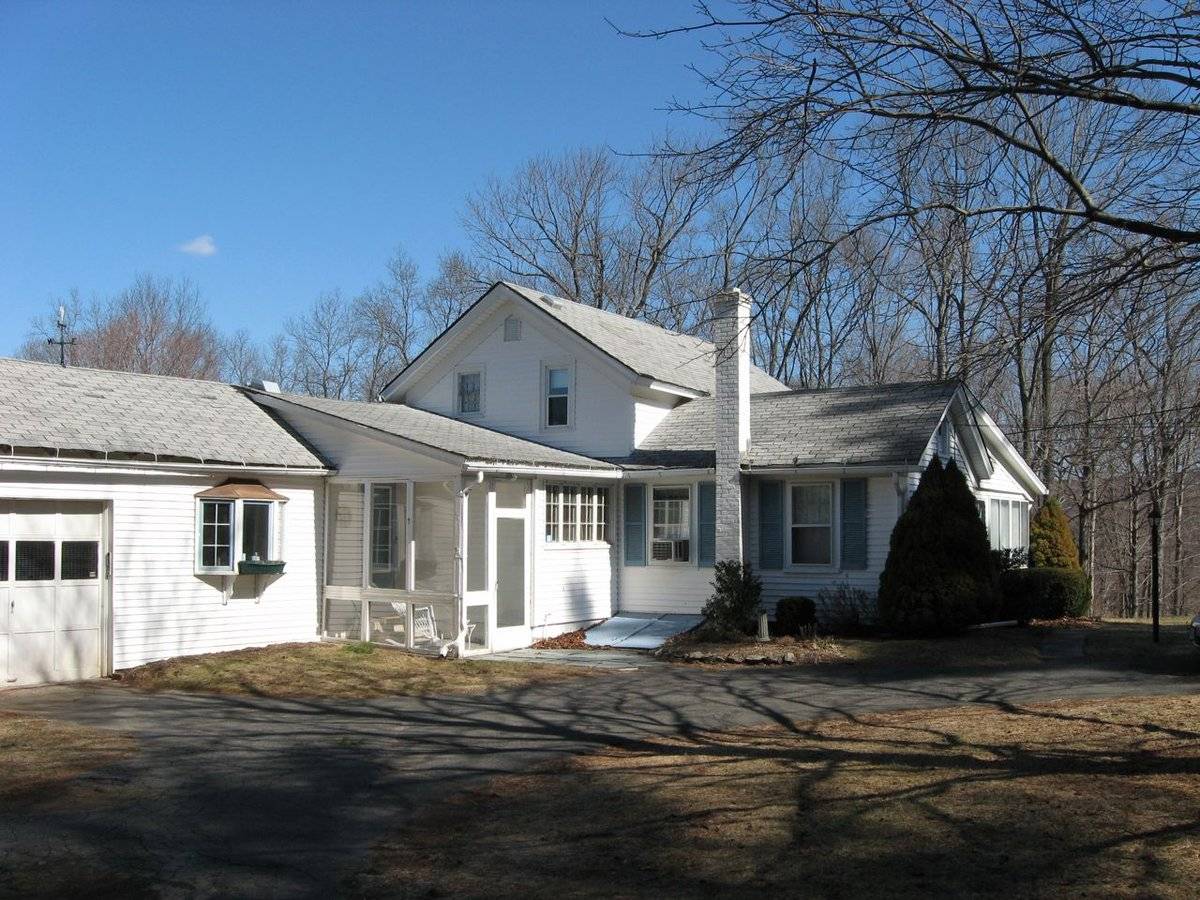
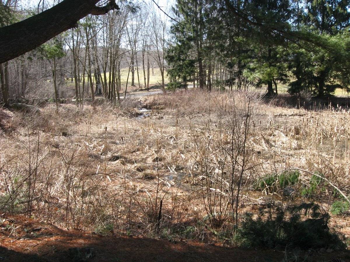
This 1.85 acre property sits on the intersection of Country Club Road and Coldbrook Road. The house with which this barn is associated is to the northeast of the barn. The main façade of the house faces north and the ridge-line is parallel with Country Club Road. To the southwest of the barn is a shed. To the south of the barn is a small pond and a creek that runs along the southwest boundary of the property. Glastonbury Hills Country Club is directly to the south of the property. To the northwest is Cold Brook Reservoir. The property is surrounded by open land, farmland, woodland and light residential areas.
Map/Street/lot # I12/1480/S0009J
- Typology & Materials
-
Building Typology
Materials
Structural System
Roof materials
Roof type
Approximate Dimensions
Barn: 20 x 30, Addition: 15 x 15. Entire structure: 1020 square feet.
- Source
-
Date Compiled
06/07/2011
Compiled By
K. Young & T. Levine, reviewed by CT Trust
Sources
Field notes and photographs by Todd Levine and Deborah M. Harrod - 6/2/2009.
Aerial Mapping: Glastonbury Maps
http://www.bing.com/maps - accessed 6/7/2011.Town of Glastonbury GIS Mapping:
http://gis.glastonbury-ct.gov/ceo/default.aspx?service=assessment - accessed 6/7/2011.Sexton, James, PhD, Survey Narrative of the Connecticut Barn, Connecticut Trust for Historic Preservation, Hamden, CT, 2005, http://www.connecticutbarns.org/history.
Visser, Thomas D.,Field Guide to New England Barns and Farm Buildings, University Press of New England, 1997.
- PhotosClick on image to view full file
-