Barn Record Guilford
RETURN TO ‘FIND BARNS’- Building Name (Common)
- John M. Bishop Barn
- Building Name (Historic)
- John M. Bishop Barn
- Address
- 131 Nut Plains Road, Guilford
- Typology

- Overview
-
Designations
n/a
Historic Significance
Architectural description:
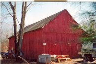
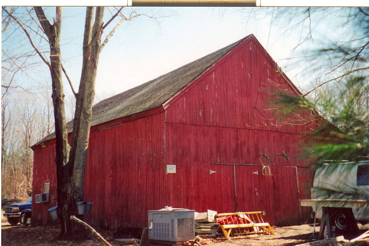
This is a 1 ½-story gable-roofed gable-entry barn with a shed addition. The main entry facade faces west and the ridge-line runs approximately east-west, at an angle to Nut Plains Road which curves northwestward at this point. The main entrances are two pairs of hinged doors on the west facade. A one-story shed addition is located on the south eave-side and encompasses the entire side. The south eave-side of the addition has four evenly-spaced stable windows. The east gable-end of this addition features a door which appears to be an overhead door. South of this door is a stable window. A small vent is located in the attic gable. The north eave-side has a short six-over-six double-hung window located on the left (east) toward the northeast corner.
The barn has vertical flush-boards painted red with white trim. The roof is covered with asphalt shingles and a metal chimney is located off-center towards the west on the south plane of the roof, suggesting use as a heated workspace.
Historical significance:
The New England barn or gable front barn was the successor to the English barn and relies on a gable entry rather than an entry under the eaves. The gable front offers many practical advantages. Roofs drain off the side, rather than flooding the dooryard. With the main drive floor running parallel to the ridge, the size of the barn could be increased to accommodate larger herds by adding additional bays to the rear gable end. Although it was seen by many as an improvement over the earlier side-entry English Barn, the New England barn did not replace its predecessor but rather coexisted with it, as both types continued to be built.
Field Notes
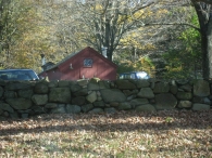
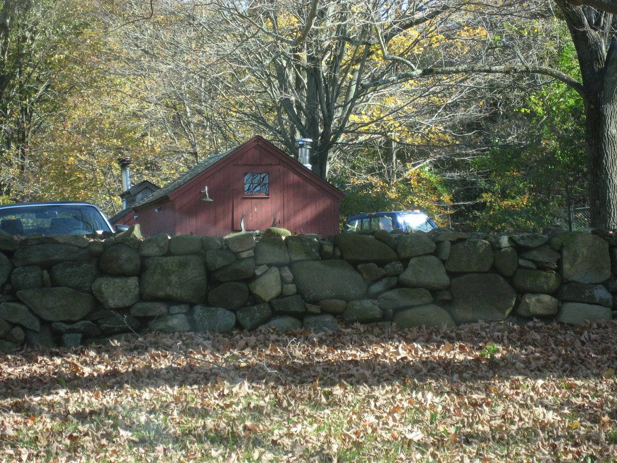
The house associated with this property is dated c.1860. It has a barn and two sheds, one of which is probably used to boil maple syrup, which is offered for sale every year.
- Use & Accessibility
Use (Historic)
Use (Present)
Exterior Visible from Public Road?
Yes
Demolished
n/a
Location Integrity
Unknown
- Environment
Related features
Environment features
Relationship to surroundings
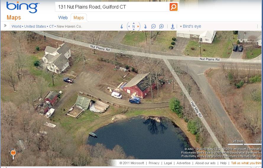
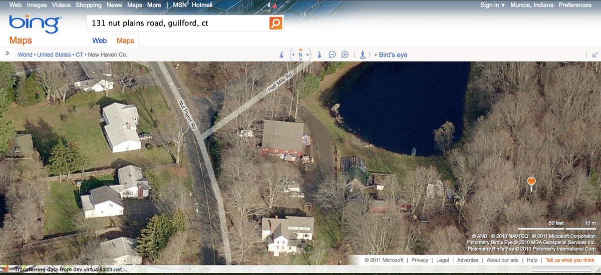
The barn is located north of the c. 1860 house it is associated with, at the southeast corner of Nut Plains Road and Half Mile Road. The ridge-line of the 2 1/2-story gable-roofed house runs approximately parallel to that of the barn; perpendicular to Nut Plains Road. Two small sheds are located east of the barn and house, both with ridge-lines that run approximately parallel to that of the barn. The smaller of the two sheds may be a sugar house. Northeast of the barn is a small pond. A fieldstone wall runs along the western property line bordering Nut Plains Road. The total size of the site is 8.75 acres. The surrounding area is residential and woodlands. The site is located in the less densely populated eastern part of Guilford, north of I-95.
- Typology & Materials
-
Building Typology
Materials
Structural System
Roof materials
Roof type
Approximate Dimensions
1,118 square feet
- Source
-
Date Compiled
02/10/2009
Compiled By
Beth Bjorklund & T. Levine, reviewed by CT Trust
Sources
Field notes and photographs by Ellie Green and Nona Bloomer, 02/10/2009
Town of Guilford Assessor’s Record or GIS Viewer:
http://www.guilfordgis.com/detail.asp?parid=080104
http://www.prophecyone.us/index_prophecy.php?town=Guilford
Parcel ID: 080104Aerial Mapping:
http://maps.google.com accessed 03/12/2011
http://www.bing.com/maps accessed 03/12/2011
Sexton, James, PhD, Survey Narrative of the Connecticut Barn, Connecticut Trust for Historic Preservation, Hamden, CT, 2005, http://www.connecticutbarns.org/history.Visser, Thomas D., Field Guide to New England Barns and Farm Buildings, University Press of New England, 1997, 61.
- PhotosClick on image to view full file
-